UncleTgt
SOH-CM-2025
Hmm,
What a mess.
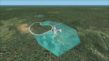
The Rapopo shot from the air showing the black square suggests the Rapopo airfield background bitmap is missing, or the wrong format.
A couple of the shots don't show any coastlines, so the stock coastlines have been removed, or excluded.
The Rapopo shot from the ground suggests the airbase A16N is at a significantly different level to the mesh.
My guesses:
You've got Rhumbas mesh active, but are trying to use Masriders old PNG airbases.
These airfields were created long before Rhumbas mesh, so you'll have problems like this
Or
You've got some PTO Coastal flattens/ watermasks active, & they're playing havoc with airbases close to the shore.
Again, apart from Rhumbas 2019 work all his earlier flattens were made long before he released his mesh.

