• There seems to be an uptick in Political comments in recent months. Those of us who are long time members of the site know that Political and Religious content has been banned for years. Nothing has changed. Please leave all political and religious comments out of the forums.

    If you recently joined the forums you were not presented with this restriction in the terms of service. This was due to a conversion error when we went from vBulletin to Xenforo. We have updated our terms of service to reflect these corrections.

    Please note any post refering to a politician will be considered political even if it is intended to be humor. Our experience is these topics have a way of dividing the forums and causing deep resentment among members. It is a poison to the community. We appreciate compliance with the rules.

    The Staff of SOH

  • Server side Maintenance is done. We still have an update to the forum software to run but that one will have to wait for a better time.

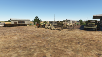
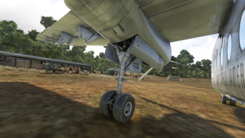
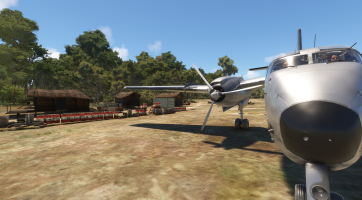
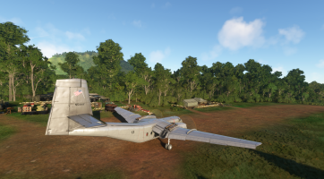
Laos 1968 Air America scenery

roger-wilco-66

Administrator
Staff member
I'm at it again.
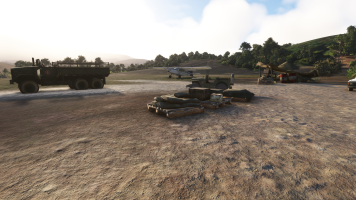
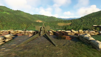
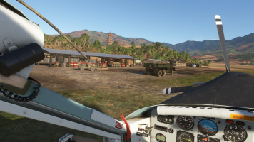
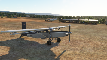
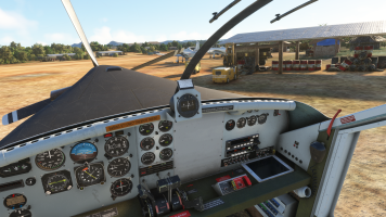
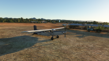
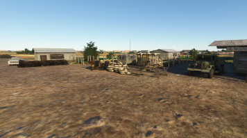
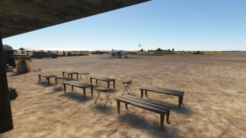
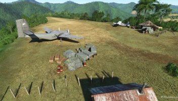
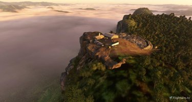
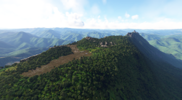
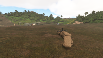
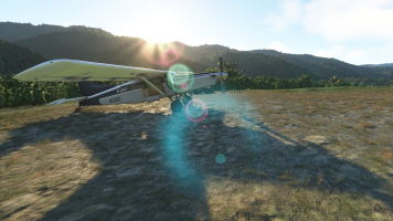
My Laos 1968 scenery - dedicated to the Air America pilots as well as Ravens - is about half way done. It will only be for MSFS 2020 for a start.

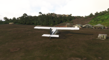
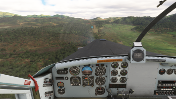
This also will be a treat for anyone who loves bush flying. You will have some real challenges on these remote airstrips.

I will post some dev updates here, and anyone who wants to follow me can do that on discord (new server, so there's not much on it as of now). Just give me a note with your user name and I'll give you an invite.


1250410_20251016143642_1.png1250410_20251010172326_1.png1250410_20251016143606_1.png1250410_20251010171845_1.png
 
This is great news. I've been hoping that some one would venture into that area to do some "VietNam Era" scenery. This is a great start!
 
Beech 18 and some Volpars too. Need a Helio Courier. ;) I'd love to have this scenery. Last one I remember for AA was one someone did for FS98 maybe. It was way back there.

Don BP;)
 
Last edited:
Jan Kees, your AA Caribou and other AA aircraft are constantly in use here :)
I hope the C-119 will be reborn, and some will pick up the C-123K Provider. And Anthonys T-28....


1250410_20240919174054_1.png1250410_20241010175414_1.png1250410_20241018183423_1.png
 
Yesterday I made a count of the airfields I made so far. I'm at 48 airfields now, covering all of Laos from the north, PDJ down to the Boloven Plateau. I think it will top out at around 60.
Larger airports are included, like Vientane (Wattay), Luang Prabang, and Udorn Airbase (Udon Thani), which is in Thailand but was vital for the Laos operations.

Cheers,
Mark
 
Sime time ago I uploaded Lima Site 85 scenery to fs.to

1000123063.jpg

1000123065.jpg


I am looking forward to your package
 
LS85 will also be part of the scenery, I hope you don't mind.
Because of it's historical significance I make a 3d package for it. I already made the station buildings and did a lot of pinpointing as to where everything was located, which is not easy. I'll also put a TACAN (VOR) radio nav source on it for the sim, so it can be used properly :)
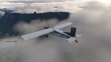
The airfield (very short, but I can get in and out with the Porter, which is a real challenge) is also there. One thing is for sure: you only can land on this field with a Porter (or not existent Helio Courier), but nothing else, no Caribou. The strip has around 600ft (say 200 meters) usable length. Wind conditions are always challenging due to the location and you only can land up hill. Back then, most missions to this place were flown with helicopters like the Huey, or Chinook.


Cheers,
Mark


ls85-radar-hut2.png1250410_20251031160925_1.png1250410_20251031133203_1.png
 
Last edited:
@Apollon, I made a couple of test runs from LS36 (which was a staging airfield for LS85) to LS85 and had your scenery active. I almost ran over a Dragunov with sandbags during the landing :D I was really puzzled. Landing there is a real challenge, even with the Porter.
LS85 assets are going well. But I think I have to relocate the Radar/Tacan station a bit uphill.
Last image is the landing back on LS36 Nha Khang. To the right is a little ridge where a machine gun kept harrassing the airfield, as the books tell. So the landing has to be tight and expedited quickly.

Cheers,
Mark


1250410_20251104172525_1.png1250410_20251104171035_1.pngAO-Shader2.png1250410_20251104175219_1.png
 
This is shaping up really nicely 👍

My old scenery of LS85 was based on rather limited information regarding the installations on top of the hill and the strip down on the foothill.

All the objects come from freeware libraries or MSFS.

It looks like your rendition will be on a different level 😀
 
This is shaping up really nicely 👍

My old scenery of LS85 was based on rather limited information regarding the installations on top of the hill and the strip down on the foothill.

All the objects come from freeware libraries or MSFS.

It looks like your rendition will be on a different level 😀

At the moment I think your placement of the radar site was better than mine, but the airstrip was far off (valley, not ridgeline).

I use the original air facilities data from Air America / CIA. The coordintates there are a bit loose (no GPS back then), but the orientation of the runway and it's length is what counts. In these places there is usually no room for variations. And of course correlation with old photos.
Anyways, when your sandbag machine gun site appears on my runway, you were on the target :)

Cheers,
Mark
 
Last edited:
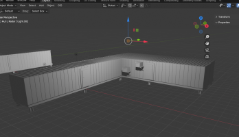
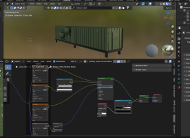
I got sidetracked because I hate cumbersome and repetetive tasks in 3d model generation.

Particularly texturing in Blender is really horrible to me, expecially when you work with non MSFS native pbr textures e.g. from Blenderkit or other sources. Or procedural textures (produced by procedural shader nodes), which I also use. So I made a plugin for Blender which converts the non native textures with a single click (open object in object mode and click on it, N-> PBR MSFS Converter -> Click. Done!!

Features so far:

MSFS PBR Converter – MarkSchimmer Edition v3.4.0

One-click full MSFS PBR conversion (COMP + ALBD + NORM)
Automatically creates 2048×2048 _COMP.png (AO→R, Rough→G, Metal→B)
Forces every texture to PNG (JPG/TGA/EXR/BMP → PNG guaranteed)
Auto-bakes all procedural textures (Noise, Voronoi, Musgrave, Brick, etc.)
Detects and converts DirectX normal maps → OpenGL (MSFS standard)
Adds msfs_material_type = "Standard" to material
Saves everything in //texture/ folder (MSFS-ready)

Second button:
Bake Active Texture Node only (any map, 2048 PNG)
Manual bake replaces original node instantly

Works with Blenderkit, Substance Painter, Quixel, Poliigon, scanned photos
Zero user input needed for full conversion
Zero white textures in MSFS
Zero normal map flip errors
Zero file corruption or overwrites
100 % compatible with Asobo glTF exporter
Tested on Blender 4.5.0 LTS + MSFS 2020 SDK

It is integraded into Blender as a standard Python addon.
For me it works so far, and soon I will release it on flightsim.to

There are a few crazy ideas which are already scripted, but not yet part of the package (alpha).
Like:
  • Emissive texture support
  • Alpha channel handling (OPAQUE / MASK / BLEND)
  • Parallax interior (fake windows/rooms)
  • Detail maps (micro-surface wear – scratches, moss, rust)
  • Full Auto LOD generator for geometry AND textures.
I'll keep you posted, there is another project which even dwarfes this one regarding Blender and MSFS. It is about AI controlled dynamic scripting in Blender. I call it Blender Co-Pilot. Tell it what you want, either vocally or by text, and it does it. But that is another story.


Cheers,
Mark
 
Last edited:
The scenery project is coupled to a larger AI driven history project of mine where I analyze an original, scanned CIA / Air America pilot pamphlet called "Air Facilities Laos". This pamphlet has all known L / LS / PS sites which were constructed in Laos for Air America operations (also CAT and flights initiated by USAID). In that listing, there are around 450 airfields, with coordinates and coded informations. With the help of AI (Grok 4) I translate the raw and often faulty OCR data into a database and contextualize as much is possible. It also generates a database for Google Earth with placemarks for all the LS/L sites.

LS 85 has the following entry for 1972 (coding interpreted by the AI) :

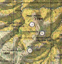
LS85 Phu Pha Thi
UH 6860
Coordinates: 20-26N, 103-44E
Map Reference: NF 48-14, J-llA
Elevation: 4500, Runway 16/34, 600x50
Advisory remarks: RU, 1,2,4
Rolling, Slicky when wet, Tricky approach winds, Restricted takeoff weights
Status: CLOSED UNF

Hint:

Elevation: 4500, Runway 16/34, 600x50

The orientation of the airfield is landing 340 / take off 160 degrees, 600ft runway length. One way for landing due to the slope. The photos show that it was on the ridge, in a small depression next to the radar station.
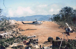
It looks like that there was a little clearing orientated to the right - in landing direction- at the very end of the runway (where you placed an AA Huey), which later was used only by helicopters. The aircraft use was almost NIL at that point in 1968, until the site fell.

If you have other information, please share :)

Cheers,
Mark
 
Nice info! (y)

This is what I've got:

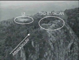
LZ on top of the hill to the east of the Tacan site

1762725858821.png
Source: https://www.limasite85.com/fall-of-lima-site-85

1762725681400.png
Source: https://www.historynet.com/lima-site-85/

Airstrip down at the foothill to the west of the mountain

1762725941823.png
Source: https://www.limasite85.com/do-chi-ben-document
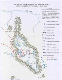
The image above depicts also the heli LZ to the east of Tacan

1762726038099.png
Source: https://www.limasite85.com/installation-of-trn-17-tacan

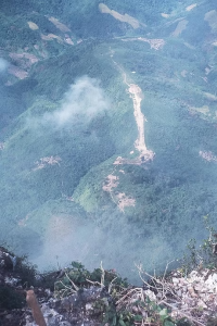
1762726108383.png
Source: https://www.geocities.ws/koratmahknut/warinlaos/Lima85/phouphathi.jpg linked from this website https://www.geocities.ws/koratmahknut/warinlaos/Lima85/adoptmia.htm

My scenery includes only the LZ on top of the hill and the airstrip down to the west of the mountain as I believed I had enough info to re-create them as per historically relevant info.

I did not include the earlier airstrip 34/16 at the ridge to the south-east of the Tacan as at the time when I was working on the scenery I did not have the last image above and therefore little to confirm its existence.

Unlike you :) which makes me happy to see you are working on it.

I hope the info above is useful in case you have not seen it yet.
 
Yes, that is typical for historical sceneries. You have to pinpoint a time frame. When I made Solomon 1943 for FSX, that drove me almost nuts. The airfields were constant construction sites, during a few months they changed completely or were relocated to a place nearby.
I am in contact now with a historical group and a professional historian to get it right. Thank you for your input!

Together, we'll get it right!

Best,
Mark
 
Back
Top