CFS2 sceneries or sceneries objects converting to FS2004 sce

michaelvader

Members +
Good evenening friends,
would it be so much or even too much work to convert CFS2 sceneries to be usuable in FS2004?
I have seen that the area around Lorient, especially the U-Boot base of Keroman has been done
for CFS2. But of course no chance to use it in fs9 as it is.
Could some one have a look on it and try to make a fs9 scenery about it?
I live there. All the freeware I found concerns the airport of Lann-Bihoué and the the citadel of Port-Louis
But the port area is quiet generally, the peninsula of Gavres is %&$§ (censored by the author).
Sadly I have any knowledge about scenery design
Best regards
Yours
Michael Vader
 
Hi Papi ; a lot of CFS2 sceneries drop right in to fs9,you'll
need the stock cfs2 objects in your fs9 folder...but...if the sceneries are of the GSL type then they won't work in fs9

Ttfn

Pete
 
Goodmorning,
what I hoped in the background that one of the scenery experts would jump on the topic and make the Lorient area.
It is astonishing for me that this area is so forgotten in fs2004!
It was the greatest and most german U-boot base in france. I served till late in the 80ies for the french submarines and today the binkers are still there and had become an important place for race sailing.
It is a very nice sailing area around the island of Groix and the bay of Lorient.
There are still some military activity with the BAN of Lann Bihoué, the naval arsenal and the scholl of the Commandos de Marine.
For those friends living in england or on the continent this area is full of history and will be nice for hollydays.
So I I find it sad that this area is so forgotten in FS2004.
Kenavo
Michael
 
I never found a simple working program that could place "Library" .bgl objects. I tried FS02s BGLPlacer.exe and objplacer.exe. One of them gave me .csv excel file I couldn't make since what to do with. IIRC Ground Maker lets you place objects by name or GUID number as I used it way back when for CFS2.

EDIT:
Maybe I somehow made an .API file that could be used with Ground Maker.

Abacus ez scenery does just that; and was downgraded as freeware last year IIRC; you can still find v1.3 around the web using Mr Google (Instant Scenery does the same, and is by same author)

ttfn

Pete
 
CFS2 sceneries or sceneries objects converting to FS2004 sc

Hallo again,
I tried several freeware to recreate my home envirement brrrrr scrap
scenery design is realy not my thing. Some times one must admit his limits.
In the film Memphis Belle the Lorient area is well metionned as the Hell of Lorient
There where to airfields to protect the U-Boot bases.
Lorient Kerlin Bastard (now called Lann Bihoué used by the french aeronavale and partially cilvil users)
and Vannes Meucon.
Also the region was burried with Flak.
On the peninsula of Gavres the Flak was guided by a radar installation
The ez and other softs are really too generic to mak a nice scenery, also the coast lines of FS2004
of this region are not very accurate. I have the doupt Microsoft used cards from ante dilluvian times for the region of brittany.
Kenavo
Michael
 
Motormouse:
If you can find a link to the freeware let me know. All I see is payware.

Everyone:
After diggin out the External hard drive and hour or so of fighting I got Ground Maker and the .api file working. Was able to dump my rebuild of the CFS2 Wharf from the Stock Infrastructure Rebuild into FS04. It has no collision of any kind.

QqMthU6.png


Another option may be ModelConverterX Convert Wizard but you need the FS04 MakeMDL.exe and bglcomp.exe. Also the Convert Wizard isn't the most user friendly. How you load and save files is bad. Latitude and Longitude is decimal long and lat. Why? :censored: if I know why. Just really dumb to make the needed Latitude and Longitude in a format that FS9 or FSX doesn't display so you have to find a website to convert Latitude and Longitude to decimal. These do have collisions. So that is nice I guess for most cases.
 
CFS2 scenery in FS9, is a case of install it and see if it works or not, some do, some dont. Airfields are tricky as they have no ADE file's for them to be recognized by 9, so you have to build one up with ADE9 underneath to make it flyable, i did this with some of Maskriders Henderson airfield complex scenery and that works quite well when the ground polys matches up with the FS9 coastline. If the objects are in Bgl format, thats quite easy, ive got quite a few CFS2 objects including newer ones by UncleTgt run through MDLX and converted to object library's, which can be used in FSX also, some already in use in some of my scenery's in the library. Most CFS2 scenery can be dragged kicking and screaming into 9, it all depends how much work you want to put in
 
Hi Michael,

There is FS2002 scenery for the Port Louis Citadel by Frédéric Picci at Flightsim. The CFS2 submarine pens are by Robert John on this site. They can probably be converted to API by Allen's method.

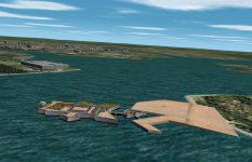
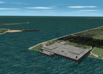
Here are CFS2 screenshots showing the Brest pen being used for Lorient.

Cheers,
Kevin
 

Attachments

  • Lorient 1.jpg
    Lorient 1.jpg
    674.3 KB · Views: 14
  • Lorient 2.jpg
    Lorient 2.jpg
    716.9 KB · Views: 14
CFS2 sceneries or sceneries objects converting to FS2004 sc

Good evening Kevin,
Iknow the citadel of Port Louis,
it is now a part of Jean Jacques Lorient Lann-Bihoué LFRH package downladable from lfrh.simu.free.
Sadly the citadel does not realy match with the coastline.
When you compare te coast concerning this region done by fs9 and google earth - brrrr
All had to be redone.
when I look on the second of your screen shots I see the citadel and in the far back ground left the peninsula of gavres.
Refering to this the bunker is on the wrong side of the "anse du ter"
The site is very complex and would be a real challenge for a designer who would cover this region.
I asked a french designer if he would be interested - no answer.
Sadly most of the talented scenery designers has switched over to the later sims and seem to consider fs2004
as an old dying dog beeing under their level.
Kenavo
Michael
 
Lorient area

Good evening again,
I join a google earth pic with some indications from me
If one day some one will take of the challenge to make this scene (I wonder about what I dream at night)
I will furnish all you need in precise cards or scans
Kenavo
Michael
 
Happy New Year Michael,

Yes, the sub pen is on the wrong side of the bay and facing the wrong way. Fortunately the placement of GSL objects can easily be fixed in CFS2. As with most CFS2 and FS2004 scenery, the entire Lorient harbour could be redone with Ground2K. When I get my list of unfinished projects out of the way, I'll have a look at Lorient. In the mean time I'll download the Jean Jacques Lorient Lann-Bihoué LFRH package.

Tobob did a more accurate rendition of La Rochelle/La Pallice for CFS2. He redrew the coastline at that location. I don't know if it will work in FS2004. It's available in the CFS2 scenery section.

Cheers,
Kevin
 
Back
Top