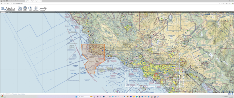
Hey all !, im on the mend , well for now and im determined to get some flight time in..
Heres my issue, i know about TFRs, but when flight planning a big long distance flight, how do you know where you can and cant fly? In particular,id like to start at the factory in a YMF-5 , and im delivering it to a customer in,,, lets say the san diego area,,, to ramona. so again, how do i know where restricted airspace is,id be flying low level of course.is that information on those charts? like the jeppesen charts, and if so,how do you read it? honestly ive never done a big flight. in all the years ive had the various flight sims, ive never done a long flight, auburn california to catalina island was my longest, and id just gone from auburn,over sacramento and pretty much followed the sacramento river, or what i thought it was,went over san francisco bay ,over the golden gate, and turned south and flew along the coast, and searched for it..lol.. found it and then "panthered" the landing.this was in an AT-6 , or SNJ,, i dont even recall what sim it was..lol.
a little guidance if someone could.. in this sim.thanks Dave


