• There seems to be an uptick in Political comments in recent months. Those of us who are long time members of the site know that Political and Religious content has been banned for years. Nothing has changed. Please leave all political and religious comments out of the forums.

    If you recently joined the forums you were not presented with this restriction in the terms of service. This was due to a conversion error when we went from vBulletin to Xenforo. We have updated our terms of service to reflect these corrections.

    Please note any post refering to a politician will be considered political even if it is intended to be humor. Our experience is these topics have a way of dividing the forums and causing deep resentment among members. It is a poison to the community. We appreciate compliance with the rules.

    The Staff of SOH

  • Server side Maintenance is done. We still have an update to the forum software to run but that one will have to wait for a better time.

How to eliminate this blue / green visual renderer?

wiekniera

Charter Member
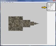
Guys, I've been searching how to remove this blue sea/green ground visual distance, starting from tweaking the config that i've read from any source but seems this thing kinda still show up and really annoying me
the blue pacific sea or green visual renderer that not match with the visual distance sight, like playing in ETO but you will see that blue coral or greeny thing kinda ruin the feels of flying
is there any tweak config to eliminate or minimize this thing?

Thanks

RdSBNnR.jpg

wX9ZQCT.jpg

9KRNz9t.jpg

YcMVsQx.jpg
 
Asked the same a few years ago and was told there is no way to. Just pull the fog in.
 
Allen is right. Setting the maximum viewing distance to 10-15 miles will generate a "fog" that will hide this problem.

Here is a quote from Rami's ETO Install Guide:

Go into the “settings” menu, and under “advanced settings” click on “image quality.” Once in that menu, you will see a bar on the bottom left called “maximum visibility level.” Slide this down to the lowest setting, 15 miles. This will prevent any “rough edges”…looking out over a long distance.
 
Thanks guys! that simple thing did the trick but too bad the contrast color of blue sky simply fading because of fog, i set them 20
 
Guys,
My settings seems now not working anymore even i set it to 15, i don't know what happen but suddenly the "thing" come back and even i set it to 15 it's not working anymore
already delete cfs2.cfg but no luck :banghead:
 
Here is my text from my Europe installation. It's the preference section. These are working good. Paste it into yours, see if anything changes.

Code:
[PREFS]
ADF_500_HZ=0
ADVANCED_WEATHER=0
ASLAT=2
ASLON=0
COM_RATE=7
DEMO=0
FULL_SCREEN=1
FULL_640=1
Keyboard_Current=Dave
Keyboard_Default=CFS
SYSCLOCK=0
HAZE_FLAG=0
HEAR_COCKPIT=1
HEAR_ENGINE=1
HEAR_NAVIGATION=1
INDASPD=0
KBDAIL=64
KBDELEV=64
KBDRUD=64
LOADSIM=0
LOADWINDOW=1
LOG_TIME=0
MAP_ORIENTATION=2
LINEAR_CONTROLS=0
UNITS_OF_MEASURE=2
MEASURE=0
MOU_AIL=25
MOU_ELEV=35
MOU_NUL=64
PAUSE_ON_LOST_FOCUS=1
QUICKTIPS=0
RADIOS_25_KHZ=0
SOUND=0
SHOW_OPENING_SCREEN=1
PROMPT_ON_EXIT=0
NORTH_SEASONAL_LAT=32
SOUTH_SEASONAL_LAT=32
FOREIGN_TRANSLATOR=0
PERFORMANCE_MODE=0
DEF_PERF_MODE=6
MAP_GROUND_TEXTURE=1
TEXT_SCROLL=1
PANEL_MASKING=1
PANEL_STRETCHING=1
AUTO_LOD=0
TEXTURE_QUALITY=3
IMAGE_COMPLEXITY=5
DYNAMIC_SCENERY=0
DYN_SCN_DENSITY=0
DAWN_DUSK_SMOOTHING=1
SMOOTH_VIEW=0
IMAGE_SMOOTHING=0
LOD_TARGET_FPS=30
COCKPIT_HIGH_LOD=1
TEXTURE_MAX_LOAD=1024
DETAIL_TEXTURE=1
EFFECTS_QUALITY=2
TERRAIN_ERROR_FACTOR=1.500000
TERRAIN_MAX_VERTEX_LEVEL=19
TERRAIN_TEXTURE_SIZE_EXP=8
TERRAIN_DEFAULT_RADIUS=9.500000
TERRAIN_EXTENDED_RADIUS=4.500000
MAX_UNLIMITED_VIS=56327
AIRCRAFT_SHADOWS=1
GROUND_SHADOWS=1
IMAGE_QUALITY=0
TEXTURE_BLDG=1
TEXTURE_GND=1
SKY_TYPE=1
TEXTURE_WATER=1
AIRCRAFT_TEXTURE=1
SEE_SELF=1
PROPELLER_VISIBLE=1
SOUND_FADER1=0.200000
SOUND_FADER2=0.200000
SOUND_FADER3=0.200000
SOUND_FADER4=0.100000
SOUND_FADER5=0.200000
LOADWEATHER=0
LOW_RES_RENDERING=0
SITUATION=
STARTUP_DEMO=
KNEEBOARD=0,520,304
LOG_FILE=1
[SOUND]
 
W,
I have an idea that it's possibly a memory/render issue. If you are using upgraded land texs, water, scenery and clouds CFS2 does render it all well. Nothing to do with the speed/spec of your pc or pc memory, it's the sim's limits. If you have a basic installation, test it out, and I think you'll find that you won't have these issues. Now it could be a setting, but I have had this problem for years, and never been able to get rid of it. My sim pc is high end, running XP, runs Fs2004 and FSX well, but still the issues with CFS2 and distance tile rendering.

If you have got new land and water texs, (back-up) and then swap them for the standard texs, see if that does it.

Cheers

Shessi
 
Maybe the easier question to ask is "what has been added to the Main Texture folder and the Scenedb/World/Texture folder.

For myself, there were problems if ground or cloud textures were not formatted to the same size as the original MS stock ones.
This is in Win XP. Never ran CFS2 on newer OS.

The fog comes from a cloud texture. Which one? I do not know.

This picture shows the formatting of a ground texture. Notice the upper right corner. It has to be this or problems.
Since Im not at home, can not tell you the texture format or size for clouds.
 

Attachments

  • Image Tool.jpg
    Image Tool.jpg
    46.2 KB · Views: 9
Thanks for quick response guys...the last time i remember what i did is installing some GC files which i just download it from their site but im not sure if they were effecting the settings and i don't know which one of it has to do with this..trying to installing the new folder of cfs2 and move it one by one also didn't work
or is there something to do with ground tiles 512x512 ?!?

well the settings using 15mi-20mi just run fine and perfect with 1024x1024 tiles before and then after i did install some files from Groundcrew files from their site that thing come back and this time it won't add the fog even sliding to 15-20mi distance view :pop4:
 
or is there something to do with ground tiles 512x512 ?!? Well the settings using 15mi-20mi just run fine and perfect with 1024x1024 tiles before.

There is the answer wiek. Ground tiles, water and shorelines all need to be 256 x 256 and 8 bit and with mip maps. It's true what you said, they will show but CFS2 is being pushed very hard to display them. After a certain distance it will default to the base world texture which is what shows in your pictures. A paint program will resize to 256, and image tool will format first to 8 bit, then create mip maps.
There really is no other way unless someone can re-write new dll files.

IMHO it still looks pretty good given its age. Boxted England.

36498018775_660847a5d3_o.jpg


I'll attach image tool if you need it. Dxtbmp will work also but my install of it is not working correctly at the moment.

Dave
 

Attachments

  • imagetool.zip
    76.5 KB · Views: 1
Now flying at some altitude the distance seems looks fine dave but when it's above about 15-20K or above then it's start to show up even it's using 15mi-20mi distance
but this time the looks were not so bad as before as im back using 256x256 8bit as well as the water but the clouds still in variety size which i didn't change it
thanks for the help Dave ! im still not satisfied yet because before this thing comes back, everything's okay even flying at 20K feet above..well at least it's better now :encouragement:
 
Only my 2 cents worth BUT;
Many times in my scenery projects, I find that the texture must be placed in both the
"World" texture folder and the "TEXTURE" texture folder and for the hell of it I also release
it in the scenery texture folder................??

Dave
 
The green effect is being loaded from the worldlc.bgl. That is all I know now.
 
Both Allen & Dvslats have parts of the puzzle sorted.

The sim is hard-coded to limit the number of LOD13 scenery cells it draws/textures, & 256 colour with mip-map format reduces the load on the sim graphics engine wrt drawing & texturing.

I've found Martin Wright's BMP2000 programme to be the most useful when creating ground/water textures - it allows you to access transparency levels for each of the 256 colours in the palette, which can let you model some interesting texture overlay effects. See my version of the waveshoresu.bmp, shipped with most of my PTO sceneries - only the whitecaps show, meaning it lets the colour of the underlying water texture to show through, whatever colour that may be.

The key may be to finding the dll module that limits the texture cell totals, altering it to allow a further radius of cells to be textured, & measuring it's impact (if any) using today's extra computing power.

The attached pdf diagram illustrates what I think is happening, & illustrates the exponential effect of trying to make the sim draw terrain further out from the player aircraft.
 
That's a very good explanation UncleTgt. My understanding of this sim has been improved. :encouragement:
Thank You!
 
UncleTgt
From what I see it looks like all stock areas BUT Pacific area are lacking land LODs. If you go to Top Down View and Zoom out you can see that the Pacific area has more scenery cells drawn in detail when zoomed out. In Rabaul you can see this quite good.

View attachment 52741

Once you go to europe or desert like I did the ground is lacking LODs. So it may be going from Full detail LOD to the lowest with no step down so we see the ruff edges when at high Alt.
 
UncleTgt
From what I see it looks like all stock areas BUT Pacific area are lacking land LODs. If you go to Top Down View and Zoom out you can see that the Pacific area has more scenery cells drawn in detail when zoomed out. In Rabaul you can see this quite good.

Once you go to europe or desert like I did the ground is lacking LODs. So it may be going from Full detail LOD to the lowest with no step down so we see the ruff edges when at high Alt.

That would explain why distance viewing settings are greater in the Pacific.
 
Back
Top