K5083
SOH-CM-2024
With no wish to gamify what seems likely to be a horrific weather event in Florida, I have been tracking the hurricane hunters of the USAF and NOAA to provide realistic flight details in order to take advantage of MSFS's real weather and, for educational purposes, simulate the flights of these brave folks over the next few days.
The USAF's 53rd Weather Recon Sqn operates out of Keesler AFB (KBIX) with WC-130J Weatherbird (Hercules) aircraft. The CaptainSim C-130J would be the most suitable MSFS aircraft. There are skins for these aircraft on flightsim.to, but they are for the old CaptainSim exterior-only C-130. The main tail number I am seeing is 97-5303, and 96-5300 sometimes shows up as well. This unit's "airline code" is TEAL and the flight number is a sequential sortie number. TEAL72 is in the air as I type this, with TEAL73 scheduled for tonight. The schedule and flight track are difficult to piece together because FlightAware keeps dropping the ADS-B data and showing one flight as four flights. Stitching the pieces together, the best I can guess over the past few days is:
USAF FLIGHTS KBIX-KBIX, WC-130J
10/6/2024 3:56p 1:35a 10/7
10/8/2024 4:42a 1:54p
10/8/2024 2:12p 11:18p 97-5303
10/8/2024 TEAL71 10:54p 7:32a 10/9 96-5300
10/9/2024 TEAL72 7:56a 1:54p 97-5303
10/9/2024 TEAL73 10:26p TBA 97-5303
The NOAA has been operating its two WP-3D Orion aircraft, N42RF and N43RF, for two trips per day. N43RF flies in the morning with code NOAA43, and N42RF flies in the afternoon with code NOAA42. They operated from Lakeland KLAL until Tuesday, 10/8, when the weather started to deteriorate there, and on that date landed at Mobile KMOB after their hurricane surveys and have continued operating out of KMOB. Their timetable over the past few days has been:
NOAA FLIGHTS WP-3D ORION
10/7/2024 NOAA43 3:49a 11:11a N43RF KLAL-KLAL
10/7/2024 NOAA42 4:05p 10:54p N42RF KLAL-KLAL
10/8/2024 NOAA43 4:04a 10:01a N43RF KLAL-KMOB
10/8/2024 NOAA42 4:12p 10:04p N42RF KLAL-KMOB
10/9/2024 NOAA43 2:55a 11:30a N43RF KMOB-KMOB
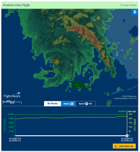
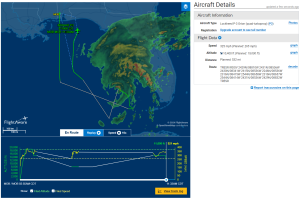
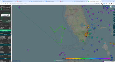
You can use the flight numbers, airports, and tail numbers above to query FlightAware and FlightRadar24 for more details. I was interested in the altitudes and routes that they fly over the storm. Generally, 10,000 feet seems to be the altitude for observation, but they fly higher in transit to the storm and back. Here are a couple of FlightAware screen grabs. One shows NOAA43 from this morning, the entire route. The other shows a live shot of TEAL72 making a pass over the eye. This gives you a sense of the speeds and altitudes. If you query TEAL72 on FlightAware you'll see fragments of the flight presented as different flights as FlightAware acquired and lost the tracking data, and you can more or less piece the whole flight together. These are long flights, generally 7 to 9 hours.


