
-
Please see the most recent updates in the "Where did the .com name go?" thread. Posts number 16 and 17.
-
IMPORTANT DOWNLOADING INFORMATION - ALL MEMBERS PLEASE READ
Please see this thread for updates. Update Thread
SOH ADMINISTRATION
You are using an out of date browser. It may not display this or other websites correctly.
You should upgrade or use an alternative browser.
You should upgrade or use an alternative browser.
Italy and Sicily, revisited by Achim...
- Thread starter Rami
- Start date

 )
)
Rami,
As always with Achim.........absolutely wunderbar ausgezeichnet!
Wonderfully Excellent!
Thanks Achim!
As always with Achim.........absolutely wunderbar ausgezeichnet!
Wonderfully Excellent!
Thanks Achim!

kelticheart
Charter Member
Thank you, Achim!
Splendid shots indeed!
If I may remind a simple correction in one of Northern Italy airfields, while Achim hasn't released them yet, the take off direction in Piacenza-San Damiano should be reversed. There's a specific reason to it, since today San Damiano is still a military base hosting Italian Air Force 50th fighter-bomber Gruppo, equipped with Panavia Tornadoes, specialized in AA radar suppression and electronic warfare countermeasures. It's valid nowadays as it was in WWII.
Due to the proximity to the town of Carpaneto, east of the airport, aircrafts take off heading West instead of East for obvious safety reasons. In case of engine failure, pilots heading West will not face densely populated areas to try an emergency landing in. Taking off heading East, as Achim's San Damiano scenery is set now, they would crash land among civilian settlements instead.
I already pointed this out in the past, if it didn't mean tweaking the *.bgl file I'd have gladly done it myself and uploaded it to spare Achim extra work. Since he is working on this update right now, I think this is the right time to fix this tiny, yet unrealistic, detail.
Thank you!
KH
Splendid shots indeed!
If I may remind a simple correction in one of Northern Italy airfields, while Achim hasn't released them yet, the take off direction in Piacenza-San Damiano should be reversed. There's a specific reason to it, since today San Damiano is still a military base hosting Italian Air Force 50th fighter-bomber Gruppo, equipped with Panavia Tornadoes, specialized in AA radar suppression and electronic warfare countermeasures. It's valid nowadays as it was in WWII.
Due to the proximity to the town of Carpaneto, east of the airport, aircrafts take off heading West instead of East for obvious safety reasons. In case of engine failure, pilots heading West will not face densely populated areas to try an emergency landing in. Taking off heading East, as Achim's San Damiano scenery is set now, they would crash land among civilian settlements instead.
I already pointed this out in the past, if it didn't mean tweaking the *.bgl file I'd have gladly done it myself and uploaded it to spare Achim extra work. Since he is working on this update right now, I think this is the right time to fix this tiny, yet unrealistic, detail.
Thank you!
KH
Last edited:

achim27619
Charter Member
Kelti,
this one is noted and I will reverse the take-off direction of Piazenza.
Cheers
Achim
this one is noted and I will reverse the take-off direction of Piazenza.
Cheers
Achim
kelticheart
Charter Member
Kelti,
this one is noted and I will reverse the take-off direction of Piazenza.
Cheers
Achim
THANK YOU, SIR!


Cheers!
KH
Cheers!
KH

Shadow Wolf 07
SOH-CM-2025
AQs always, excellent work! Thank you Achim.

The pics are looking really good. Thanks Achim 
achim27619
Charter Member
kelticheart
Charter Member
Great!
Wunderbar, Achim!
It looks splendid, were you able to overcome Rhumba's mesh around it, so that now the airport does not sit on top of a mesa as before?
I am attaching my Piacenza gsl work for you to consider, I did attach it before but it got lost with the recent server upgrade.
Cheers!
KH
Kelti,
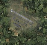
here is a screeny of the new Piacenza.
Cheers
Acgim
Wunderbar, Achim!
It looks splendid, were you able to overcome Rhumba's mesh around it, so that now the airport does not sit on top of a mesa as before?
I am attaching my Piacenza gsl work for you to consider, I did attach it before but it got lost with the recent server upgrade.
Cheers!
KH
Last edited:
achim27619
Charter Member
Stefano,
I will look into that and make the necessary cahanges.
Cheers
Achim
I will look into that and make the necessary cahanges.
Cheers
Achim
kelticheart
Charter Member
Stefano,
I will look into that and make the necessary cahanges.
Cheers
Achim
Hi Achim,
I just tried to reproduce the WWII layout of the airport with no photographic documentation at all. Starting from the dispersal areas still visible on the Google satellite overview of the airport, I tried to imagine how it would have looked back then.
Differently from the Reggiane aircraft factory, which is still in the same location as it was in WWII, next door to the Reggio Emilia airport, Piacenza lacks sufficient documentation about how it was during WWII. If you add the fact that buildings and hangars were blown up entirely by retreating Wermacht in April of 1945, you can imagine that mine is more of a guesswork than anything else.
I tried to place trees and woods more or less where they can be seen today and I added a fuel depot, still in the same location as it was in WWII, Northeast of the airport, some two-three km away from the main runway.
Please, find attached a group of files that place road and RR bridges over the Po river in Piacenza, North of the airport and the gsl Reggiane factory in Reggio Emilia. The Reggio Emilia airport layout comes from a picture of the local civilian pilot school in the 1930's.
May I suggest to add to Northern Italy the two airports of Verona-Villafranca (today's civilian Valerio Catullo airport) and Ghedi-Montichiari, just South of Brescia? They were both very important Repubblica Sociale airbases in 1944-45, used by the Luftwaffe as well.
Their WWII layout can still be seen in Google satellite overviews.
Thank you!
Stefano
kelticheart
Charter Member
Stefano,
I checked the files Achim sent me this morning, and the airfield is mesa-free.
GREAT NEWS, RAMI! A BIG
TO ACHIM!Cheers!
KH