MayDay! Northern Quebec is missing!

hubbabubba

Charter Member
I expected some airfields missing here an there when I started my trek around Northern Quebec - especially once I had heard that Stuttgart (EDDS), among others, had been ommited. But this was a whole void I found.

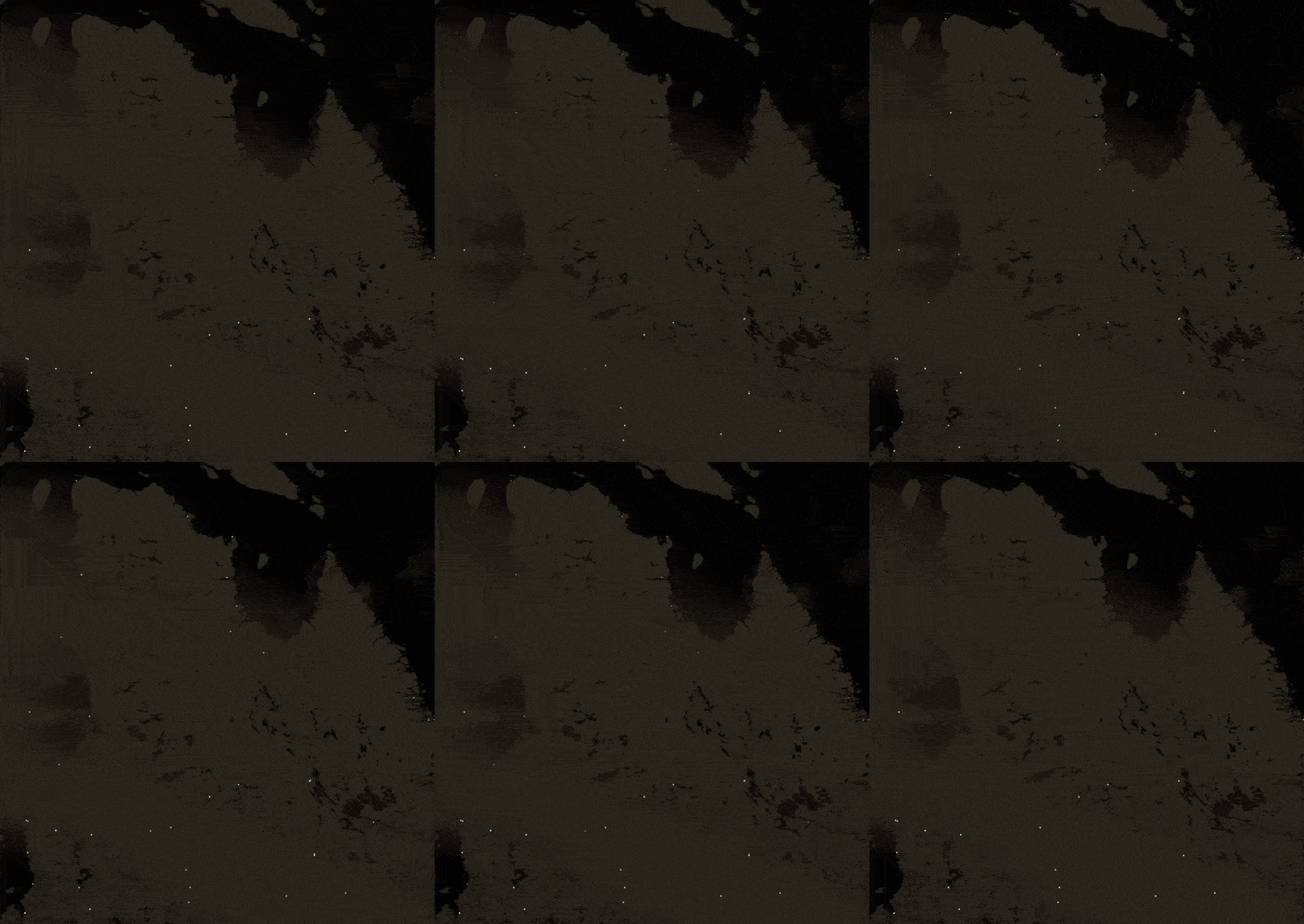
To give you an idea, this GIF shows that region with and without NAVAIDS filter. Most of these airstips have some form of NAVAID, mostly in the form of NDB and, curiously, they were integrated in the game... but not their relative airports! Note that not all airstrip have NAVAID and that some do but are missing entirely, NAVAIDS, airstrips, buildings altogether.


But the "funniest" part is that it appears that they were voluntarily ommited. Often they were even purposefully "camouflaged". And I can't imagine why. I will most definitely make a series of reports at Zendesk but I thought it would be of interest to some of you if I made a few remarks on these cases.

First case; Kuujjuarapik Airport (YGW, CYGW), NDB 371 active in game. Coodinates: 55.281898,-77.765297 ;

This is a picture taken from the drone camera of Kuujjuarapik/Whapmagoostui;
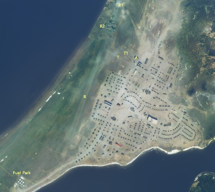


It is all too evident that most of the runway (R) is visible, only parts missing are from a ground-level cloud (R1) and a "green filling blur" (R2). The taxiway is also clearly visible (T) with a fudgy tarmac (T1) and the main airport building present (A). Note that the fuel park only has 7 main tanks and one small one, all simply painted on the ground and not 3D.
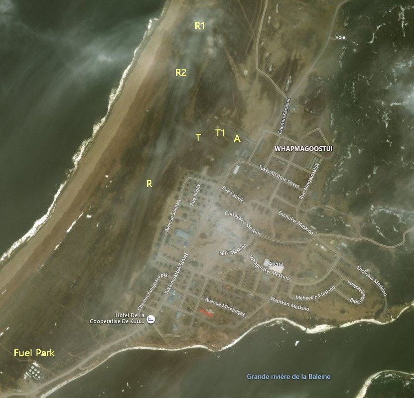


Note that the 7 big tanks are here in this Bing satellite image, minus the little one that was "made up" for no reason. The ground-level cloud (R1) is easily recognizable while the "blur" (R2) appears to have been formed from another cloud lurking around. But the runway (R), taxiway (R1), tarmac (R2) and airport building (A) are all clearly visible. Now, let's compare with Google Map;
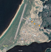


The fuel park now has 11 big tanks and one small one. Google does re-shoot its satellite images more frequently which, in turn, permits a "cloudless" rendering. But even with Bing Map, the runway is visible like a nose in the middle of the face and I cannot believe for a second that it was an unfortunate oversight.
 
On Bing maps the runway and most of the town are obfuscated by clouds, particularly the ends of the runways (R1 in your screenshot). R2 appears to be one of the default textures the sim uses when satellite data is not good enough (obfuscated, low resolution etc), which is quite common in a lot of parts of Canada (and other countries, you can see quite a lot of it on the Patagonia Bush Trip) particularly in northern regions. Hopefully Canada gets some better aerial data whenever we are due for a World Update, they recently updated the water/river data and it was a massive upgrade compared to what they originally had in the sim so I'm hopefully for further improvements down the line :encouragement:
 
COVID got you. ;) You let one of us Americans in country.

BTW: I do miss visiting Canada.
 
I doubt they will ever explain what bank of images is used or what the algorithm is for selecting which image for any location.
As a reference, I checked my house:
- the default Google Earth image is quite clear and with the zoom function there is a lot of detail.
-going into the 'historical imagery' I find the above view is an image dated 8/31/2017
-going through the timeline, nothing between then and the most recent image is worth the bandwidth used to view it.
- checking Bing maps (Aerial) I get the same image as the best above (ie. 3 yrs old) but it doesn't allow the same level of zoom and is of lower resolution.

At Kuujjuarapik, GE has 3 images (all August dates) 2010, 2013, 2019/ The extra fuel tanks appeared sometime between 2013 and 2019 (and they lost a dock SW of the tanks - just out of hubba's image - in the same time period). The Bing image appears to be the same one as used by GE.

So, part of the puzzle is whether they are using the "most recent" image, or one selected for clarity, and what the criteria are for 'stitching' areas together. If it's arbitrarily all the newest available, then there are going to be some awful areas depending on whose sat. shoots the image at what time on what day and how it's post-processed.

I'm not expecting a lot for a long time to come.
 
On Bing maps the runway and most of the town are obfuscated by clouds, particularly the ends of the runways (R1 in your screenshot). R2 appears to be one of the default textures the sim uses when satellite data is not good enough (obfuscated, low resolution etc), which is quite common in a lot of parts of Canada (and other countries, you can see quite a lot of it on the Patagonia Bush Trip) particularly in northern regions. Hopefully Canada gets some better aerial data whenever we are due for a World Update, they recently updated the water/river data and it was a massive upgrade compared to what they originally had in the sim so I'm hopefully for further improvements down the line

I have observed some improvements already. For example, the stooopid high-rise buildings are mostly gone. But if we wait for Bing Maps we will die of old age.

COVID got you. You let one of us Americans in country.

BTW: I do miss visiting Canada.

With that rig, you can... virtually :kilroy:
 
Second case; Kuujjuaq Airport (YVP, CYVP), NDB 390 (appears inactive in game) and VOR-DME 112.5 (non-tested). Coordinates; 58.0951000, -68.426903 ;


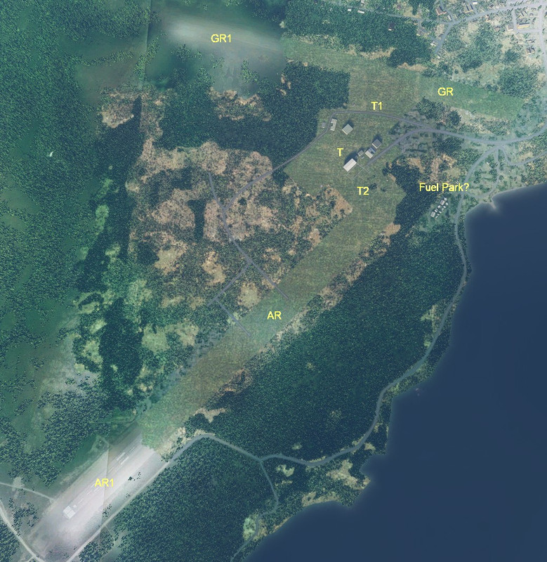
Here, the runways have been mostly blanketed with some green variety "wild lawn grass", but the the clearings for these runways are there. Kuujjuaq has two runways, the old gravel one(GR)and the more recent, made out of asphalt (AR). I said "mostly" because, for some unknown reason, they missed some spots. The south section of AR is well visible (AR1), apron "piano bars" and number (07 BTW) included! Ar first glance, I thought that the cut was at the joining of two sattellite photos half-hazardly stiched together but, no, the "stiching" is there as well!

I was so surprised that, at first, I didn't notice that GR was also 1/3 uncovered (GR1). As impressive is the fact that the clearing not only encompass the runways, but it does the same for the tarmac (T) and the taxiways (T1 and T2). Bing map is even more cloud-covered than Kuujjuarapik was. So how the clearings were so precisely made? Noticeable also is the replacement of the Fuel Park by a hodge-podge of cranky shacks. Better than Kuujjuarapik flat picture, but still...


At least, the place is quite landable from both runways' clearings. The next, and final, case is quite different. As you will see
 
More reasons as to why I wont ever use the Simulator MSFS2020. They should be ashamed to have a complete sim so chalked and unreal. Pure hate by MSFS2020 of the Canadian Arctic and Nunavik Northern Quebec and Slap to my Canadian RW home and Roots. Good thing for Lockheed and Xplane for not ignoring the Canadian Attic.
 
Please be aware that this forum is a place were we come together to help each other. Yes, FS2020 has its issues. Yes, we're all still learning its internal workings. But yes, it will improve with time. Please limit posts and replies to something that will help others. Letting everyone know that there are missing airfields is good - at least someone else won't be wondering if they're missing something. But coming here and just saying that is just crap, especially if you don't even own it, isn't helpful. We've probably all had our own frustrations with it. I know I have. If you feel the need to express them, at least be civil about it, as the initial post here is. If you have an issue that needs to be brought to the attention of MS/Asobo, please do so via their Zendesk page: https://flightsimulator.zendesk.com/
 
Last edited:
It never was my intention to disparage or deprecate MSFS 2020 in any way, shape or form. But those who will fly there, and the smaller portion that will build there, must have an idea of what's ahead. When I was making sceneries for CFS1, it was normal to make a reconnaissance of the place beforehand.

One thing that became clear as I was "prospecting" the region is that airfields were not missing by error but were purposefully masked to different degrees. Does it mean that, eventually, MSFS 2020 team will finish what is already half-there, or is it an invitation to 3rd party to go-ahead?

I will make reports to Zendesk, but I will also contemplate doing the job myself. My basic concern is the Community folder and Official folder butting heads at every upgrade.

I know that there's a lot of ropes' learning between CFS1 and MSFS 2020, but it's not called a "pastime" for nothing. Is it going to help others? Only time will tell.
 
It never was my intention to disparage or deprecate MSFS 2020 in any way, shape or form. But those who will fly there, and the smaller portion that will build there, must have an idea of what's ahead. When I was making sceneries for CFS1, it was normal to make a reconnaissance of the place beforehand.

Which is why I mentioned that your initial post was done with civility - for which I thank you. I also frequent the official forum, and there are more trolls than you can shake a stick at. At one point, it was nearly out of control, but the moderator team there has gotten better control over it. Many of the troll users are still there, but they're quieter now.
 
I must be outdated and I admit that "trolls" make me think of LOTR and the Hobbits. I guess I'm not "forum-savvy".
 
They're just people that care more about getting attention and causing trouble than they do about helping. You just want to "Gibbs Slap" 'em!

tumblr_inline_p7gg6eBaDU1t8ox7x_540.gif
 
Back
Top