mongoose
SOH-CM-2025
I know this has been a sublet on SOH before but I was revisiting it for missions where there were more than 8 aircraft supposedly part of a same group and meant to be flying together. getting them to actually do so as totally separate flight s is very difficult with mb app.
In this case I had 11 Spitfires, and separately, 12 BF110c-4/Bs meant to be together.
Initially I made groups of 8 + 3 and 8 + 4 and then using notepad I edited the xml to add the 3 Spits and 4 110's to their respective 8's and cancelled their respective separate flights.
The result, which probably I knew some years back, was explosion as another ac merged with the player.
Next I kept the 3 and 4 flights separately but transferred/copied the respective 8 flight waypoint info to them.
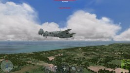
Result the same. See photo.
Finally I altered the 3 and 4 flight waypoint altitude by about 4-5 metres from the 8 flights, plus adjusted the Longitudes and Latitudes by a few seconds or so; depending.
Result; All OK and all flying more or less together; 11 Spits and 12 Bf110's.
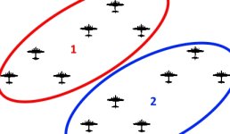
Now someone may have an easier way to deal with this, in which case I would like to know. as it is very relevant to really large groups which all should be flying together. Ideally one should be able to work out the geometry WRT alt, Lat, & Lon for each flight so they are in their proper large formations. It would help if one knew what 1sec. Lat or Lon was in metres I suppose.


