falcon409
SOH-CM-2026
I have posted this over at FSDeveloper however after many views I haven't gotten even a guess as to what is causing the problem. I am helping Richard with the satellite imagery for NAS_Argentia. The airport sits on a triangular peninsula which in terms of scenery basically renders it an Island with all the problems that incurs for scenery work.
1.) the default must be deleted, then that area must be filled with water
2.) the Hydro Poly that fills that area must be manipulated to cause a hole to form around the Island allowing the new Satellite image to show through.
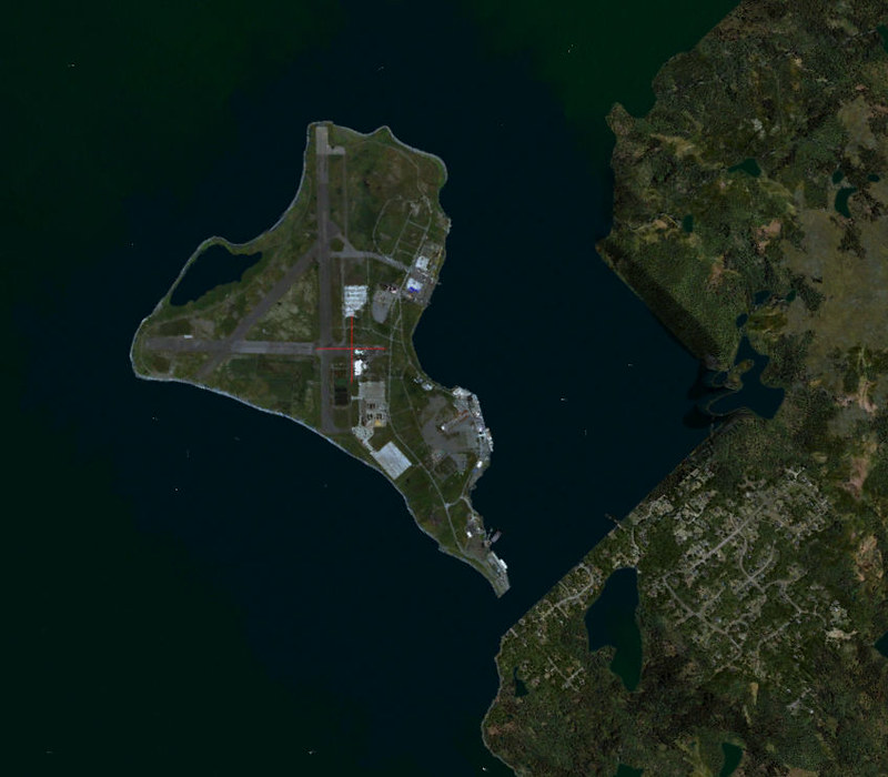 Image1 by Ed Wells, on Flickr
  NAS_Argentia-2023-aug-9-002 by Ed Wells, on Flickr
If the Island was free standing that would be the end of it, however being a peninsula it has attaching landmass which is affected by the hydro poly causing the poly to knock out a portion of the existing landmass away from the peninsula. I am trying to figure out how to clear that portion that's affected so that the default area is revealed and I can get this to Richard and he can complete his project.
Any help would be appreciated.
1.) the default must be deleted, then that area must be filled with water
2.) the Hydro Poly that fills that area must be manipulated to cause a hole to form around the Island allowing the new Satellite image to show through.
Image1 by Ed Wells, on Flickr NAS_Argentia-2023-aug-9-002 by Ed Wells, on FlickrIf the Island was free standing that would be the end of it, however being a peninsula it has attaching landmass which is affected by the hydro poly causing the poly to knock out a portion of the existing landmass away from the peninsula. I am trying to figure out how to clear that portion that's affected so that the default area is revealed and I can get this to Richard and he can complete his project.
Any help would be appreciated.
