Panther_99FS
Retired SOH Administrator
<TABLE cellSpacing=2 cellPadding=2 width="100%" align=center bgColor=#aaccee border=0><TBODY><TR><TD align=left colSpan=2>[FONT=verdana, sans-serif]Category: Flight Simulator X - Scenery[/FONT] </TD></TR><TR><TD align=left width=*>[FONT=verdana, sans-serif]New! [/FONT] [FONT=verdana, sans-serif]Anson County Airport (KAFP) [/FONT]</TD><TD noWrap align=right><!--  -->
-->
 </TD></TR></TBODY></TABLE>
[FONT=verdana, sans-serif]Images related to this file:
[/FONT]
[FONT=verdana, sans-serif]File Description:
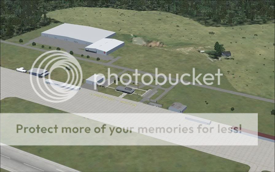
The Anson County Airport (KAFP) in Wadesboro, North Carolina for Flight Simulator X. This rendition of Anson County Airport represents the airport as it looks as of December 2008, with all buildings, hangars, and other structures accurately modeled, in addition to the large "Triangle Brick" factory across the railroad tracks. Look forward to future updates adding more hangars and a full ILS system. For more great general aviation airport sceneries from JD's, visit us at www.jdsceneries.com
<TABLE width="50%" align=center bgColor=#aaccee border=0><TBODY><TR><TD width="25%">[FONT=verdana, sans-serif]Filename:[/FONT]</TD><TD width="75%">[FONT=verdana, sans-serif]jd_sceneries__anson_county_airport.zip[/FONT]</TD></TR><TR><TD width="25%">[FONT=verdana, sans-serif]License:[/FONT]</TD><TD width="75%">[FONT=verdana, sans-serif]Freeware[/FONT]</TD></TR><TR><TD width="25%">[FONT=verdana, sans-serif]Added:[/FONT]</TD><TD width="75%">[FONT=verdana, sans-serif]2nd December 2008[/FONT]</TD></TR><TR><TD width="25%">[FONT=verdana, sans-serif]Downloads:[/FONT]</TD><TD width="75%">[FONT=verdana, sans-serif]175[/FONT]</TD></TR><TR><TD width="25%">[FONT=verdana, sans-serif]Author:[/FONT]</TD><TD width="75%">[FONT=verdana, sans-serif]JD's Scenery Simulations, Jon Raines[/FONT]</TD></TR><TR><TD width="25%">[FONT=verdana, sans-serif]Size:[/FONT]</TD><TD width="75%">[FONT=verdana, sans-serif]9745kb[/FONT]</TD></TR></TBODY></TABLE>
[/FONT]
--> </TD></TR></TBODY></TABLE>[FONT=verdana, sans-serif]Images related to this file:
[/FONT]
[FONT=verdana, sans-serif]File Description:
The Anson County Airport (KAFP) in Wadesboro, North Carolina for Flight Simulator X. This rendition of Anson County Airport represents the airport as it looks as of December 2008, with all buildings, hangars, and other structures accurately modeled, in addition to the large "Triangle Brick" factory across the railroad tracks. Look forward to future updates adding more hangars and a full ILS system. For more great general aviation airport sceneries from JD's, visit us at www.jdsceneries.com
<TABLE width="50%" align=center bgColor=#aaccee border=0><TBODY><TR><TD width="25%">[FONT=verdana, sans-serif]Filename:[/FONT]</TD><TD width="75%">[FONT=verdana, sans-serif]jd_sceneries__anson_county_airport.zip[/FONT]</TD></TR><TR><TD width="25%">[FONT=verdana, sans-serif]License:[/FONT]</TD><TD width="75%">[FONT=verdana, sans-serif]Freeware[/FONT]</TD></TR><TR><TD width="25%">[FONT=verdana, sans-serif]Added:[/FONT]</TD><TD width="75%">[FONT=verdana, sans-serif]2nd December 2008[/FONT]</TD></TR><TR><TD width="25%">[FONT=verdana, sans-serif]Downloads:[/FONT]</TD><TD width="75%">[FONT=verdana, sans-serif]175[/FONT]</TD></TR><TR><TD width="25%">[FONT=verdana, sans-serif]Author:[/FONT]</TD><TD width="75%">[FONT=verdana, sans-serif]JD's Scenery Simulations, Jon Raines[/FONT]</TD></TR><TR><TD width="25%">[FONT=verdana, sans-serif]Size:[/FONT]</TD><TD width="75%">[FONT=verdana, sans-serif]9745kb[/FONT]</TD></TR></TBODY></TABLE>
[/FONT]