MaskRider
Tiller of Soil
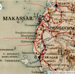
...your more than welcome. I did see that some of the seaplane "bases" that were maintained by the Dutch at that time appeared to be bases in name only. Some appeared to be described as no more than a gas can (kidding) and some boats. No real infrastructure as we would expect for a base. I will,however, look for some more stuff if you want.
BTW: did the batch file links work for you?
Yes. Apprently this base too, while serving as an actual civilian stop before the war was actually nothing more than the jetty, a workshop and a place for flight crews to take a naps and refuel their planes. It was never a staging location for large operations. Although at the time of the Japanese attack on Manado, there were those six Do-24 flying recon flights from the "base".
MR


 )
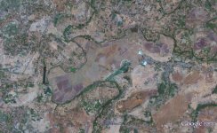
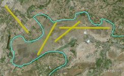
) For some stupid reason I was keeping to the area just south of the dammed up river. The darker area. Probably because that's where the coordinates referenced to.