• There seems to be an uptick in Political comments in recent months. Those of us who are long time members of the site know that Political and Religious content has been banned for years. Nothing has changed. Please leave all political and religious comments out of the forums.

    If you recently joined the forums you were not presented with this restriction in the terms of service. This was due to a conversion error when we went from vBulletin to Xenforo. We have updated our terms of service to reflect these corrections.

    Please note any post refering to a politician will be considered political even if it is intended to be humor. Our experience is these topics have a way of dividing the forums and causing deep resentment among members. It is a poison to the community. We appreciate compliance with the rules.

    The Staff of SOH

  • Server side Maintenance is done. We still have an update to the forum software to run but that one will have to wait for a better time.

An "Oldie" Revisited

falcon409

Moderator
Staff member
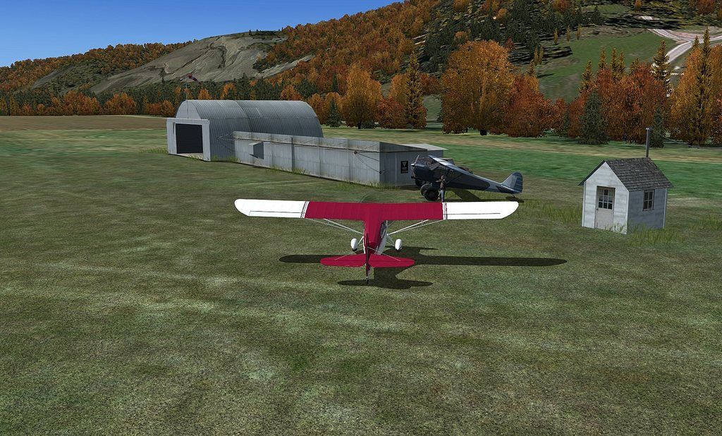
This might have been one of the first scenery projects I did using satellite imagery for the ground texture. It was a request from someone who was familiar with this airport and many others in the same region of the country. I believe it's closed now. . .but since this is a Simulator. . .I'm simulating that it's still open.

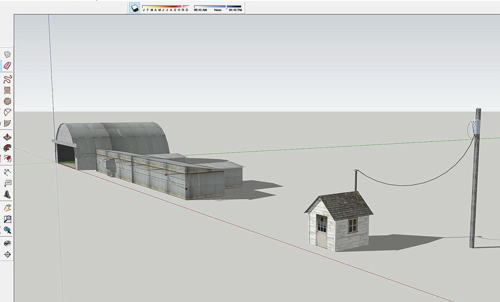
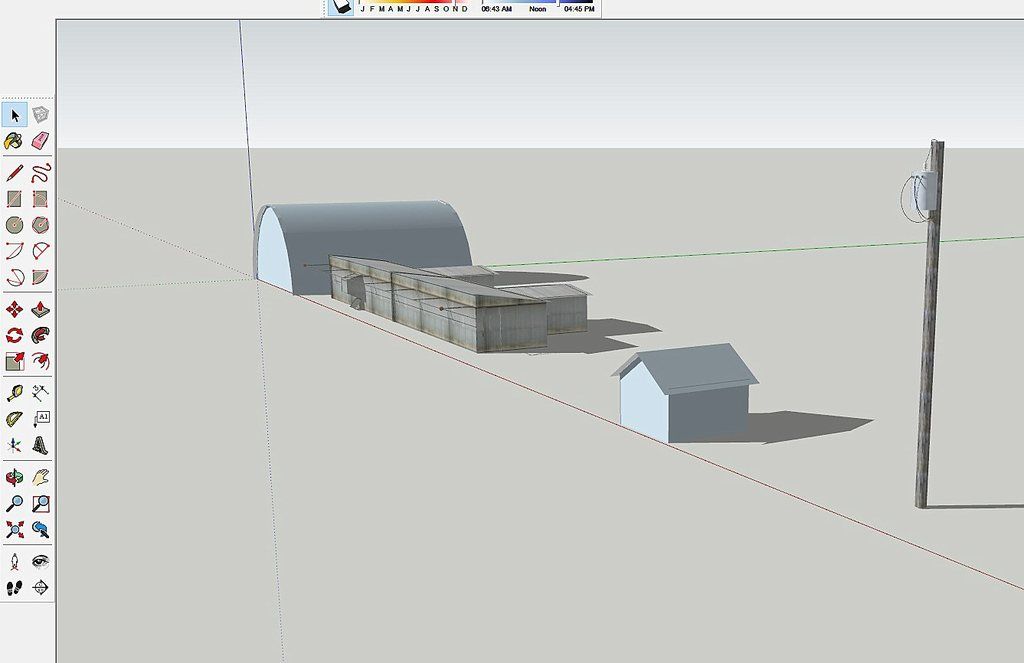
I found some good images of the buildings, something I don't think I had originally because I used all default hangars. This time around it should look pretty close to how it was.

Oldie-002.jpg
 
The airport I am thinking is the one a US President used when he went to his home or something like that.

 
Downsville?

Either way, I'm glad to see you're turning your considerable skills back to the Northeast, Ed! New York state and Pennsylvania offer a surprising amount of rolling and challenging topography. Outside metro areas, they really do present a stunning amount of rural natural beauty. The Poconos, Catskills, etc....
You are correct Mark. Downsville, White Birch, Valley View and some others....all enjoyable and scenic small strips that I have done and plan to revisit to give a facelift to.
 
Almost there:

Downsville_WIP.jpg


Next step will be to move it into MCX for final compile and then into the scenery.
 
Where?

Uploaded to the SOH Library.
I went to the library hoping to find this little airstrip in the Catskills. But while the screenshot is the same as above, the associated file is the previously-uploaded Airpark-Dallas.zip.

I hope it's just a simple file error and can easily be corrected.

Thanks, Ed!
 
I went to the library hoping to find this little airstrip in the Catskills. But while the screenshot is the same as above, the associated file is the previously-uploaded Airpark-Dallas.zip.

I hope it's just a simple file error and can easily be corrected.

Thanks, Ed!
Thanks, not certain why the pic changed on the Airpark-Dallas download. The Downsville upload will not be available til Rami has a chance to get it officially uploaded and access is available. I would guess not until later today or this evening.
 
A bit tight for my usual scenery test ride, but doable. I really had to study out the approach and it was still pretty tense. The Howard doesn't slow down that well coming in down a mountainside into a valley. Great little airfield!

attachment.php
 

Attachments

  • wm-2018-sep-27-001.jpg
    wm-2018-sep-27-001.jpg
    63.7 KB · Views: 2
Beautiful airport, Ed! Thanks!

I wish the tree colors in P3DV4 were a little more realistic. Not enough color differences! Pete

Update:

What can I do to fix this problem (I guess with elevation?). I do have FTX Global Vector installed, and ran the Airport Elevation Tool. That did not fix it. When I have a aircraft at different areas of the Downsville runway, the aircraft will be above ground a foot or so, or beneath the surface, as in this picture. NC

attachment.php
 

Attachments

  • Sinking.jpg
    Sinking.jpg
    50.5 KB · Views: 2
Back
Top