tgycgijoes
Members +
I discovered on Flightaware when I was researching the Wings of Rescue flights highlighted in my last post about the Carenado Embraer 120, the airport in Denton, Texas, Denton Enterprise Airport. The airport was established in 1942 and used during 1943–44 by the United States Army Air Forces as a contract glider training airfield. It was known at the time as Denton Field. Harte Flying Service provided instruction. It was used primarily by C-47 Skytrains and Waco CG-4 unpowered Gliders. The mission of the school was to train glider pilot students in proficiency in operation of gliders in various types of towed and soaring flight, both day and night, and in servicing of gliders in the field.
It was inactivated in late 1944 with the drawdown of AAFTC's pilot training program. It was then declared surplus and turned over to the Army Corps of Engineers on September 30, 1945. It was eventually discharged to the War Assets Administration (WAA) and became a civil airport in December 1946.
Denton Enterprise Airport serves as an operation base for flight and medical air ambulance training and corporate aviation, helps relieve traffic from DFW International Airport and Dallas Love Field and is an aircraft refueling center.
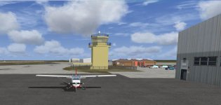
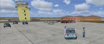
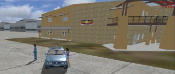
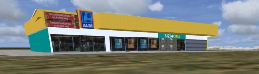
To create the airport I extensively used not only Google Earth for all the aerial map views for building placement; runways; taxiways and roadways which were all created in Airport Design Editor. The custom buildings were created as closely as possible using Google and Facebook sites as reference and Sketchup Make 2016 and Model Convertor X. It took a lot of time and effort but it was really fun, satisfying and a challenge.
Here are shots of the results:
It was inactivated in late 1944 with the drawdown of AAFTC's pilot training program. It was then declared surplus and turned over to the Army Corps of Engineers on September 30, 1945. It was eventually discharged to the War Assets Administration (WAA) and became a civil airport in December 1946.
Denton Enterprise Airport serves as an operation base for flight and medical air ambulance training and corporate aviation, helps relieve traffic from DFW International Airport and Dallas Love Field and is an aircraft refueling center.
To create the airport I extensively used not only Google Earth for all the aerial map views for building placement; runways; taxiways and roadways which were all created in Airport Design Editor. The custom buildings were created as closely as possible using Google and Facebook sites as reference and Sketchup Make 2016 and Model Convertor X. It took a lot of time and effort but it was really fun, satisfying and a challenge.
Here are shots of the results: