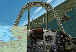
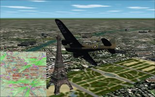
France Map Gauge.zip

France Map Gauge.zip 2024-07-27

No permission to download
What a great little option, Martin.

Superb and many thanks!

Oh, could this be expanded to other areas, the world etc?

Cheers

Shessi
 
Many thanks Shessi
The FS2004 .CAB gauge was made by ROFMR for GeoLibre, his contact was lost since 2014, it was uploaded for preservation.
I made the code to "convert" it to a .gau format and permit its use for CFS2.
One can do such gauge with any map in "mercator" format, where the longitudes are drawn perfectly vertically and latitudes perfectly horizontally, as if our mother earth was a cylinder.
On the north west front map, I re-shaped each map portion to correspond to this necessity.
There is a distortion that grows when the latitude increrase in the way to the poles, sorry for the Flatists, but our earth is round, neither a cylinder nor flat ;)
So, if someone propose the maps well shaped, I can do the code if the zone is not too close to the poles.
Cheers
Martin :jump:
 
I can see this as a VERY useful gauge, especially when flying in "older" eras where there aren't many nav aids, but where you need a good "navigator" that can place your aircraft on a custom map. :encouragement:

We did something similar with the LORAN gauge, but only after you went through all the steps needed to get a position with the APN-4 unit. ;)

Jorge
Miami, FL
 
Back
Top