• Please see the most recent updates in the "Where did the .com name go?" thread. Posts number 16 and 17.

    Post 16 Update

    Post 17 Warning old domain name stealing credentials

  • Special Server Maintenance

    Just when you think you have everything running some what better...

    You get a message from the Hosting company. Short story they need to move us to a new server. I have been working with them to plan a good date for all concerned. Here is what we have come up with as a schedule.

    1. November 4th 17:00 -5UTC shut off the forums and start backup proceedures. During this time there will be no access to the forums or the Resource Section.
    2. November 5th Continue with Backups and download same until complete.
    3. November 6th 7:00 turn over server to hosting company to move system to new server
    4. November 7th - 8th restore backups and upgrade forum software.

    If all goes well we should be back online on November 8th.

    To keep you updated we will post updates on AVSIM forums.

    Thank you for your support.

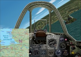
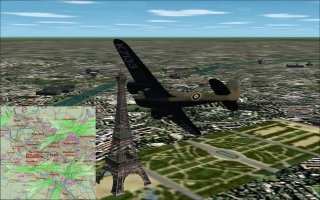
France Map Gauge.zip

France Map Gauge.zip 2024-07-27

No permission to download
What a great little option, Martin.

Superb and many thanks!

Oh, could this be expanded to other areas, the world etc?

Cheers

Shessi
 
Many thanks Shessi
The FS2004 .CAB gauge was made by ROFMR for GeoLibre, his contact was lost since 2014, it was uploaded for preservation.
I made the code to "convert" it to a .gau format and permit its use for CFS2.
One can do such gauge with any map in "mercator" format, where the longitudes are drawn perfectly vertically and latitudes perfectly horizontally, as if our mother earth was a cylinder.
On the north west front map, I re-shaped each map portion to correspond to this necessity.
There is a distortion that grows when the latitude increrase in the way to the poles, sorry for the Flatists, but our earth is round, neither a cylinder nor flat ;)
So, if someone propose the maps well shaped, I can do the code if the zone is not too close to the poles.
Cheers
Martin :jump:
 
I can see this as a VERY useful gauge, especially when flying in "older" eras where there aren't many nav aids, but where you need a good "navigator" that can place your aircraft on a custom map. :encouragement:

We did something similar with the LORAN gauge, but only after you went through all the steps needed to get a position with the APN-4 unit. ;)

Jorge
Miami, FL
 
Back
Top