-
Please see the most recent updates in the "Where did the .com name go?" thread. Posts number 16 and 17.
-
IMPORTANT DOWNLOADING INFORMATION - ALL MEMBERS PLEASE READ
Please see this thread for updates. Update Thread
SOH ADMINISTRATION
You are using an out of date browser. It may not display this or other websites correctly.
You should upgrade or use an alternative browser.
You should upgrade or use an alternative browser.
Global AI Ship Traffic V1 for FSX and P3D News and Support
- Thread starter kl791
- Start date
-
- Tags
- ai traffic boat navy ships
delta_lima
Charter Member 2015
Henrik, these look superb.
The period bracket you cite would be perfect - I had your ships instalalled in FSX, but haven't yet in P3D, because I wanted to limit my shipping environment to primarily the classic period.
If it's possible for the ships from the period of 1950-1970 to be segregated, that would be superb, because then I can create a "classic period" shipping install separate from a "modern period" install and one or the other.
Anyway - looking forward to these.
dl
Henrik, these look superb.
The period bracket you cite would be perfect - I had your ships instalalled in FSX, but haven't yet in P3D, because I wanted to limit my shipping environment to primarily the classic period.
If it's possible for the ships from the period of 1950-1970 to be segregated, that would be superb, because then I can create a "classic period" shipping install separate from a "modern period" install and one or the other.
Anyway - looking forward to these.
dl
Thanks
 It will be two completely different set of routes. I want to recreate a realistic shipping from the time, and then there shouldn't come a 400 metres long container giant spoiling the nostalgia... I won't be able to cover the whole globe - at least not in one go, so wishes to focus areas are welcome - and better if some classic sceneries exist for the area.
delta_lima
Charter Member 2015
Thanks
Hi Henrik,
My suggestion would be where there’s already some good FSX compatible Calclassic scenery. So nodes I’d consider:
New York
Miami
Havana
Beirut
Hong Kong
Calcutta
Seattle
Los Angeles
Honolulu
Lisbon
Nice
As examples. Excited for this package, whatever you decide.
Many kind thanks.
DL
awstub
SOH-CM-2023
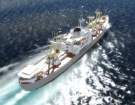
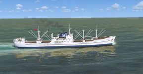
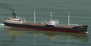
Ships for Hong Kong 1962... I am getting to the point where I have enough models to start doing the first routes
Very, very nice!
I am correct in assuming that you will be including routes within the South China Sea (and Haiphong Harbor prior to Operation Pocket Money)?
Very, very nice!
I am correct in assuming that you will be including routes within the South China Sea (and Haiphong Harbor prior to Operation Pocket Money)?
Yes, that is the intention. Several of the new models I can document have been to Vietnam during the conflict, so besides all the new carriers coming along at the moment you will also have the civil traffic.
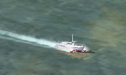
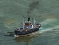
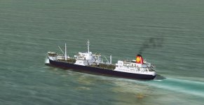
Today was spent building and testing routes - below screenshots taken in FSX between Buenos AIres and Montevideo:


Attachments
This will work in FSX and all P3D versions released so far - I just do my initial testing with a default version of FSX to check the routes compared to default coastlines.Sorry for the annoying question in advance but P3Dv4 does accept FSX boat/ferry routes as-is or?
Thanks! Just bought P3Dv4 like a few weeks before it got upgraded - sigh, but happy I did.
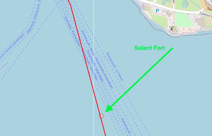
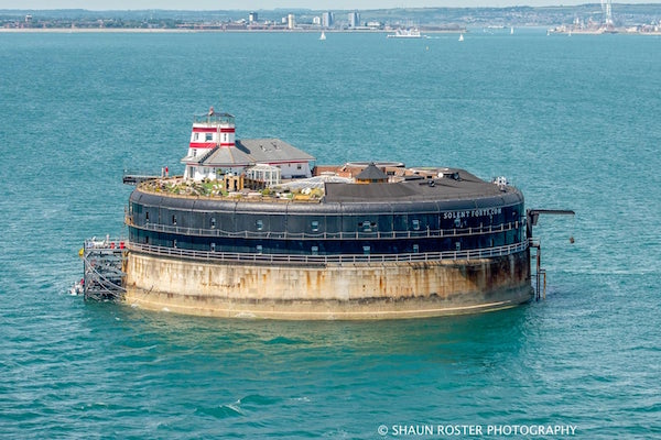
This is a wonderful collection that has breathed new life in to FSX for me. Thank you.I have one question; I fly mainly in the south of England and have HMS Illustrious and her Type 45 destroyers and HMS Ocean in convoy. As they sail in to Portsmouth they are colliding with a Solent fort which is constructed on spit of land and piling up on each other. Is there a way to slightly alter their course as the convoy heads towards Portsmouth harbour?I have tried using AIFP but although it loads the traffic file it shows nothing. I have tried BGLAnalyze as well and it says it cannot read the file either.I would really like to get the RN back to port!Thank you.
This is a wonderful collection that has breathed new life in to FSX for me. Thank you.I have one question; I fly mainly in the south of England and have HMS Illustrious and her Type 45 destroyers and HMS Ocean in convoy. As they sail in to Portsmouth they are colliding with a Solent fort which is constructed on spit of land and piling up on each other. Is there a way to slightly alter their course as the convoy heads towards Portsmouth harbour?I have tried using AIFP but although it loads the traffic file it shows nothing. I have tried BGLAnalyze as well and it says it cannot read the file either.I would really like to get the RN back to port!Thank you.
Why not use AIBTC instead?
AIBTC.exe http://lc0277.gratisim.fr/boat/
Decompile the traffic file that’s crashing into Solent fort, re-map out your route using google earth and use the above tool to recompile. That’s what I do anyway and find it easy to add new routes.....I’ve got type 21s and 22s sailing out of Guz and Ark Royal with destroyer escort sailing out of Pompey.
Out of curiosity do you know where the bgl came from in the first instance/what tool was used to create it? As I’ve yet to come across a boat traffic bgl that couldn’t be decompiled using AIBTC so assuming it’s been compiled using that method I stumbled across ages ago (creating water “taxiways” and having ships “taxi” along it using an aircraft flight plan tool.... ‘orrible!)

cheers
Gary
cheers
Gary
Thanks for your help with this Gary.
The .bgl file is included in the Global Ships Traffic v2 that this thread is about.
I downloaded that program you suggested and pointed it to the folder I have the file in but it doesn't seem to see it/ load it.
----
Oh hang on a minute - I've got it working now. I chose wrong folders for source and destination.
It's making sense now thanks.
Managed to open the .kml in a flight planning app as you can see - the course takes the boat straight into one of the solent forts. I just need to shift that over a bit.
Blame Orbx England as the forts are not there in default scenery.
What is the name of the .bgl you are using?
I will look and see to adjust the plot if I can know the name.
You can also open the .kml in Google Earth and adjust it yourself (if you have GE).
The sailings are spread across multiple .bgl's. Each one represents one of the fleet - they're not in convoy in a single .bgl.
Lusty in one, then Duncan, then Dragon, Then a couple of other earlier destroyers then Ocean bringing up the rear.
I tried to edit the .kml in GE but could not find a way to do it.
Thank you so much for looking at this.