-
There seems to be an uptick in Political comments in recent months. Those of us who are long time members of the site know that Political and Religious content has been banned for years. Nothing has changed. Please leave all political and religious comments out of the forums.
If you recently joined the forums you were not presented with this restriction in the terms of service. This was due to a conversion error when we went from vBulletin to Xenforo. We have updated our terms of service to reflect these corrections.
Please note any post refering to a politician will be considered political even if it is intended to be humor. Our experience is these topics have a way of dividing the forums and causing deep resentment among members. It is a poison to the community. We appreciate compliance with the rules.
The Staff of SOH
You should upgrade or use an alternative browser.
Grosvenor House
- Thread starter MM
- Start date
 Here are a few shots of my flight from LFML Marseilles to LIRA Rome. Had thunderstorms for the complete flight, hehe lots of lighten and it was rock and roll. Sure glad I didn't eat and breakfast this AM, if I did, more than likely it would be all over the cockpit, but for a change I did something right. But I did get coffee all over the place when trying to pour myself a cup, hehe looks like I wet me pants, or maybe something else happen with the bouncing of the this here bird. What the heck, we made it!
So earlier I'm humping along in near clear weather and then POW! Just after passing the LAR NDB, the sandstorm closes in right on cue. At least I had one more beacon before really sweating it out.
There was some light this time so I dropped to about 900' when I was approx 15 miles out so I could see the ground and followed the coastline until I spotted the tents, shack and palm trees.
Here we are early in the flight, sailing along enjoying the southern Iran mountain range:

Routing for this segment:

View from the cockpit and spot view at about 6000' after the viz went to heck. (Thankful the Hornets didn't seize up from the sand):


I had nice tailwind after taking off from Coco Island but the winds shifted midway over the Bay of Bengal to a 22knt headwinds, increasing to 37knts as I crossed the coast into India, and kept increasing till I was beating into a 44knt headwind.
srgalahad
Charter Member 2022
Having finally gotten some of the issues out of the way I figured it was time to get started on the marathon. A pre-dawn departure from Mildenhall precluded any photos (and strangely no press types with their fancy flash bulbs).
View attachment 14228
A passably good morning with sunshine welcoming me over the Belgian coast and a trouble-free passage of western Europe. Occasional clouds obscured the scenery and of course began to get thicker as we neared the Alps.
View attachment 14223
This was worrisome as the Miles may be a stout bird and has thusfar performed flawlessly, but she strains at heights and there was also the admonishment From 119 Piccadilly to take care not to break Miss Nellie's 12,000 ft glass ceiling. That means possibly winding through the southern Alps to the Italian frontier while dodging cloud and rock!. Fortunately, there was a clearing trend that lasted until the greatest peaks were passed.
View attachment 14224
Thank goodness I chose this northern route and avoided the really tall mountains as 11,749 ft was just sufficient. The maps are just not quite correct...
From the Italian border to southern Croatia it was just a concerted effort to navigate and maintain focus on the tasks at hand. Fortunately the weather remained benign and I was treated to a pleasant sunset as the route eased away from the coast
View attachment 14225
... and finally, fighting exhaustion and cramps from the rudimentary seat I was able to negotiate final approach past the Acropolis and, with a firm bounce, a landing at Hellinikon.
View attachment 14226 and now, Ouzo and sleep (Thanks MM)
MM
Charter Member

This innocuous shot of the Beech, at 3,000' over the Bay of Bengal, marks that truth. Flying from Allahabad to Rangoon, after passing Calcutta and changing course, I handed the aircraft to my co-pilot Lear. After a few minutes in the back, freshening up, I returned to scan the gauges. But the first thing was the sound, or the lack of sound. Then a quick glance at the altimeter suggested that all was not right in the world. While Lear was dutifully following the course and holding pitch, he had forgotten to switch from the nose to the wing tanks. Don't know what he was thinking when confronted with the loud deafening silence. We had lost 8,000' and were sinking toward the sparkling sea below.
Tanks switched, engines restarted, and altitude regained. Made for an entertaining and instructive "I learned about flying from that" story. If you happen to live from these experiences…"never again."
Let's see, flying over the Bay of Bengal on the way to Burma. A close shave. We might call this a B-Shave … a Bur-Shave. …I've got it. A Bengal Shave! No. Must be something in there, though.
Flew on to land at Rangoon. After a quick lunch, departed southward through Siam and down the Malay Peninsula to Singapore. Lots of thunderstorms over the Gulf, but I managed to check and switch my tanks on schedule.

On approach to Singapore, thunder, lightning, and low thick clouds made me quickly find cross-referencing NDBs. If I landed in the impenetrable mist, I wanted to pick the right aerodrome. Got the needles set up and was frantically shifting my glace from the ADF to the opaque grey ahead, straining my eyes looking for the field.

Suddenly, the little Beech popped out of the muck and into the clear. There were the centerline lights of RAF Seletar! No worries.

srgalahad
Charter Member 2022
we all know fliers chew gum. However you should have been using
instead of that
A proper choice would have probably prevented that
as you found yourself silently heading for the drink...
Ron Attwood
Members +
Flying from Allahabad to Rangoon, after passing Calcutta and changing course, I handed the aircraft to my co-pilot Lear. After a few minutes in the back, freshening up, I returned to scan the gauges. But the first thing was the sound, or the lack of sound. Then a quick glance at the altimeter suggested that all was not right in the world. While Lear was dutifully following the course and holding pitch, he had forgotten to switch from the nose to the wing tanks. Don't know what he was thinking when confronted with the loud deafening silence. We had lost 8,000' and were sinking toward the sparkling sea below.
All I can say is "Eek!"

srgalahad
Charter Member 2022
Athens to Baghdad.
Eight and a half hours - an hour less than estimated thanks to mostly good weather and 15 Kt tailwinds all the way.
View attachment 14386
Turkish thunderstorms are not a delight but they cleared eventually.
Approaching Adana (LTAF) I was a bit south of course, but that worked out well as I might have had to scratch or break Miss Nellie's ceiling As it was, 11,000 just worked.
View attachment 14387
It's difficult to fly in cruise for 8, 10, 12 hours with nothing to do but monitor fuel and check navigation, then suddenly it's time to gather thoughts, get oriented and remember how to hand-fly to a landing. Rasheed is not the easiest place to find but I finally picked out which straight, grey bit of asphalt was the runway, only to turn final and discover they plunked the airport rotating beacon right on the centerline at the threshold!
So, stay a bit high, a bit right and once it feels good, reduce power and float... float... float. Good thing that runway is 8800 ft long!
View attachment 14388
Now time to contemplate the next segment -- 2005 miles to VIAL -- one leg or two??? Hmmmm...
MM
Charter Member
An early morning departure from Singapore led to this rain squall being lit up by the pink sunrise.

Passing along the Ring of Fire made for good landmarks off the starboard side. Here is a picture of the Beech passing the high caldera on the legendary island of Bali. (In 1934 Bali retained its mystical aura of enchantment. Today the southern part of the island has become a jam-packed tourist magnet for Japanese, Chinese, and especially Australians.)

Landed in thick haze at the Dutch aerodrome at Rambang where the locals set up a wonderful luncheon. (They fondly remember Jean Batten's stopping here on her record flight from Australia to England.) And then took off to the southeast, turning into the Timor Sea. In the 1930s, the sea was rather empty--carrying very little ship traffic except for a few pearling boats below. Here the image captures the hours of vast emptiness as the pilot alternates periods of boredom with moments of nervy worry about the arrival of the Australian coastline.

Then over Cullen Bay and short finals into Parap Aerodrome, just north of Port Darwin. Here you can see the Eucalyptus trees that line the western edge of the field. The Beech 18 will stop here for a few days…as the pilot has commitments ten thousand miles away.

The Beech 18 will stop here for a few days…as the pilot has commitments ten thousand miles away.
MM
Charter Member
An early morning departure from Singapore led to this rain squall being lit up by the pink sunrise.

Passing along the Ring of Fire made for good landmarks off the starboard side. Here is a picture of the Beech passing the high caldera on the legendary island of Bali. (In 1934 Bali retained its mystical aura of enchantment. Today the southern part of the island has become a jam-packed tourist magnet for Japanese, Chinese, and especially Australians.)

Landed in thick haze at the Dutch aerodrome at Rambang where the locals set up a wonderful luncheon. (They fondly remember Jean Batten's stopping here on her record flight from Australia to England.) And then took off to the southeast, turning into the Timor Sea. In the 1930s, the sea was rather empty--carrying very little ship traffic except for a few pearling boats below. Here the image captures the hours of vast emptiness as the pilot alternates periods of boredom with moments of nervy worry about the arrival of the Australian coastline.

Then over Cullen Bay and short finals into Parap Aerodrome, just north of Port Darwin. Here you can see the Eucalyptus trees that line the western edge of the field.

The Beech 18 will stop here for a few days…as the pilot has commitments ten thousand miles away.
srgalahad
Charter Member 2022
The flight was smooth but as many have discovered the mixture of desert and sea can produce a heavy, stable fog along the coast. All was fine until about half an hour out of Jask when the fog ( some 8000 ft thick) reduced forward visibility to seemingly nothing although the locals said it was 2.5 miles. Forced to descend quite a way out to maintain reference, I then crept along the coast at 70 knots until I finally found the airport
View attachment 14576
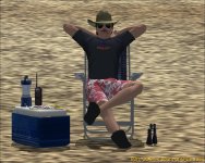
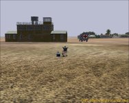
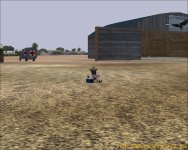
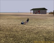
Tired after the strenuous approach I found a lounger on the beach and fell asleep. I suppose it was the strange noise that woke me, or perhaps I just was dreaming but I swear there was a giant moth that landed on the beach beside the airport. Apparently one of the crew saw the same apparition and had a camera and caught this...
View attachment 14577
Darkness descended and we all finally found sleep.
This morning we awoke and decided to get as far from this place as we could, so the Miles launched with a plan that I would go to Karachi, and if able would carry on to the heart of India. Through Pakistan all was fine, but soon after crossing into INdia I was enveloped once again in thick fog. We had discussed this and some wag offered that it would come and go in 15-30 minute cycles, but only after 90 minutes did it clear. Then an hour or so later and just before sunset, again comes the fog. With great trepidation I began planning what was likely to be a difficult approach and landing in Allahabad. Amazingly, and to my great joy, the skies cleared about 45 miles west of the city and I was able to make an easy and speedy descent to the airport which stood out clearly amid the city lights.
View attachment 14578
Almost halfway now and over an hour ahead of my flight plan estimate for time.
A great flight and a feeling of accomplishment knowing all system are working properly at last.
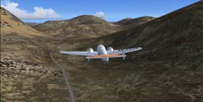
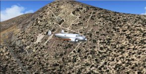
After meandering through the canyons of the mountains, just after entering Iranian airspace, there’s nothing but dessert until just after passing over the boarder of Afghanistan/Pakistan there is another mountain range.
Unfortunately shortly after the silhouette of those mountains came into view we hit scud for over a couple hours.
There were some tense moments or, should I say hours, looking out into nothing but a white cloud, which was none other than a thick fog-like atmosphere.
We were just waiting to crash into the side of a mountain as just to the north of the flight plan there are peaks over 9000 feet, and with no means of knowing just exactly where we were, usning only DR for that long period of time, we had no choice, but to climb up higher than the highest point showing on the navigational charts and maps.
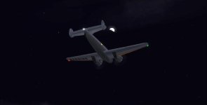
Once we were clear of the mountins darkness set in and we we able to navigate a fix once again.
About an hour out of Allahabad we hit thunderstorms and low clouds.
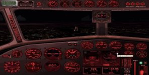
Just after breaking underneath the clouds wha la Airport in Sight with all the little brown bags with candles lining the RW! THANKS GROUND CREW!!

It's fun again!

The final leg of the MacRobertson in Reverse ended much like it started. Lot's of agreeable banter and laughter and more than a few strong oaths.
Ron agreed to join us in a multiplayer session for the final leg into Mildenhall. After a few glitches we got setup on Ron's FSX multiplayer server. Nick and I were in Split LDSP and Ron was starting from Venice about 200 miles closer to EGUN. I setup my flight quickly and took off without making an announcement hoping to delay Ron's departure so I could close the gap a bit before he departed, but Beech Boy 1 did not know my plan and revealed my departure on teamspeak. The game was up and Ron took off and headed into the Alps climbing quickly and strongly to cruise altitude, where with the aid of good tailwinds he achieved his highest groundspeed of the event.
Lively banter ensued at we progressed across the Alps and into Germany, but the VAS time bomb was ticking away on Ron's FSX session. Nick and I had experienced the dreaded OOM while practicing with the F1 King Air while flying over Orbx Europe and England. The only fix was to pull sliders to the left. I had a revised display config loaded before I started the session and forgot to mention the OOM danger to Ron. As Ron was passing over France he sudenly exclaimed OOM!!! He said he would continue to fly but he was more than 120 miles from EGUN. Ron's world became progressively blurrier as FSX could no longer display the higher resolution tiles. Nick suggested that Ron try to land at the nearest airport and then start another leg with reduced settings to finish. But it was not to be. FSX terminated before he could land. He did rejoin the multiplayer from the airport he was attempting to land at and continued on from there to Mildehall for the finish of our session.
Here is a picture of the Beech Boys with Ron's Lancair in the middle.

Attachments
Craig Taylor
SOH-CM-2025
Finally got to experience the weather all the "Modern Era" pilots were talking about over the radio - 28 knots straight in the teeth almost the entire way from Allahabad. Speaking of which, this is apparently what passes for 'high noon' at this time of year. Very bleak!
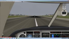
I figured I would be able to climb out on top of it for a sunny afternoon jaunt to Karachi, but Mother Nature was having none of it.
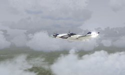
At least Karachi's arrival wasn't as foggy as Allahabad. Must be those soft breezes off the water to keep the air so clear.

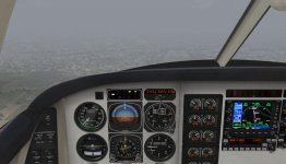
Off to find a nice hotel for my layover.

