• There seems to be an uptick in Political comments in recent months. Those of us who are long time members of the site know that Political and Religious content has been banned for years. Nothing has changed. Please leave all political and religious comments out of the forums.

    If you recently joined the forums you were not presented with this restriction in the terms of service. This was due to a conversion error when we went from vBulletin to Xenforo. We have updated our terms of service to reflect these corrections.

    Please note any post refering to a politician will be considered political even if it is intended to be humor. Our experience is these topics have a way of dividing the forums and causing deep resentment among members. It is a poison to the community. We appreciate compliance with the rules.

    The Staff of SOH

  • Server side Maintenance is done. We still have an update to the forum software to run but that one will have to wait for a better time.

How do I correct the location of or remove an airfield?

Browncoat

SOH-CM-2023
I've been going through the myriad of airfield that I have installed in my PTO theater install of CFS2. This uses Rhumba's mesh and water. Many of the airfields I have installed work just fine, but of course not all. Many of Xavier's China, Burma and India fields, as well as his Japanese fields just don't work. Is there a way I can edit their location, or should I just remove them from this install?
 
Cheers Browncoat:

The easy way to move or delete an airfield is by modifying the Long and Lat info on the airbases.dat file for that entry. The real way is more complicated and can require flattens, compensation for elevation and so forth. You'll need a tutorial for that, probably.

SW07
 
Try deactivating Rhumba's mesh and/or watermasks in the Scenery Library and see how those airfields look.
 
Try deactivating Rhumba's mesh and/or watermasks in the Scenery Library and see how those airfields look.
The Xavier scenery was done 2004-2005 before the Rhumba's mesh was done so the scenery is not setup for it.We use DEM5,7 and 8 and everything works fine.

Hiede
 
I was reading an account of the 1st Air Commando Group flying p-51A and later P-47d out of Hailakandi, India. that airfield is not in Xavier scenery, but i have located the approximate location latitude and longitude near the existing town . could that be added on the end of the list in the CBI of Talon's AVG , place airfield scenery and fly missions out of it?
 
Try this old buddy: You can build any base anywhere in the world using Maskrider's tutorial (attached), FSSC (Flight Simulator Scenery Creator}, and a decent paint program like Paint Shop Pro . You'll need the lat and long, elevation and orientation to place your airbase.
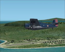
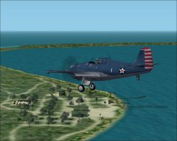
Below are 2 screenshots of my first attempt at base building some 15 years ago. It's really not that difficult
Or... you can hope one of us builds it for you! (y)

Cheers:

SW07
 

Attachments

  • mr_scenery_tutorial-pdf.zip
    4.3 MB · Views: 7
  • GCS0037A.jpg
    GCS0037A.jpg
    114.5 KB · Views: 12
  • GCS0041.jpg
    GCS0041.jpg
    99 KB · Views: 12
Thanks SW. It may be a bit over my head. I will take a look when my schedule is a little cleaner.
I will have to get the elevation.
 
Easiest way to get the elevation -

Start a Free Flight at the coordinates you have for Lat & Long.

Ctrl Z to see the coordinates & altitude.

Note these

Look at the aircraft.cfg of the aircraft you used.

Subtract the c of g height from the altitude you noted & you have your airfield elevation.

Whilst you're standing at the location, just take a good look around, noting the mesh in the surrounding area.

Ask yourself if this " looks right".
Would they build on sloping ground?
Are there obstructions nearby that would make approach & egress "problematic"?
Does the terrain vista look like any photos you might have?

I often find that published location data is somewhat "innacurate", so use aircraft Slew to move around a bit until I'm happy with the location...
 
Another elevation measuring technique: Go to the location in mission builder. Move your cursor over the area of the prospective site and note the elevation readout. Use that elevation for the flatten you will create to put the base on. It sounds complicated, but it's easy . ;)
 
Back
Top