Low Level, High Speed...

ViperPilot2

Moderator
Staff member
Howdy!

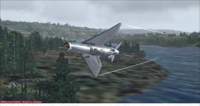
Last year (I think), a few of us here got together to do a 'comparison' of different Fighters making a high speed, low level run down a River valley somewhere, starting in either the NW US or SW Canada.

Does anyone here remember that Thread, and the series of Flights that were posted? I cannot remember if it was here, or in the FSX Forum.

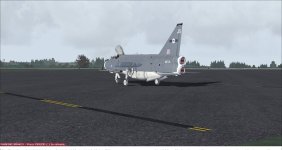
I remember using Kirk's Viper, Kaz's F-117N and his A-7 to do the runs with...

Just wondering if there's any interest to give these another go, all in the name of FUN and BRAGGING RIGHTS afterward?

Thanks for your interest! I'll also put this in the FSX Forum.

Alan :encouragement:

EDIT: Thanks to Navy Chief, I was able to find the Original Thread
 
Hmm... how did I miss this the first time around?

I'm in, just name the river, take off & landing points and when.

P-80 or Ford? That is the question!!
 
Some basic Information...

The Original Route was from Abbortsford to Prince George, via the Fraser River Valley/Gorge. Down in the River valley, no more than 600' AGL, minimum 350kts.

The 2nd Route selected was Military Route VR-1355, in WA & OR. The same rules apply. Well, sort of...

Basically, any airplane can be used, whether it be big or small. But, something that's fast. Post a couple Screenies and some Comments about the Route and your airplane. No Duenna necessary; it's all for fun, and for the variety of choices. The 1st time around, everything from an A-10 to a P-3 were used.

Thanks to padburgess for the original concept, and everyone who participated the 1st time around.

Anybody game?
Plus, can anyone suggest a good freebie Screenshot program for W7? :biggrin-new:

Thanks!

Alan :encouragement:
 
... can anyone suggest a good freebie Screenshot program for W7?...

I run Win7pro and I use FS Berlin's Screenshot Manager (version 2.3), the same thing I used on my old XP rig.

I don't recall where I got it from, their web site (now defunct) or one of the FS download sites. I know it was freeware because I wouldn't pay for a screenshot program when there are free ones available.

I could send you a copy if you send me a PM with your e-address.
 
It's been a while since I've fired up the Sim - might have to dust off the X-52 for this!

As for screenshots, there are tons of threads on every single forum debating the merits (or lack thereof) of every sort of screencap app out there. My personal preference is the original FSScreen. It saves the files in 24-bit bitmap (zero loss) and then I do the "post production" edits and type conversions myself. It's over a decade old, but still works perfectly:

http://www.flightsim.com/vbfs/fslib.php?do=search&fsec=0&fname=fsscreen.zip
 
Thanks for the heads up, Tom!

I have FSScreen, but for some reason I cannot get it to work with W7... maybe it's just me.

Alan :untroubled:
 
Thanks for the heads up, Tom!

I have FSScreen, but for some reason I cannot get it to work with W7... maybe it's just me.

Alan :untroubled:
What folder do you have the program sitting in? If it's in one of the "protected" areas, that might do it. I just have mine in a sub-folder in my user folder (C:\Users\me\Apps\FSScreen) and it works just fine. That's on two different W7.1 laptops - personal and work.
 
Tom,

I have the .exe File in a 'Screenshots' Folder in My Documents. I open FSScreen, use the Fn + Prnt Scrn keys, but I get a black screenie!

Let me fiddle with Location a bit...

Thanks again, Tom!

Alan :encouragement:
 
By a happy coincidence, I've been experimenting with the duenna to see if it can accurately log your position over time across a route with zigs and turns in it for the purpose of determining how closely you've managed to fly the route, or if you "cut corners". I tried adding up the distances between the flight points in the duenna file, to see how closely it matches the total distance as shown by a flight planner. Unfortunately, it doesn't appear that the duenna is up for this sort of task. For some reason, the faster you run a course, the shorter the total distance comes out after adding up the flight points, even if you nail the route perfectly. Not sure why, because the duenna does some pretty slick flight point plotting during a flight. For example, it samples very rapidly when you're turning, but hardly at all, even for hours, if you're going perfectly straight and level. Still, there is this arithmetic problem I can't get around.

No matter, your idea is a good one, and I'm in too! :)
 
Alan, drop the Ctrl key and just use PrtScn. Alternately (pardon the pun), you can use Alt+PrtScn to capture only the active window. If that doesn't work, there may be something screwy with your system clipboard.

Edit: I did a little digging into malfunctioning clipboard issues, and most seem tied to virtual machines. If you have anything like that running, it may be a goodidea to shut them down. It would free up quite a bit of CPU resources for the Sim anyway.

Edit 2: I just re-read your post. I thought I read "blank," but you said they're black. If you're running the Sim in full-screen, try windowed mode and just maximize the window.
 
FSrecorder?

Alan:

I'm in! but how about FSRecorder-(ing) it? If you want I'll turn it into a video, think of it. The best way to prove it is for all to see. All that is needed is FSRecorder Then e-mail me the frc. file with the start location, weather theme, your call sign or name and the description of the aircraft you used. (EX: title=FA-18 Hornet) freeware or pay-ware item. I'll be recording my run in the Iris F-20D in Canadian Colors. Anyone else? Interested then PM me.

David...

See Sample Video: Filmed sometime ago with several of us in a on-line chase/battle.

 
Well I had a first try at this last night , using my laptop since my main FS rig has died.
Very neat challenge

Ttfn

Pete
 
Greta video! BTW, what tools were used to create it? I'm especially interested in how you created the realistic radio effects when ya'll spoke.

Thank you

Bookman
 
Thanks to everyone who replied!

David -- great idea, but unfortunately I don't have FSRecorder. Maybe there's folks out there who do have it, and would be willing to post their Runs using it!

By all means, give the Route a go, and post some Screen Shots, everyone!

What I did originally was take off from Abbotsford, circled the field once climbing to 2,000', then dove down to the start of the Gorge for the Run, and leveled off @ 300'.

Alan :encouragement:
 
First go at it

I made the run in a Lightning F6


attachment.php


and here I am at Prince George shutting down


attachment.php


Lots of fun, still learning the big brute but she is fun to fly. weather was a little sketchy but otherwise a great flight. Cant wait to try it in another aircraft.

Sean
 

Attachments

  • Screenshot209847.jpg
    Screenshot209847.jpg
    47.5 KB · Views: 0
  • Screenshot184928.jpg
    Screenshot184928.jpg
    60.1 KB · Views: 0
406 seconds

That's it! Then on the third hairpin turn and boom! I went into the trees! I will have the video of this disaster, very soon. Will try again tomorrow. Video will have all attempts and fubars. This may take some time to complete but I will keep you informed.

Respectfully:

David.
 
Do we need any add on scenery for the route, been in the UK ill admit I havent got round to flying in Canada as yet :banghead::banghead:
 
Back
Top