New theater tutorial Step by Step for CFS3

odin_br

Members +
[h=2]
icon28.gif
Some info about the objectives on new theater tutorial[/h]
Dear all,

Please consider the following points before using the tutorial:
0-) My English is not good.
1-) The theater produced is a "blank" scenery - For community research, test and development.
2-) The theater produced is very small - It´s an Islands scenery in the middle of Atlantic ocean. The Azores islands.
3-) Procedures detailed:
- How to produce the terrain.
- How to produce Shorelines and Water shape (ocean and big lakes)
- How to produce Landclasses
- How to edit the required files to produce a new theater.
- How to use SDK tools
4-) Not yet
- Vectors (roads, railroads, rivers).
- Detailed Global layer
- Terrain mosaic files
- Ref Map (UIRES)

Best Regards,
 

Attachments

  • CFS3 New Theater detailed tutorial_STEP ZERO.doc
    268.5 KB · Views: 19
  • STEP 1.doc
    672.5 KB · Views: 16
  • STEP 2.doc
    628.5 KB · Views: 17
some pics

Some Pics
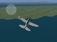
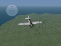
Please, note some aleatory lines on 1st pic. And note the default landclass on farway island and a grass land class on near island on 2nd pic...
 

Attachments

  • pic2.JPG
    pic2.JPG
    47.3 KB · Views: 2
  • pic1.JPG
    pic1.JPG
    39.7 KB · Views: 2
About Step 3

Dear all,
The Step 3 is for Shoreline and water shape creation.
Maybe, I´ll finished on next Sat or Sunday.

Best regards
 
Kit for new Theater

Dear all,

Check the cfs3_math.xls. This file is used to MESh generations calculations.


Best Regards
 

Attachments

  • KIT CFS3 NEW THEATER.zip
    8.9 KB · Views: 12
Step 3 - File generation for Shoreline

Dear all

The Step 3 shows how to GM generate a SHP file for CFS3 shorelines.

On next days, i´ll release the Step 4 - The Water Shape.

Best Regards,
 

Attachments

  • SETP 3.doc
    237.5 KB · Views: 12
I've started looking over these and saw the $500 price tag on global mapper. But it has that 30 day trial...do any of the next steps require global mapper? Does the trial version have all the features we need? I wonder how many maps I could make in 30 days?:mixed-smiley-010: The tutorial seems well done Odin, thanks! I may have more questions after diving into it though.
 
STEP 4 - Shoreline and Water shape

Dear all,
For this tutorial, GM and QGIS were used.

gecko,


Maybe MICRODEM can be used. But MICRODEM cannot produce shorelines. You can produce it by hand... point to point. But it´s a titanic work to do...
I´m looking a freeware that can make shorelines, but i didn´t find yet...

Best Regards
 

Attachments

  • STEP 4.zip
    1.4 MB · Views: 12
Thank you, thank you, thank you odin_br! :applause:
You cannot know how long I've hoped for something like this.
One thing I would like to do is put shipping lanes in the Rising Sun theatre, that would allow for better campaigns.
Once I am out of hospital I hope to read your guide more carefully

salut!
 
Delay

Dear all,

I´m very busy this week. Please, wait until next week for STEP5 tutorial.


Sorry,
Best Regards...
 
Step 5 - terrain mesh

Dear all,

Please, check the step 5. if you do not understand something, let me know.
No time to check...

Best Regards
 

Attachments

  • STEP 5.doc
    427.5 KB · Views: 13
Step 6 - Water

Dear all,

Please, check the step 6. if you do not understand something, let me know.
SHP2POL,
Shorelines and
water commands covered.

Best Regards
 

Attachments

  • STEP 6.doc
    127 KB · Views: 12
I've been reading these as I have time, haven't gotten the last couple yet, but the others have seemed complete and well done. I am not stepping into trying this until I can maximize my 30 day trial and try to knock something out in that amount of time.
 
STEP 7 - Landclass file

Dear all,

Please, check the step 7. if you do not understand something, let me know.

TIFF2LCF command covered.

Best Regards
 

Attachments

  • STEP 7.doc
    59 KB · Views: 13
Excellent, thank you Odin! I do have a question on the lcf files - is there a way to go from an lcf back to a tiff so that existing maps like the stock one can have their landclasses revised?
 
Thanks for this Odin, much appreciated! I haven't had chance to read them all yet but have them downloaded and tucked away for future use. Cheers, Clive
 
Thanks Odin,

nice write up, a lot of good detail.
like others have said above I have down loaded the files and will take a look in the future. would like to see a few improvements for RS down the track.

thanks for the hard work. regards Rob.
 
STEP 8 - Global Layer

Dear all,

Please, check the step 8. if you do not understand something, let me know.

MKGLOB / MAKE_GLS command covered.

Gecko, about TIFF and LCF I found similarities on a free hex editor (avihex can compare 2 files). I believe that is possible to reconvert LCF to TIFF, but we need a professional hex analyser and someone with a good knowledge to do this.
But for new theater makers, we need to request, at least, the tiff file (and txt of colors) of the landclasses used, for others users can edit and improve it.
If you want some info about some LCF and TIFF comparisons, contact me at: odin_br@uol.com.br

Best Regards.
 

Attachments

  • STEP8.zip
    998 KB · Views: 13
Good news! I got in touch with Martin Wright yesterday, and he has a tool for viewing and exporting lcf files back to bmp, so existing lcf files can be modified rather than building from scratch. Martin couldn't recall if the rewrite function works, and I haven't tested it yet, but it might be possible edit existing lcf files without using the SDK tools. It does have the limitation of only recognizing the stock landclasses, but this still makes it extremely useful if you want to rework the stock lcf.

Martin wrote the program a long time ago and won't be offering support on it, but he is graciously allowing it to be uploaded here as is. You will need the dlls available on his site required for using any of his tools.
 
Back
Top