New theater tutorial Step by Step for CFS3

Good news! I got in touch with Martin Wright yesterday, and he has a tool for viewing and exporting lcf files back to bmp, so existing lcf files can be modified rather than building from scratch. Martin couldn't recall if the rewrite function works, and I haven't tested it yet, but it might be possible edit existing lcf files without using the SDK tools. It does have the limitation of only recognizing the stock landclasses, but this still makes it extremely useful if you want to rework the stock lcf.

Martin wrote the program a long time ago and won't be offering support on it, but he is graciously allowing it to be uploaded here as is. You will need the dlls available on his site required for using any of his tools.

:jump: Great catch, gecko! And thanks to MW. That would expalin why I was sure I'd seen an image of the CFS3 landclasses floating around somewhere....
 
Good news! I got in touch with Martin Wright yesterday, and he has a tool for viewing and exporting lcf files back to bmp, so existing lcf files can be modified rather than building from scratch. Martin couldn't recall if the rewrite function works, and I haven't tested it yet, but it might be possible edit existing lcf files without using the SDK tools. It does have the limitation of only recognizing the stock landclasses, but this still makes it extremely useful if you want to rework the stock lcf.

Martin wrote the program a long time ago and won't be offering support on it, but he is graciously allowing it to be uploaded here as is. You will need the dlls available on his site required for using any of his tools.

Wow, that's promising, I could make use of that if it works. Good find Daniel (and Martin!).


I am not stepping into trying this until I can maximize my 30 day trial and try to knock something out in that amount of time.

There's a list of available GIS software here, some of it is freeware - or is Global Mapper the only one that is useable with the SDK? I haven't looked deep enough into this yet.

https://en.wikipedia.org/wiki/List_of_geographic_information_systems_software
 
I have uploaded Martin's tool to the library, should show up under CFS3 Other - Utilities.
 
STEP 9 - ZIPPING MESH and WATER files

Dear all,

Please, check the step 9. if you do not understand something, let me know.

Its just procedure to zip MESH and water files.

Best Regards
 

Attachments

  • STEP 9.doc
    320.5 KB · Views: 12
STEP 10 - Final STEP

Dear all

Please, check the final step - Config and file exclusions for new scenery.

Thanks to you all.

Now, I´ll start to research about mapdata. Next it, I´ll try to use SRTM1 to see if CFS3 have capability to handle high resolution terrain.

Best regards!
 

Attachments

  • STEP_10.rar
    1.3 MB · Views: 13
Dear all,

Please, check the step 6. if you do not understand something, let me know.
SHP2POL,
Shorelines and
water commands covered.

Best Regards

I know it is an old thread, but I really hope someone could reply. In fact, I've started working on a new theater, but unfortunately, I've been unable to locate shp2pol. It is not contained into the CFS3 Terrain SDK tools package. Same for the so-called make_water.zip (has to be downloaded from SOH), which isn't available from the library (at least I wasn't able to find it)

Any help would be fantastic! Thanks!

Best Regards,
Xav.

You will find both here at SOH at this link: http://www.sim-outhouse.com/sohforums/local_links.php?catid=169

All the best with your project! I hope Odin's tutorial will solve everything
 
You will find both here at SOH at this link: http://www.sim-outhouse.com/sohforums/local_links.php?catid=169

All the best with your project! I hope Odin's tutorial will solve everything

Thanks! Yes it is helpfull, I'm getting slightly different results BTW.

Maybe I'm doing something wrong, but my main observation is that the orignal CFS3 Europe theater isn't a square on GM default projection (Geographic).

This contradicts Odin's step 1. In fact, this is important because as per my tests, ers2tiff reduces width by 1.5 to get a squared .tiff.

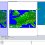
https://i.ibb.co/DrNkP0r/org-cfs3.png
https://i.ibb.co/qD6kFhW/org-cfs3-2.png

This is intriguing! What region are you building?
Nothing new I must say. I'm trying to improve the Europe theater. Especially for WOFF as the orginal one is a bit off to say the least; and to be honest I've played a bit and stopped cause it hurts me :wiggle: Anyway, instead of complaining blindly, I'm trying to improve it.
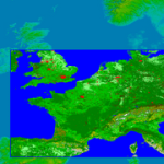
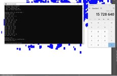
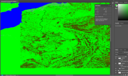
Actually, I'm struggling about if it is possible to use SRTM3 data rather than SRTM30 which lacks precision. I think that this will allow to use a larger CFS3eur.lcf as the 1536x1536px orginal one is not appropriate. As you can see below, I can generate way bigger files (15360x15360px). I've started working on a more precise lcf, focusing on northern France (the ideal solution would be to create a new theater for this area only)

https://i.ibb.co/DrNkP0r/org-cfs3.png
https://ibb.co/ZL7MqKz
 

Attachments

  • org-cfs3.png
    org-cfs3.png
    51.1 KB · Views: 21
  • org-cfs3-2.png
    org-cfs3-2.png
    30.1 KB · Views: 22
  • org-cfs3-10.jpg
    org-cfs3-10.jpg
    41.5 KB · Views: 3
  • org-cfs3-11.png
    org-cfs3-11.png
    301.8 KB · Views: 6
Last edited:
Wow! I'm impressed, and that's a huge project! Do you plan on making this available outside of WOFF? Would love a more detailed Europe map in CFS3.
 
Wow! I'm impressed, and that's a huge project! Do you plan on making this available outside of WOFF? Would love a more detailed Europe map in CFS3.


Indeed, it is quite big. But if I can clear out questions regarding elevation data (SRTM3 vs. SRTM30), I think that creating more detailed theaters won't be too long to do; especially over Europe.


However, it has to be said, using 10 times more detailed data would lead to create less expanded theaters. Of course, PCs are much more powerful than what they were when CFS3 was released, so we can deal with bigger files, but they have their limits.
 
Hi before, did you know there was a revised ETO mesh prepared as part of the ETO project? its only shortcoming for your purposes would be it is exactly the same area as the stock mesh. From the readme: "Notes: CFS3 ETO Expansion Terrain V 0.2 - 28 June 2008

Enclosed are 3 Zip Files - cfs3etomsh128.zip; cfs3etomsh256.zip; cfs3etomsh512.zip

These files replace cfs3msh1.zip, cfs3msh2.zip, cfs3msh3.zip, in the terrains and terrains2 folder of CFS3. It may be best to backup the old files before placing the new files in the relevant terrains folder.

Delete the existing *.zx files in the terrains folders.

Place the files cfs3etomsh128.zip and cfs3etomsh512.zip in the terrains folder and cfs3etomsh256.zip in terrains2 folder. There will only be slight differences between this and the previous terrain i.e corrections of elevation in low lying areas."

If you could find someone to give the approvals this might be a good start? Or not :running:
 
SRTM3 v SRTM30

Indeed, it is quite big. But if I can clear out questions regarding elevation data (SRTM3 vs. SRTM30), I think that creating more detailed theaters won't be too long to do; especially over Europe.

However, it has to be said, using 10 times more detailed data would lead to create less expanded theaters. Of course, PCs are much more powerful than what they were when CFS3 was released, so we can deal with bigger files, but they have their limits.

hi before, I saved an old blog where a terrain builder discussed this very question - whether to use SRTM3 v SRTM30.
http://www.mediafire.com/file/di58atc5jcjy0ga/Building_Terrain_in_CFS3.doc/file

At first, he thought, like you, that more detailed DEM data might be a big load on the average computer. But IIRC when he tried using the more detailed elevation data in a small trial, it proved workable. And this was with much older computers than we have now.

Hope that link I posted works, I've uploaded the doc to my Mediafire account.
 
Shp2pol

On the subject of shp2pol, I have a brief extract from a thread on the subject:

“CFS3 uses an interim Pol data format for the vector data. The shp2pol converter converts standard arcinfo shapefiles to Pol format that will allow you to create water, shorelines and other vector data. This was the missing link for creating the MAW and Korean scenery but because of how CFS3 groups all the vector data together it will not be very useful for adding any vector data to CFS3Europe. I've already setup batch files files with sample shape files for
Japan that I used to create the Korean addon.”

[FONT=&quot](in the make_water package at Korean Skies and now SOH, which includes the missing tools and the example batch files mentioned above)[/FONT][FONT=&quot][/FONT]
 
Thank you so much for your replies.

I've looked at the blog post, and it is very interesting. Unfortunately, he didn't explain how to deal with more precise data. Anyway, knowning that it is possible makes me want to find out how. :)
 
I've modded the original lcf file to add more details (did some reverse engineering to get the trenches code used for the WOFF lcf and tested it there); but the file is too small and the result isn't really good. It's a shame that this tiny little file of 1536x1536px is the key file of such a large theater. :wiggle:

However, I've finally found out how to use SRTM3 elevation data with ers2tiff. That's very nice. So, I started today to work on a theater focusing on Ypres (51.45N 3.50E 50.10S 2.15W).
 
I've managed to get the theater to work. A more precise elevation data produces much more variations in terrain elevation which is great. However, I got a problem with the lcf file and also, the average elevation looked like it was higher than excepted. But things going well.
 
That is great news! If you have any improvements to Odin's tutorial, please post them, for posterity. Those few benighted souls who work on theater building all seem to have had to learn things from scratch; it would be great to make things easier for them.
 
Back
Top