Papua New Guinea Redux

You don't happen to have anything going on with the global layer would you?

Also, what are your config settings for Water Elevation Bias
 
Global Layer is okay, no problems with that. Haven't touched the water config settings.:unsure: ?

<InteriorWaterLoadingFactor val="0.800000011920929"/>
<WaterDetailTextureSize val="5"/>
<WaterElevationBias val="4"/>
<WaterElevationBiasFactor val="0.5"/>
 
You might be able to experiment with the elevation bias settings. Alternatively, would localized flattening via putting an empty land facility in the global layer on the offending locations do the trick? Using 0 or possibly even negative elevation values?
 
I have tried many of the tricks. Triangulated grid areas and of course facilities flattening. I might try a larger facility which kisses some of the shoreline rather than just the sea. Limited because the facilities files must be square, they don't fit well in a round bay. I will also try different settings of water elevations settings.
I appreciate and thank you for your suggestions, I think the elevation tweaking has potential.
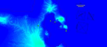
The toilets location is the root of the problem in the attached pic.
Flattening of Rabaul.jpg
 
Last edited:
Can they not be rectangular? A few custom sized ones made for specific sections of the bay?
 
I have run into a major snag, in PNG. The Rabaul area has major phantom islands when placing the Lakunai airfield. I have tried all different flattening tricks to try to eliminate them to no avail. I could flatten the whole area as was done before, but one of the reasons for redo was to get terrain elevations in the Rabaul area. :(

Odd, I was getting that for a bit but I thought it was from having water areas with missing elevation data. For some reason it went away before I applied a fix???
 
I always add an elevation of zero meters to the ocean water file. A lot of times the phantom islands occur because the shoreline is above 0 meters and in that case you have to move your shoreline to the area where there is 0 meters elevation. I had already made sure that the shoreline in this area is at a location of zero meters elevation.
The problem started when i added the airbase facilities file onto the peninsula area and flattened part of the peninsula.
 
Is the airbase also at zero? I have had this in ETO where a facility is close to the water. In all cases setting elevation to zero solved the issue. The difference was small enough that it didn't look bad on the terrain to have the base a couple meters lower than it technically should be.
 
Yes, have had the airfield at different elevations in an attempt to resolve or minimize the problem. Still searching despite the other things I have going on. Still up is to try a facilities flattening file the shape of the bay, but its has always been my understanding that facilities files have to be square.
 
Back
Top