-
There seems to be an uptick in Political comments in recent months. Those of us who are long time members of the site know that Political and Religious content has been banned for years. Nothing has changed. Please leave all political and religious comments out of the forums.
If you recently joined the forums you were not presented with this restriction in the terms of service. This was due to a conversion error when we went from vBulletin to Xenforo. We have updated our terms of service to reflect these corrections.
Please note any post refering to a politician will be considered political even if it is intended to be humor. Our experience is these topics have a way of dividing the forums and causing deep resentment among members. It is a poison to the community. We appreciate compliance with the rules.
The Staff of SOH
-
Please see the most recent updates in the "Where did the .com name go?" thread. Posts number 16 and 17.
You are using an out of date browser. It may not display this or other websites correctly.
You should upgrade or use an alternative browser.
You should upgrade or use an alternative browser.
Ron's 'Too much airplane for me!' thread.
- Thread starter Ron Attwood
- Start date
Ron Attwood
Members +
Ron Attwood
Members +
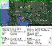
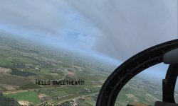
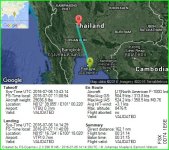
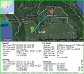
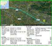
Another day, another wander around. From VTBU to VTPI in the middle of nowhere! Still, there is a big ol' lake to let me know I've gone too far, which is some help I guess. 

Ron Attwood
Members +
Ron Attwood
Members +
Anyone reading the Duenna file will think 'Jeez! He's flying low!' and he was, at times too bloody low! VFR is really exciting when there's a fog.
PhantomTweak
Members +
I try, try I say, not to break much more than 700' or 800' agl on any leg, at least until I get on approach, then up to 1200'AGL. Makes for a really, um, interesting flight at M0.98 or so in an F-111.
When I was in my avionics school, AFTA, in Millington Tenn, many many years ago, they showed us a film about the F-111 Terrain Following Radar system. Some pilots tried to set it on a fairly "firm" setting, which determines how closely the plane follows the terrain, but they got so beat up, banging up and down over every tiny little bump, hard and fast, that they wouldn't be able to fly for a while. Strap marks all over their bodies, or banging their heads off the canopy, even the seat-cushion seemed to turn solid, they'd say. After showing everyone how tough they weren't, they would never set the system past about 50% firmness.
I haven't tried that system yet. I only hand-fly the plane. Maybe after the race I value what's left of my old, tired bod!
Pat☺
When I was in my avionics school, AFTA, in Millington Tenn, many many years ago, they showed us a film about the F-111 Terrain Following Radar system. Some pilots tried to set it on a fairly "firm" setting, which determines how closely the plane follows the terrain, but they got so beat up, banging up and down over every tiny little bump, hard and fast, that they wouldn't be able to fly for a while. Strap marks all over their bodies, or banging their heads off the canopy, even the seat-cushion seemed to turn solid, they'd say. After showing everyone how tough they weren't, they would never set the system past about 50% firmness.
I haven't tried that system yet. I only hand-fly the plane. Maybe after the race
 I value what's left of my old, tired bod!
Pat☺
Ron Attwood
Members +
I'm going to give the "Don't go above 800' AGL" method and see where it gets me. I'll be back!
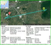
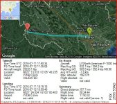
VTPI to VTUD
VTPI to VTUD

Ron Attwood
Members +
PhantomTweak
Members +
Makes the flight a bit of an adventure, don't it? Kinda fun, IMO. Drinks gas, though, but these things seem to have legs AND range, so it's not a huge problem 
I just thought I'd try it the way they flew the Aardvark back then, and I have a good time with it. It's a personal preference, though. If you enjoy it, fly it, if not, go up a bit. 5'000' AGL? Most of these legs are short enough, in my mind, I don't like to waste time climbing and descending to 30,000' or something. Just me, though. A flight like that might be what another prefers. Like I say, personal preference.
Above all, have fun!
Pat☺
Ron Attwood
Members +
Ah yes, fun. I remember that. 
To compound my crash, I did it at the WRONG AIRPORT!
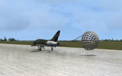
Anyway, 's all good now. I remembered to ignore the first set of lakes. When I did arrive at VTUD I was terrified of landing. In fact I did a go around and took a longer run-up to it. I also lowered it Soooo gently onto the tarmac there wasn't even a 'chirp'.
Attachments
Ron Attwood
Members +
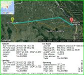
This little flight is simply to correct an FSX airport naming mistake. Either that or Skyvector has it wrong. Skyvector show VTUN as the smaller military air station which FSX insists is VTUQ. Anyhow, I flew from the military field to the civilian, larger airport just for completion's sake.
Did any of that make sense?
Did any of that make sense?

Attachments
PhantomTweak
Members +
Yep! Made perfect sense to me. I had to divert to VTUQ because of a weird weather glitch that had a small area around VTUN with a 75kt wind, directly across the runway heading. At VTUQ, just a few miles away? 7kts, just off the runway heading. Weird. Anyway, just hopped over to VTUN. Never even raised the gear or swept the wings.
Glad you made it ok, glitches in naming aside
Pat☺
Glad you made it ok, glitches in naming aside
Pat☺
Craig Taylor
SOH-CM-2025
There's also that VTUD/VTED mismatch as well - apparently because the airfield is mixed civil and military.
Ron Attwood
Members +
I've just done VTUD and didn't notice anything untoward.
I'm about to give VYUD-VYUW a go. Fire it up sergeant. Sir, yes Sir!
That's mah boy.
I'm about to give VYUD-VYUW a go. Fire it up sergeant. Sir, yes Sir!
That's mah boy.

Ron Attwood
Members +
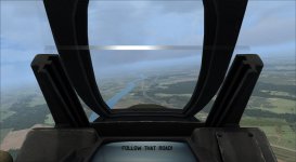
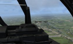
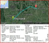
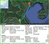
Moochin' along nicely when I spied a socking great river. Don't recall a river that big in my 'to watch out for' list. Zoomed out my map...Mekong river! I'd overshot my target. dis a U-turn and lawdy lawdy! there it was, VTUW. I wish I could say it was great navigation but I cant. Pure luck. I went round to approach from the other end and was lining up beautifully.......On a lump of road! Eek, where'd it go? Phew, there it is.
*checks blood pressure*
*checks blood pressure*
Attachments
Ron Attwood
Members +
Nicely refreshed after a day's R&R, I'll now set about finding my way from VTUW to VVCI. Should be a doddle, what with lakes, mountains, coastlines and islands. What can go wrong? 
EDIT: Actually, not very much. Apart from my undercarriage lights not going green, and the warning buzzer giving me stick, causing me to go around, go outside and check my gear WAS down(Is that allowed?), it was. Made another approach with no greens and buzzer screaming blue murder, I braced myself for a crash.....Which never came.
  Milviz have some nasty tricks up their sleeves. It's not right to frighten old gentlemen like that!

EDIT: Actually, not very much.
 Apart from my undercarriage lights not going green, and the warning buzzer giving me stick, causing me to go around, go outside and check my gear WAS down(Is that allowed?), it was. Made another approach with no greens and buzzer screaming blue murder, I braced myself for a crash.....Which never came.
  Milviz have some nasty tricks up their sleeves. It's not right to frighten old gentlemen like that!
Attachments
Last edited:
Ron Attwood
Members +
Last two legs. VVCI to VVNB to Dien Bien. Dien will be....interesting.
EDIT:
Oh dear! This does not auger well for Dien Bien. 20 minutes to do 56 miles. Too much wandering around methinks. I had the curly river on my left and the little range of hills on my right. Airport should be about in the middle right? Wrong. Some blighter moved it. By the time I did a big loop they'd put it back again.
Attachments
Gregory Paul
Charter Member
Once more into the breach dear friends, once more...blah blah blah...or fill the sea with our dead F100s. (Sorry Will)
Count me in with the C-130E and the Mig-21MF! lol


