Ruhr Smog - Pictures and Descriptions Wanted

gecko

Charter Member
I've been thinking about this since James mentioned it, and it seems to be a significant phenomenon and worth an attempt at getting it right, even though I'm not certain it can be done well. So, I'm requesting pictures and other descriptions of the smog in the 30s and 40s to get an idea of how dense and pervasive it was. With that info to reference, I'll then try to see what can be done to add it to the weather portion of the upcoming shaders update.
 
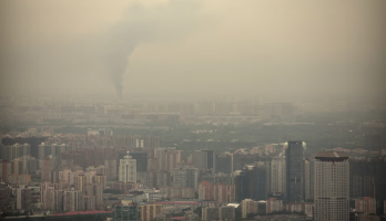
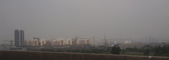
The problem is getting aerial shots, also in colour. I doubt the Rhur was much different from other places though. Some photos here https://www.gettyimages.com/photos/pollution-smog?page=2
I'll look for more.

 
My feeling is that smog was slightly different from today's in that less to do with vehicles, and more to do with coal fires and industrial chimney stack coal and gas pollution, therefore less maybe or the orange- brown colour, and more white-grey-black kind. Maybe take fog and more grey, possibly grey-brownish? Obviously this would effect daylight bombing as well as night bombing, so useful in both cases, in addition fire from previous raids would have added a lot of smoke from that into the mixture. Maybe, just like fog, one could have several degrees of smog?
 
Yeah, I was thinking modern smog might have some different characteristics, given the different sources and also the environmental controls that are in place now that hadn't been enacted at that time.
 
Well, I guess environmental controls haven't been put in place everywhere...yuck. That first one may be a decent approximation of the smog looked like in the industrialized portions of Europe in the time period we're concerned with here. Were there other hotspots besides the Ruhr? London perhaps?
 
Wonderful report and work ! Such detail, and earnest work ! Just ask, and i'll do anything to help. Kind Regard's, scott...
 
Well, I guess environmental controls haven't been put in place everywhere...yuck. That first one may be a decent approximation of the smog looked like in the industrialized portions of Europe in the time period we're concerned with here. Were there other hotspots besides the Ruhr? London perhaps?
Well London was infamous for smog from residential coal fires. AFAIK, most large cities anywhere in Europe suffered the same problems, although heavy industry cities would have been much worse. The thing about the Rhur was that there were multiple heavy industry cities in that area. I image what we called 'the black country', namely the Midlands in England was the same; even moths genetically changed to dark colored wings due to the general pollution! Now major cities like Berlin would have domestic coal fire pollution, the same with Hamburg, on top of smoke from bombing raids. Most RAF BC raid reports mentioned the Rhur smog/haze being a real problem, probably more before Oboe and good Pathfinder marking. In addition of course, the Germanscreated a lot of detour smoke to confuse the issue, something that could be made into good facilities perhaps, I think they also did that for USAAF raids. Andy's top photo is good. AFAIK high pressure on cold days kept the smog/haze in place, besides places like LA which is effectively a basin surrounded by mountains. (I remember when living in Taipei, Taiwan, I sometimes would have breakfast on the Hilton rooftop restaurant and watch the haze layer rise in the morning, as it also was partially trapped by hills.)
 
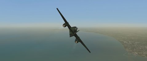
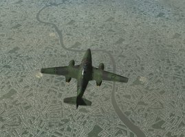
Here is an example of what can be done with the horizon haze effect. I made this one to simulate when a dust plume from the Sahara blows over western Europe. Just used a dusty haze color and turned the density setting way up. With a tweak to the color it could make for a nice smog effect. The problem is that this effect cannot be kept to a localized area. It will be everywhere. I am more inclined to use special clouds that reduce visibility, similar to the effect I have added under precipitation-producing clouds. That type of effect can be geographically defined, but I'm not sure I can get it to look good. We'll see.
vdrvvdi.jpeg
 
What is the actual difference between the horizon haze effect and something like a weather xml file which one can specify an area such as in England Med Fog-France Clear for example? I know the latter are clouds but what is the horizon haze effect then? I note your picyure seems to show the ac level with the horizon haze effect; what happens when you are at a higher altitude?
 
Here it is at 23,000ft. This effect is controlled by the fog color in the weather xml file - in this case I have fogColor="16379360". This setting is only valid in the BackgroundWeather section, and will be applied to all geographical areas defined in the weather xml. A separate new shaders setting allows you to adjust how thick the haze is. All of this is as opposed to creating a specific smog cloud to be used in the weather xml.

T4H4bth.jpeg
 
It's been years ago, but I thought you could apply different fog colors within the bounds section of the weather xml. I've used fogColor="4288987369" with the dr_sandstorm_cloud and thought I had it localized. Perhaps I was wrong. I'll have to take a look again.
 
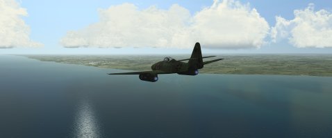
Just made this to check with a quick trip across the channel. It seems to be doing what we wanted.

<Weather Name="England Low Dust-France Clear">

<BackgroundWeather precipType="NoRain" skyboxCloudType="NoClouds" MaxAltitude="-90" MinAltitude="-100" fogColor="4288789972" Windspeed="0" windDir="0" >
<CloudLayer cloudfile="cloudCumulusSmall.xml" CloudType="ScatteredClouds" CloudRadius="40000" CloudCount="40" Lightning="noLightning" MinAltitude="900" MaxAltitude="900" fogColor="4287542759" />

<CloudLayer cloudfile="CloudCumulus2.xml" CloudType="ScatteredClouds" CloudRadius="45000" CloudCount="12" Lightning="noLightning" MinAltitude="900" MaxAltitude="900" fogColor="4287542759" />

</BackgroundWeather>


<WeatherObject skyboxCloudType="BrokenClouds" MaxAltitude="20000" MinAltitude="0" fogColor="4290432475" Windspeed="8" windDir="270" >
<Bounds>
<Point Lat="N52 54" Lon="E3 41"/>
<Point Lat="N49 22" Lon="E0 2"/>
<Point Lat="N51 9" Lon="W4 48"/>
<Point Lat="N54 16" Lon="W11 14"/>

<CloudLayer cloudfile="dr_sandstorm_cloud.xml" CloudType="ThickClouds" CloudRadius="20000" CloudCount="20" MinAltitude="10" MaxAltitude="10000" fogColor="4288987369" Density="1"/>

</Bounds>
</WeatherObject>


</Weather>

Calais
cfs3 2025-01-18 Calais.jpg

Dover
cfs3 2025-01-18 Dover.jpg
 
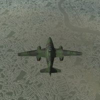
The thickness varies.

cfs3 2025-01-18 London Docks.jpg

cfs3 2025-01-18 London Center.jpg

I'm not saying this is the solution for smog over the Rhur, but it does demonstrate that it can be localized to a region using bounds.
 
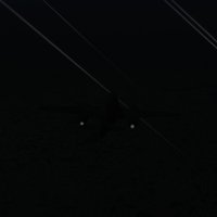
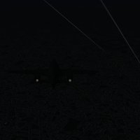
I wondered what it would look like at night. These both have my city lights mod enabled.

Smog
cfs3 2025-01-18 London Smog Night.jpg

Clear
cfs3 2025-01-18 London Clear Night.jpg

It does make quite a bit of difference at 15,000 ft.
 
Here's the text for the thicker lower version used for the night shots.

<Weather Name="England Low Smog-France Clear">

<BackgroundWeather precipType="NoRain" skyboxCloudType="NoClouds" MaxAltitude="-90" MinAltitude="-100" fogColor="4288789972" Windspeed="0" windDir="0" >
<CloudLayer cloudfile="cloudCumulusSmall.xml" CloudType="ScatteredClouds" CloudRadius="40000" CloudCount="40" Lightning="noLightning" MinAltitude="900" MaxAltitude="900" fogColor="4287542759" />

<CloudLayer cloudfile="CloudCumulus2.xml" CloudType="ScatteredClouds" CloudRadius="45000" CloudCount="12" Lightning="noLightning" MinAltitude="900" MaxAltitude="900" fogColor="4287542759" />


</BackgroundWeather>

<WeatherObject skyboxCloudType="BrokenClouds" MaxAltitude="20000" MinAltitude="0" fogColor="4290432475" Windspeed="8" windDir="270" >


<Bounds>
<Point Lat="N52 54" Lon="E3 41"/>
<Point Lat="N49 22" Lon="E0 2"/>
<Point Lat="N51 9" Lon="W4 48"/>
<Point Lat="N54 16" Lon="W11 14"/>

<CloudLayer cloudfile="dr_sandstorm_cloud.xml" CloudType="ThickClouds" CloudRadius="20000" CloudCount="50" MinAltitude="10" MaxAltitude="5000" fogColor="4288987369" Density="1"/>


</Bounds>
</WeatherObject>


</Weather>
 
Back
Top