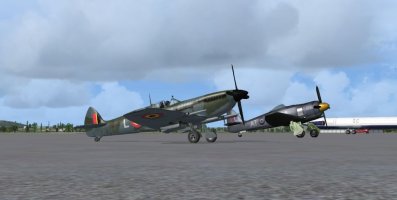
As it IS May 1st already here in the UK, I thought I'd fly Leg 01 right away as my Spitfire PRXI(T) was already in position at
Eastleigh Southampton.

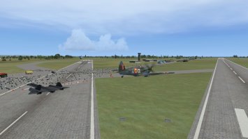
So here I was back where it all started in 1936, but I suspect it was still a grass airfield in those days, Today I've got nearly a mile of tarmac runway to take-off on, which shouldn't be too much trouble. The taxi-way here goes a long way to the far end of the 20 runway, and it's quite twisty so, I suspect the airliners backtrack down the runway, but the twists aren't too much trouble for a Spitfire, so long as I keep swinging the nose to see where I'm going!
With a just a touch of nose-up trim I was soon airborne and flying south over the Woolston Works where the original K5054 was built 90 yrs ago, and I made a long slow turn to the east and headed off across Hampshire. The route passed quite a few airfields, the UK is COVERED in them of course., especially on the eastern part of the country, and the first one I passed was Goodwood EGHR, now a motor racing circuit, but which still has its original runways in place and can operate GA aircraft. I've been there a few times, and it still has that atmosphere many ex-airfields have.

Making a long loop around the London Air Traffic Control Zone, I was navigating by roads, I know them pretty well after my last job, which had me driving 1000 miles/wk for 30 yrs or so! To ensure I did know where I was I took Melo's advice and flew at 2000 ft, with a boost pressure of 41 ins Hg, which gave me a nice 250 kt cruise, and I could see most of the roads very clearly.
")

Turning north while over Kent, and crossing the Thames just east of Rochester, the home of the wonderful Short Bros. flying boats of the 30s and during WWII, I was soon overhead Southend Airport EGMC. You can see how dense the Just Flight VFR scenery package is from the rows and rows of houses below, and Southend really IS like that, I've been there numerous times. The Airport has a resident Vulcan bomber, XL426, that makes runs up and down the runway quite often, but there's no sign of it on the scenery I'm afraid.

Further north I would be crossing the very flat scenery of Essex, Suffolk and Norfolk, and my first waypoint was the Army Air Corps helicopter base at Wattisham EGUW, and I was expecting to see millions of Apaches and Wildcats on the ramp there, but I can't have had my military traffic files loaded properly as it was empty.

Flying deeper into Bomber Country, where most of the US 8th Air Force and the RAF's Bomber Command bases were during WWII, I crossed the A11 main road, which I know very well, on its route to Norwich, the county city of Norfolk. And quite by chance my track took me directly overhead another motor racing circuit, Snetterton, which was also an ex-RAF and USAAF airfield during WWII. That's the A11 you can see on the far side of the circuit, curving away to the north.

In the 'far north' of Norfolk the airfields come thick and fast, Swanton Morley, Marham and Sculthorpe being just a few. One of my turning points was almost o'head Sculthorpe, now used as housing estate and for other commercial purposes, but it still looks just like an airfield from above.

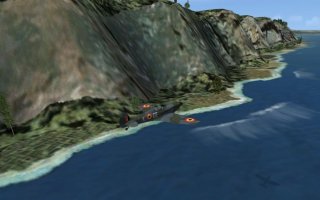
Turning west and over Kings Lynn, the largest town in the area, I could see the vast square waterscape of The Wash to my east, and it was soon time to turn north for my destination, RAF Coningsby EGXC, but as I passed the western corner of The Wash I spotted another aviation related site, the Holbeach Ranges across to my east. This is where current RAF and USAF combat aircraft practice their targeting and it's not a good idea to be in the area if the range is operational!

Coningsby was only 18 nms north of this corner of The Wash and it took me no time at all to get there. I spoke to air traffic and suggested that a fast low pass down the 25 runway might be worth while if they didn't have too many Typhoons in the area, and they reckoned it'd be a great idea, so I made a fast pass at about 100 ft and then turned 180 for the downwind leg, backing off the throttle to about 150 kts and dropping a few degrees of flap. Luckily this wasn't an early Spitfire like the original K5054 that had only two flap settings, full up or full down! Sadly my screenie of the low pass didn't work very well, so I've no evidence, sorry.
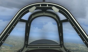
As Melo mentioned in an earlier thread, a curved approach is the only way with a Spitfire as otherwise you just can't see the runway over that long nose, and getting her on the centre line wasn't all that good really, but I did make a decent landing, which was pretty important here as Coningsby is the home of all current RAF Spitfire pilots, the Battle of Britain Memorial Flight (BBMF in future).

Taxi-ing right to the end of 25 I turned right and parked up outside the BBMF hangar where they would have been able to fix any gremlins that had cropped up, but luckily my flight was trouble-free as far as aviation was concerned.

I did have two FSX related issues as twice my PC shut down with 'You don't have enough memory for these settings' errors, so I may have to back the sliders off a bit, but it was a great flight, and being able to know JUST where I was for a change was very good indeed.
I took just over an hour on the flight, a little slower than expected with an average speed of 212 kts, and I burnt 55 galls of fuel, and still have 164 galls in the tanks. Should be OK for a couple more legs perhaps.
So that's Leg 01 under my belt, and I'm pleased to be the first one of us to manage it too.