• There seems to be an uptick in Political comments in recent months. Those of us who are long time members of the site know that Political and Religious content has been banned for years. Nothing has changed. Please leave all political and religious comments out of the forums.

    If you recently joined the forums you were not presented with this restriction in the terms of service. This was due to a conversion error when we went from vBulletin to Xenforo. We have updated our terms of service to reflect these corrections.

    Please note any post refering to a politician will be considered political even if it is intended to be humor. Our experience is these topics have a way of dividing the forums and causing deep resentment among members. It is a poison to the community. We appreciate compliance with the rules.

    The Staff of SOH

  • Server side Maintenance is done. We still have an update to the forum software to run but that one will have to wait for a better time.

Upcoming World scenery releases

Sander,
I had a look at Vancouver and New York. The shorelines are very good. Vancouver looks particularly realistic.
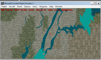
The only problem is New York requires local scenery in FS9. Consequently the Hudson and East Rivers are missing adjacent to Manhattan Island.
 
Sander,
I had a look at Vancouver and New York. The shorelines are very good. Vancouver looks particularly realistic.
The only problem is New York requires local scenery in FS9. Consequently the Hudson and East Rivers are missing adjacent to Manhattan Island.
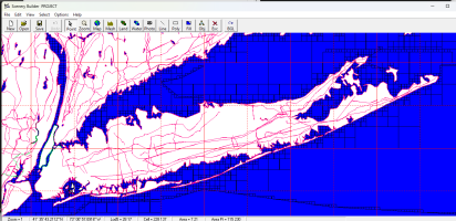
Interesting. New York has Photo scenery there; La Guardia and JFK blanked out as well, and strangely, Montauk (eastern tip Long Island).
I managed to import those from FS2002, and manually drew some shorelines; all quite easy. But cfs2autocoast won't load the SBX file, so have to go back to the code.
1724090475144.png
 
Sander,
I had a look at Vancouver and New York. The shorelines are very good. Vancouver looks particularly realistic.
The only problem is New York requires local scenery in FS9. Consequently the Hudson and East Rivers are missing adjacent to Manhattan Island.
Fix:
1724095664277.png
Also a nice fix for future customizations using SBuilder; it is easy to draw lines and forget to set the line type, it's always an extra step and SBuilder doens't warn about it. Those cases will now default to Shoreline.
 
SdC, I added all of bobhegf US training bases (US_Training_Missions 2024-05-08) to a fresh install and they work just fine. The airfield in Nevada known as "Railroad Valley" was nice but runways flash, all the others were just fine.
 
SdC, I added all of bobhegf US training bases (US_Training_Missions 2024-05-08) to a fresh install and they work just fine. The airfield in Nevada known as "Railroad Valley" was nice but runways flash, all the others were just fine.
1724096698428.png
 
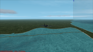
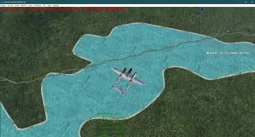
Sander, thanks for the New York fix. I had a look at Miami, San Francisco and Seattle, all of which have local scenery in FS9, and there were no problems - all the waterways looked great.
 
Last edited:
  • Like
Reactions: SdC
Hi Sander,
I'm still flying oner asia & oceania. Your scenery is a perfect match for the add-on Asian and Australian airfield.
However, as you mentioned, there are double coastline issue with UT's aleutian and andaman nicobar sceneries.
I tried manualy de-activate some bgls which covering these areas in your world scenery.
Is there any way to find which bgl should be de-activate from bgl number?
I mean numbers like, 976270, 925230, etc, means something related to locations?

Yuki
Hi Yuki, I didn't realize there would be overlaps with some of UT's stuff.
You mentioned Aleutian, so I downloaded it and had a look; it seems he partly used used the same process as me to make the land/water; when you look in the Aleutians_UT scenery folders, you'll see there are HP9......... files in there; those numbers are the same as in mine. So if you delete the corresponding 9....._vtp_*.bgl files from my scenery, you should be OK.

In MS Flight Sim, the world is based on a grid, numbered from left to right/top to bottom on the standard World map with Europe/Africa in the center.

To calculate the file names from coordinates (example somewhere in the Aleutians), the name starts with "9" followed by Column number, followed by the Row number followed by "0"
Column number for E 177:28 > to decimal degrees: 177.5, then INT ( (177.5+180) / 3.75 ) = 95
Row number N 52:30 > to decimal degrees: -52.5, then INT( ( -52.5 +90) / 2.8125 ) = 13
Resulting file name: 995130

Obviously, I want to make the @UncleTgt scenery compatible with the world scenery, as it is much more detailed. The best way would be to integrate it fully; my tool can import Ground2k files, including LC/WC into my tiles, but I would need the ground2k source files for that, Or @UncleTgt 's permission to include his scenery's as-is. It could all live together in the same folders/packages to make it much easier for people to install.
 
Last edited:
Sander,

Use whatever you want, however you like.

I'm not sure I have access to any source files from earlier than 2018 - ish though.

To be honest, IIRC the Andamans & Aleutians were my first forays into making scenery. I was still learning, refining my methods with each project.

I probably wouldn't approach them in the same way nowadays.

I use G2K for the land/water masks & polys. Also for creating VTP polys & lines.

For very large land masses (eg PNG) I use imbrication to break it into manageable parts that combine in the Sim.

The background map starts as a shuttle DEM, which I then overlay with maps to get an idea for roads & rivers.

Invariably the rivers need hand-flying in CFS2 whilst connected to G2K, adjusting the course to better match the mesh.

I now try to avoid wide-scale use of A16N flattens, as I feel the blending is rather coarse & it destroys some of subtle coastal mesh. I find hand-flying the coasts at low level, & creating localised flattens using FLATTENS where I find sloping water often yields better looking results.

Land & water classes are created using EZ-Landclass 2.

My later projects have a pretty well- established layer group structure, with airbases & Road networks often put into a separate scenery layer.

I do think separating the base land/water from the "transient" human engineered facilities is useful for modelling the creation/development/replacement of facilities during the course of WW2 in this Sim.
 
Sdc & Uncle,

Thank you so much for your quick and kind response.
I will try to adjust related bgls for aleutian and will try to find out which bgls should be removed for Andaman&Nicobar.
Both areas are important for the battle of Pacific.
Thanks again for your beautiful sceneries.

Yuki
 
Yuki,

Any file ending "_8_fixed" is a G2K lines file.

The earlier stuff I did was often a combination of shorelines, rivers and roads. My later stuff often has these separated, the names giving you a clue to whether they are roads or rivers.
 
Sdc & Uncle,

I could sucessfuly find and remove conflicting bgls with Uncle's scenery
Andaman & Nicobar : 972270, 972280
Aleutians : all bgl files which has same number with Uncle's bgl
Now, coastline issue has gone.
Thank you so much!
 
Sdc & Uncle,

I have a question about default scenery.
There are several areas road across on the sea water.
Attched pic is Tacloban, philippines and Manila harbor(Cavite area).
There are also some areas in Taiwan as same.
Do you have any idea if this is caused by any conflict or origial CFS2's bug?
If you have an idea, would you kindly share with me?
 

Attachments

  • KILLS(0) SCORE(0) GUNS(670) 8_24_2024 10_41_18 AM.png
    KILLS(0) SCORE(0) GUNS(670) 8_24_2024 10_41_18 AM.png
    2.7 MB · Views: 11
  • KILLS(0) SCORE(0) GUNS(670) 8_24_2024 10_52_23 AM.png
    KILLS(0) SCORE(0) GUNS(670) 8_24_2024 10_52_23 AM.png
    4.6 MB · Views: 12
Sdc & Uncle,

I have a question about default scenery.
There are several areas road across on the sea water.
Attched pic is Tacloban, philippines and Manila harbor(Cavite area).
There are also some areas in Taiwan as same.
Do you have any idea if this is caused by any conflict or origial CFS2's bug?
If you have an idea, would you kindly share with me?
Original cfs2 bugs
 
I see. Thanks Sdc.
Hi Sdc, Uncle,

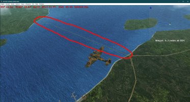
I notice there is an area road across on the sea water also World RC1.
Attached pic is in Penang Island, Malaysia.
There is a road across the channel.

I think it's because of the new world scenery is based on FS2002.
Highway across the sea was built after the war.

Anyways, my question is, if I want to remove the road, should I do it with G2K?
Would it be a right approach?

I need to remove it so Brithsh bombers can bomb those IJN heavy crusers passing the channel, he, he, he,

Yuki
 

Attachments

  • 21.jpg
    21.jpg
    439.9 KB · Views: 6
Hi Yuki & Sander,

Here are Cavite and Sangley Point as they were in WW2. The road in the water still isn't completely gone.
The files can be placed in the Philippines layer or in a layer or layers above Sander's new files.
Sander, feel free to incorporate these files in your scenery if you wish.

Cheers,
Kevin
 

Attachments

  • Cavite.zip
    4.3 KB · Views: 8
  • Like
Reactions: SdC
Wow! Thank you so much Kevin.
I'm still at work but as soon as I go home I will see it.
You gave me a sleepless night, ha,ha.
It's almost an hour drive from my house in Manila. Now days, Manila bay's landscape and coastline has much changed due to landfill.
There are lots of laxuary hotels and casino, malls, restaurants along the bay.
But the famous “sunset over Manila Bay” is as beautiful as ever.
 
Hi Sdc, Uncle,

I notice there is an area road across on the sea water also World RC1.
Attached pic is in Penang Island, Malaysia.
There is a road across the channel.

I think it's because of the new world scenery is based on FS2002.
Highway across the sea was built after the war.

Anyways, my question is, if I want to remove the road, should I do it with G2K?
Would it be a right approach?

I need to remove it so Brithsh bombers can bomb those IJN heavy crusers passing the channel, he, he, he,

Yuki
Problem is, there's gonna be 1000's of bridges all over the world that are too new. Although the fixes are very easy to make by themselves (1 or 2 minutes), because I have the whole world in SBuilder, it's going to be random what we find and decide to fix.
I've fixed Penang for you, and here is the link. If you find other stuff that needs fixing, please keep reporting, but I won't upload every fix individually after this, it's just be in the next big version.
 
Hi Yuki & Sander,

Here are Cavite and Sangley Point as they were in WW2. The road in the water still isn't completely gone.
The files can be placed in the Philippines layer or in a layer or layers above Sander's new files.
Sander, feel free to incorporate these files in your scenery if you wish.

Cheers,
Kevin
Hi Kevin, in this project I'm not touching the stock PTO region, there won't be any conflicts with my stuff there.
 
Back
Top