Beyond the Western Desert

Dan,
The hill is set up by a facility with flatten enabled at the height of the carrier deck. Presently I am calling the carrier model and runway object in the same gsl facility but i believe it could be removed and only called for in a mission. The invisible hill would still remain though.

I wish I could make the hill the same size and shape as a carrier but it ends up being much bigger by default. Attached a picture of the area with the hill remaining visible.

I have not tried this method via editing the DEM data. I am not sure it would yield a better result???
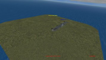
hill.jpg
 
I wonder if other facilities could be placed at sea level in the area surrounding the carrier to flatten the area and force a steeper slope?
 
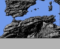
Hello, maybe I missed a pass, I see an aerodrome in Algeria, a boat but where is the file "mapdata" with the geographic coordinates of Spain and Tunisia, "global laye"r and "qclocation"?
med_west_map.jpg
 
I wonder if other facilities could be placed at sea level in the area surrounding the carrier to flatten the area and force a steeper slope?
I have tried that but it does not seem to help, though I am still trying
 
Last edited:
"I wish I could make the hill the same size and shape as a carrier but it ends up being much bigger by default."

I've also played around with this in the past. Unfortunately, it seems that how ever small you make the facility flattening dimensions you always get a much bigger 'lump' with the altitude set in the gsl. Hopefully by adding more flattening entries around it you may get it to work.
A nice little rectangular 'hill' beneath the carrier would be great!
 
Hello, maybe I missed a pass, I see an aerodrome in Algeria, a boat but where is the file "mapdata" with the geographic coordinates of Spain and Tunisia, "global laye"r and "qclocation"?

qclocation.xml and mapdata.xml are in main cfs3 addon folder. Global_layer.csv and .gsl are in cfs3 addon/global layer folder
 
Thanks for all the time and effort. Nice to see all the progress though all the difficult work just for us few CFS3 fans. Regards ,Scott
 
qclocation.xml and mapdata.xml are in main cfs3 addon folder. Global_layer.csv and .gsl are in cfs3 addon/global layer folder
I think we don’t understand each other. MAW has its files but it’s impossible to change them, I tried (see above). I changed the map in "uires", the geographic coordinates in"mapdata", the air bases in"global layer" and "qclocation", nothing moves.
 
I have not tried this method via editing the DEM data. I am not sure it would yield a better result???
Not sure what level of precision is possible, but we do have some pretty steep cliffs in places, like along the south coast of France. If the angle of those slopes can be duplicated with a DEM edit somewhere in the Atlantic, it might fit inside the carrier. Then theoretically no groundplane would be needed in the carrier facility.
 
I think we don’t understand each other. MAW has its files but it’s impossible to change them, I tried (see above). I changed the map in "uires", the geographic coordinates in"mapdata", the air bases in"global layer" and "qclocation", nothing moves.
Are you talking about MAW or the new map sdsbolt is making?
 
Not sure what level of precision is possible, but we do have some pretty steep cliffs in places, like along the south coast of France. If the angle of those slopes can be duplicated with a DEM edit somewhere in the Atlantic, it might fit inside the carrier. Then theoretically no groundplane would be needed in the carrier facility.

I've gotten the hill a little bit smaller but the big problem is that cfs3's best terrain resolution seems to be 128metes/pixel. It takes 4 pixels to make a flat plateau to place a runway on. Then you have 128meter slope around that as the plateau goes from deck height to water level. If carrier deck was super high like a mountain then you would get clifflike slopes. As its only about 50feet high the slope is gentle.

I have tried placing the carrier airfield on a 2 point hill which works sometimes but then other times it falls to one side of the hill at random.
 
I think we don’t understand each other. MAW has its files but it’s impossible to change them, I tried (see above). I changed the map in "uires", the geographic coordinates in"mapdata", the air bases in"global layer" and "qclocation", nothing moves.

Try making a copy of your whole CFS3 MAW folder then renaming what you want it to be. Run MW MultiCfs3 to create a separate install. That's what I did and I can edit global layer and QC in the new install.
 
Dan,
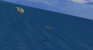
Is it possible to make a ship wake effect without the ship moving? The default one looks odd when used this way.
 
Probably, but not in the conventional way. The default wakes don't move, and are left behind by the ship and grow wider. We'd need something that moved back from the ship, or at least was placed statically extending behind it. Some bow foam would help too. Also, you can orient the ship so it points into the direction the waves are moving in from. Lastly, a weather file with some wind defined around the lat/lon of the ship to provide, at minimum, the speed of the ship to help planes get off in less deck space.
 
Back
Top