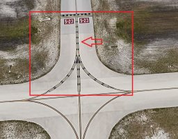
Spent the afternoon downloading photos to build the new ga terminal. It's interesting that Google Earth on the street is old and aerial views are new. Makes it very hard to do scenery when you get such conflicting information. When I created Odell Williamson Airport (60J) in Ocean Isle NC, I was able with my camera to take all the photos of whatever I wanted. Then when I created KMYR Myrtle Beach Airport, I had tons of real up to date info from the architect as well as people at the airport willing to take photos for me. NOT living in Naples, FL or anywhere near to it to drive there, I have to rely on what I can find online and Google Earth or Google Maps which basically has the same on the street photo slide show with its arrows, you HAVE to dig deeply not to create erroneous scenery which I just hate to do. That being said, I intend to do the best job I can of the Airport Authority GA Terminal and the two hangers on either side updating what Art Poole created back in 2009. Glad that Grayeagle figured out how to get around the "flickering" enhanced taxiways because it seems that all the airports are going that route. It's nice too that Airport Design Editor allows their creation with the ground poly. That's it for today.