Laos 1968 Air America scenery

Nice info! (y)

This is what I've got:

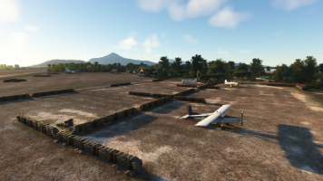
LZ on top of the hill to the east of the Tacan site

View attachment 175913
Source: https://www.limasite85.com/fall-of-lima-site-85

View attachment 175912
Source: https://www.historynet.com/lima-site-85/

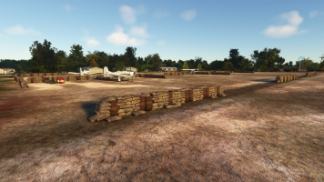
Airstrip down at the foothill to the west of the mountain

View attachment 175914
Source: https://www.limasite85.com/do-chi-ben-document
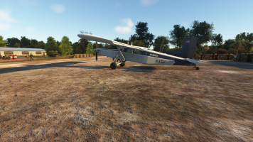
The image above depicts also the heli LZ to the east of Tacan

View attachment 175915
Source: https://www.limasite85.com/installation-of-trn-17-tacan

View attachment 175916
Source: https://www.geocities.ws/koratmahknut/warinlaos/Lima85/phouphathi.jpg linked from this website https://www.geocities.ws/koratmahknut/warinlaos/Lima85/adoptmia.htm

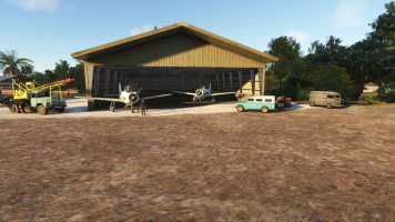
My scenery includes only the LZ on top of the hill and the airstrip down to the west of the mountain as I believed I had enough info to re-create them as per historically relevant info.

I did not include the earlier airstrip 34/16 at the ridge to the south-east of the Tacan as at the time when I was working on the scenery I did not have the last image above and therefore little to confirm its existence.

Unlike you :) which makes me happy to see you are working on it.

I hope the info above is useful in case you have not seen it yet.


OK. So I checked a lot of sources and think I have the location now. Confusion: there was a Landing Zone (for helicopters) which was on the ridge, and a Landing Strip at 4.5k ft roughly in line with the ridge (<- this is the main clue, because it is 1000 ft below the airfield which I created. the orientation and length matches though). The LZ is not mentioned in the CIA documentation. Maybe this is because the installation fell before an updated next Air Field Facilitiy booklet was released. So they just left it out.

The official STOL site was carved out of the mountain. And it is still visible today, with some imagination. There are also some hints that there was another staging field nearby, an a valley, but I have research this deeper.

Another thing - they did not have GPS back then. So coordinates mentioned in the original documentations were quite rough. But the runway orientations were rather acccurate, and the minimal length. As well as the elevation.

We will get there!

Cheers,
Mark
 
Last edited:
I think I got the location now. Hint from the litarature: 20mins hike to the top. "Carved out of the mountain side" and "below the ridge". Documents: Elevation (4500ft, matches perfectly), runway orientation and length. And cues from todays satellite or aerial imagery.

It is steep, and will be a challenge to land on.

Cheers,
Mark

1250410_20251114172342_1.png1250410_20251114172335_1.png
 
Last edited:
OK, I think I have a good version of the strip now.

It is short, steep and very demanding to land on (like in the Air America movie, first flight with the Porter). The top area is small. Be sure to go into reverse at the right time. BUT: Never come to an early halt at the slope. You'll not going to make it. If you have an easterly crosswind - PRAY.

:)


1250410_20251118165207_1.png

1250410_20251118165029_1.png
1250410_20251118165007_1.png
 
Working on L11 Pakse, a famous airfield at the shores of the Mekong near the Boloven Plateau. A major Air America and Raven airfield. Made some new typical aircraft revetments in Blender. Way to go!1250410_20260109165327_1.pngCheers,
Mark
 

Attachments

  • 1250410_20260109164021_1.png
    1250410_20260109164021_1.png
    5.6 MB · Views: 19
  • 1250410_20260109163951_1.png
    1250410_20260109163951_1.png
    5.6 MB · Views: 19
  • 1250410_20260109163834_1.png
    1250410_20260109163834_1.png
    5 MB · Views: 19
  • 1250410_20260109163733_1.png
    1250410_20260109163733_1.png
    5.8 MB · Views: 21
I had some procrastinating going on with tackling the famous LS-20A Long Tieng airfield because it is so complex. I have re-read a lot of literature now and also checked all original photos I could get my hands on and now have a basic setup for it. I check the airfield under different lighting conditions and perspectives and think I got the right feeling now. One of the main problems is to regress the scenery back to it's time, so there are a lot of custom made 3d objects (around 40) like the tower, Gen. Vang Paos Villa, the buddhist temple his wife donated, and the refugee shacks all over the place. Also the karst rock formations like Skyline Ridge and the infamous Vertical Speed Brake. I made custom 3d obejcts for that in Blender. Also got rid of the numerous TIN "skyscrapers" the sim feeds into the scenery. Here is a first look! Morning and evening screenshots.

Way to go, I think it will take a few weeks to get it right from now.

Cheers,

Mark
1250410_20260129164922_1.png
1250410_20260129170231_1.png
 
Last edited:
LS20a Long Tieng had three interesting locations around its perimeter.
  1. Kings Palace + howitzers
  2. A Thai artillery compound on the south western western ridgeline
  3. Another Thai arty compound on the eastern ridge ("Skyline Ridge"). This also was where the TACAN was located.
Today I made the Kings Palace, which was built for the King of Laos to retreat to when the climate got too hot in Luang Prabang. It was small and when the hostilities mounted, a little M-105 howitzer battery was stationed there, facing the east ridge.

I made a dedicated scenery object for the Kings Palace in Blender.

Cheers,
Mark

1250410_20260131173755_1.png1250410_20260131173826_1.png1250410_20260131173941_1.png1250410_20260131174033_1.png
 
Back
Top