falcon409
SOH-CM-2025
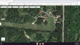
I discovered a satellite image I had captured for another airport but never went any further with it. Robertson Field in Hibbing, Minnesota. It's about 50nm NW of Duluth and Lake Superior. Other than what I can glean from the satellite image there seems to be very little, if anything available to give me an idea of what it looks like at ground level. Maybe that's why I never did anything with it. If anyone has info, or lives close to the airport, let me know. Thanks!


