• There seems to be an up tick in Political commentary in recent months. Those of us who are long time members of the site we know that Political and Religious content has been banned for years. Nothing has changed. Please leave all political and religiours commentary out of the fourms.

    If you recently joined the forums you were not presented with this restriction in the terms of service. This was due to a conversion error when we went from vBulletin to Xenforo. We have updated our terms of service to reflect these corrections.

    Please note any post refering to a politicion will be considered political even if it is intended to be humor. Our experience is these topics have a way of dividing the forums and causing deep resentment amoung members. It is a poison to the community. We apprciate compliance with the rules.

    The Staff of SOH

  • Server side Maintenance is done. We still have an update to the forum software to run but that one will have to wait for a better time.

RAF Banff

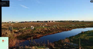
The river textures are just a basic texture no different from road or railroad, so they can't be made reflective or shiny. You would need to use actual water for that. If real water was used for all rivers, I imagine the river textures could be repurposed as a riverbank texture instead of using the shoreline texture. Color for the water bodies can be sorted out with a water color texture made for the map. If there is a way to export your shoreline data to a hi res bmp, a custom water colors texture would not be too hard to sort out for the map.

Another question about the Arctic latitudes in CFS3 - is the terrain true to life, or does it stretch like in a Mercator projection?
 
OK Dan , thank you for that answer. The rivers in this area are a bit too narrow and windy to use the ocean water tiles. They end up looking odd especially with the ocean shoreline added.

Yes, a map can be made of the actual shoreline being exported to game. I did experiment with making a water color mask like yours but its very rough .

Unfortunately CFS3 does not project the globe properly. The southern half of the map is not too bad which is the focus of this addon. The northern areas look fine but the east/west distances are farther than they should be.
 
FYI
An oblique aerial photograph captures Bristol Beaufighters of the Dallachy Strike Wing diving into the steep-sided Risnesfjord to attack the merchant vessel INGERSEKS, moored beside the cliff. Smoke and water spray from rocket projectiles launched by the photographing aircraft, along with cannon fire from the accompanying Beaufighters, nearly obscure the target.
I ynink North of your map though?

thanks , I have that pic but I can never see it too often.

Risnes fjord is very much on the map
 
Back
Top