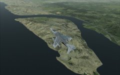
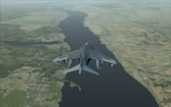
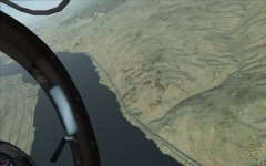
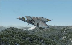
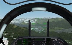
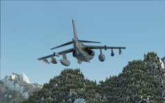
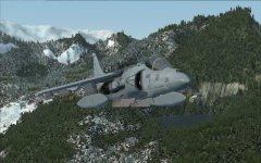
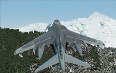
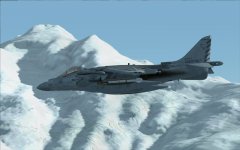
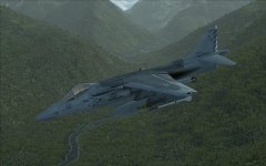
The Million Dollar Ride

Deacon211

SOH-CM-2022
Hey guys,

I had so much fun flying Padburgess's challenge this weekend, I thought I'd share something of my own.

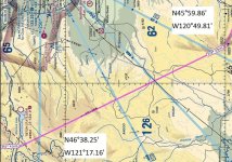
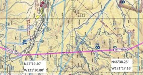
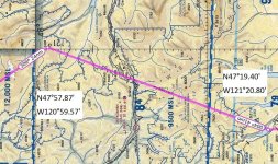
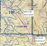
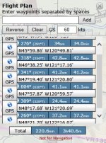
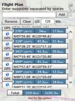
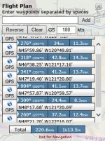
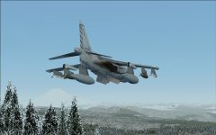
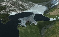
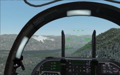
A Seattle reporter once got a ride in the right seat of an A-6 through the Cascade Mountains dubbing it "a million dollar ride". From what I remember, the ride in question was the VR-1355 low level route. Having never flown it myself (I tried once, but was weathered out by mountain obscuring clouds) I've always been dying to give it a go. So, inspired by Padburgess, I have plotted the route in Skyvector, stripped the chart (as much as SV allows), and calculated some legs.

I just tried it and it is truly a beautiful ride through the mountains.

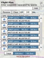
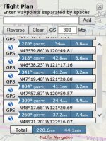
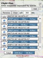
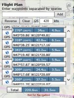
I've attached all the strip maps and waypoint logs run at every 60kts (it's an easy mile a minute calculation that I actually guess wasn't necessary since SV ran all the numbers anyway, but old habits die hard). I've also included some maps to get you to point A. This isn't quite like the other route as you will not have a valley to follow. This will be low level (500ft maximum) time/distance/heading with map interpretation. It's not a particularly easy route, especially down low. Keep honest on your headings and airspeed, form a big picture of the terrain that you are flying over from the chart, and remember "Clock to Chart to Ground". If you keep your speed and timing then don't get suckered into turning early (or late) by an inviting landmark...trust your numbers!

You will not likely be able to maintain 500ft the entire way, due to the rugged terrain. Just do you best using terrain masking and enjoy the several opportunities for inverted ridgeline crossings that the route gives you!

For those who like a challenge, pick a time on target at the last point and see if you can get to the final point on time...+/-30sec is the normal criteria for proficiency. I actually didn't do my full flight planning for you. It's much easier to add the times and keep elapsed time from point A rather than restart your clock at every point, so up to you on that. My apologies for the odd map orientations. They should be track up, but SV puts the distance and heading North up.

Anyone up for it?

Strip Charts:

A-B:
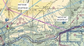
A-B.jpg

B-C:

B-C.jpg

C-D:

C-D.jpg

D-E:

D-E.jpg

E-F:

E-F.jpg

F-G:

F-G.jpg
 
Oh, depart from KHRI and route will end fairly close to NAS Whidbey Island.

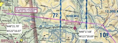
From KHRI, hold course 246 for 34mi. Point A is on the north side of the Columbia River. It's not particularly easy to see, but here's some help to get you on your way.

Flying west down the Columbia, you will see Crowe Butte State Park on an island in the middle of the river...

3CroweButte.jpg

Further west you will see Willow Lake on the south side as a sort of river delta crossed by bridges...

4WillowLake.jpg

You can see just beyond Willow Lake on the north side a very small river valley (dry in FSX)...the origin as it crosses the road is Point A...

5PtA.jpg

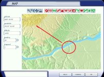
Here's Willow Lake circled in the flight map (the arrow is the initial leg more or less for orientation). Point A is at about 10 O'clock on the red circle.

Start Point.jpg

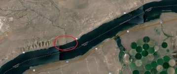
And here it is in Google Maps...

Point A.jpg
 
Last edited:
Deacon211, very nice work on the strip chart. Wish I had a dollar for every strip chart I made at VA-128, the A-6 training squadron at Whidbey Island. We could all go out for dinner on me. :very_drunk: I'm not familiar with VR-1355 from back in the day. Interesting how it starts right outside R-5701, the Boardman bombing range. I would expect a VR route to terminate there, rather than start.
 
Deacon211, very nice work on the strip chart. Wish I had a dollar for every strip chart I made at VA-128, the A-6 training squadron at Whidbey Island. We could all go out for dinner on me. :very_drunk: I'm not familiar with VR-1355 from back in the day. Interesting how it starts right outside R-5701, the Boardman bombing range. I would expect a VR route to terminate there, rather than start.

You know, I thought the same thing. I actually started the chart from Whidbey then saw the arrows pointing the wrong way.

Being a Yuma/Kingsville guy, we rarely got to get that far north; so I have flown only a few of the routes up there. Must have been a blast going through the RAG with such great terrain to fly through.

I recall going on a det there once in August. We closed the canopies in Yuma where it was 105 at least and tanked the whole way.

When we opened them in Whidbey, it was 65....it felt like outdoor air conditioner!


EDIT: Here's an EA-6B on the backside of the route by Bunting Lake I think...

http://m.youtube.com/watch?v=6ELJkITPr0A
 
Last edited:
Is "Skyvector" easy to use? I ask from the viewpoint of a retired CPO in senility training:biggrin-new:

So easy that it's remarkable that it's free!

A great place to access airport data, view sectionals, WACs, and Enroute charts. Plotting is no more difficult than right clicking and "adding to route". I do all my FSX flight planning there.
 
Most of the MTR's have been done in FSX flightplan format on Avsim:

northwest_us_flightplans.zip

I've got a current AP1B, but most of these don't change and you don't need to worry about "no-fly" areas on FS.
 
Most of the MTR's have been done in FSX flightplan format on Avsim:

northwest_us_flightplans.zip

I've got a current AP1B, but most of these don't change and you don't need to worry about "no-fly" areas on FS.

Nice! That would be very helpful for those with a moving map or just for reference.

But I actually had some fun doing it the old fashioned way...makes missing that turn more hair raising! ;)

Deacon
 
Last edited:
Anyone wanna educate me about what's possible regarding flying those low-level routes in a strict late-70s to very-early-90s scenario without spending a dime on a VC-equipped kite?


(I need a military freeware aircraft with VC that really did fly any of these routes. F-111? F-5? T-38? T-33?)

- Edit:

https://sites.google.com/site/shess0757/home/AS-F111-Panel

And Pease AFB to boot!

https://sites.google.com/site/shess0757/projectpeaseafb


Well, I can't imagine that there isn't a freeware everything for FSX by now of varying quality. Have you browsed through Simviation and seen what they had to offer? The routes are open to everyone in the mil, so any of the ones you mentioned, plus all other period correct jets and even transports would be a fair choice. Even the default Hornet is probably in there for the 80s-90s...If you can stretch your timeframe a bit, I don't think you can beat Dino's F-14D or T-45C...

....speaking of which:

http://www.youtube.com/watch?v=bk9LQtPsCdk

Deacon
 
OK, here's my first run:

Taking off from KHRI...

1KHRI.jpg

Coming up on Pt B...the hill crest

6PtB.jpg

Crested the ridge and found Mt Adams on the other side...cool!

10MtAdams.jpg

Pt C...the northern knob of Clear Lake

11Clear Lake.jpg

The eastern edge of Bumping Lake serves as a good cross check between Pts C an D.

12Bumping Lake.jpg

A couple of big drop-offs which are great for ridgeline crossings.

14Ridgeline.jpg

Pt D at the end of Keechelus Lake.

15Keechlus Lake.jpg

Terrain starts to get pretty rugged after D.

18.jpg
 
Came upon this hidden mountain lake. Always one of the best parts of low levels for me was wondering if any human had ever stepped foot here 100 miles from nowhere..

20Hidden grotto.jpg

Screwed up my timing taking pictures and was sweating the turn at Pt E a bit, especially since it was a pretty broad mountain top between to river valleys. Felt much better seeing Glacier Peak on the back side.

23Glacier Peak.jpg

According to the chart, put it on my right side and was feeling fairly confident I was back on course.

25Glacier Peak.jpg

Actually wound up a little right of center and wasn't entirely sure I was going to see the next checkpoint as it was another mountain top amongst many but spotted it as I crossed the Suiattle River and made the final turn to the target.

26Suiattle River.jpg

Unfortunately, that was the last of it. In saving my pictures and checking the chart I accidently hit whatever combination of keys was required to reload the scenario! Aaaaaaaaaaargh! Foiled again!

Well, that was my war story. Laugh a little. Cry a little.

Anyone else?
 
Nice course, Deacon!

I would like to give it a go, if that's OK. The only caveat is that I'm using FS9. :biggrin-new: I followed your routing on my SV map, and I deduce that the turns on VR-1355 correspond to the various Waypoints.

NC - You'll like Skyvector a lot, especially since they added the new Digital US Sectionals; they're much clearer than the old charts. Also adding the World VFR, Hi and Low Charts makes most Global planning much easier!

:encouragement:

I registered for SV. Took a look at it. Wish there was a way to print the generated flight plan. NC
 
Nice course, Deacon!

I would like to give it a go, if that's OK. The only caveat is that I'm using FS9. :biggrin-new: I followed your routing on my SV map, and I deduce that the turns on VR-1355 correspond to the various Waypoints.

NC - You'll like Skyvector a lot, especially since they added the new Digital US Sectionals; they're much clearer than the old charts. Also adding the World VFR, Hi and Low Charts makes most Global planning much easier!

:encouragement:


Sure man, have at it...you don't need my permission! :D it's all in good fun.

I have FS Genesis mesh. Are you running anything beyond stock FS9? I'd be curious to see how well the scenery matches in other builds. With FTX and FSG I was pretty impressed that I could follow the chart and actually recognize the terrain from the videos...pretty impressive.
 
The routes are open to everyone in the mil, so any of the ones you mentioned, plus all other period correct jets and even transports would be a fair choice.

The F-111 is fun enough and period accurate. It'll have to do.
 
The F-111 is fun enough and period accurate. It'll have to do.

Personally, I think the 'Vark is an ideal choice for something like this; she's ideal for the Mission!

Deacon & NC - At one time, SV had a Print option, but due to the FlightPrep deal they had to disable that feature.
FYI there's another neat site that gives real time Aviation Wx, with METARS and the ability to track the Wx along your entire route:

www.avnwx.com

I have a stock Install of FS9... nothing like UT, or REX running in the background. I have a couple small LC areas around Denver and Moab,
but that's it. I'll post screenies at the WP's so you can see if there's a difference in views.

:wavey:
 
Back
Top