Another one, I've been working on the North Laos road network today and found it to be very exact, right on the satellite images.
We also have the complete famous infiltration "Route 7" (and branches) the NVA / Pathet Lao used to reach the Plaines des Jarres, crossing the "Fishmouth" border, then through Ban Ban valley. It's all there!
What is not there are a couple of important land marks for VFR flying / target aquisition, like the Road Runner Lake and others. Also, the ORBX-FTX landclass is totally off in some places, that will be corrected.
Here's the dev shot as it is now:

We also have the complete famous infiltration "Route 7" (and branches) the NVA / Pathet Lao used to reach the Plaines des Jarres, crossing the "Fishmouth" border, then through Ban Ban valley. It's all there!
What is not there are a couple of important land marks for VFR flying / target aquisition, like the Road Runner Lake and others. Also, the ORBX-FTX landclass is totally off in some places, that will be corrected.
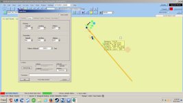
Here's the dev shot as it is now: