-
Please see the most recent updates in the "Where did the .com name go?" thread. Posts number 16 and 17.
You are using an out of date browser. It may not display this or other websites correctly.
You should upgrade or use an alternative browser.
You should upgrade or use an alternative browser.
CFS3 Terrain Creation - is anyone still around?
- Thread starter gecko
- Start date
Global Mapper
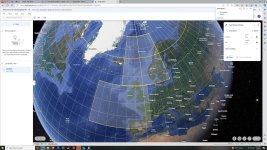
I have an older copy of GM from 2008, I think. Will see if I can get it to work again. I use Google Earth to map out two areas. I now need to be sure the areas are square for CFS3, 1835 km per side. Once that is done and I can fire up GM...well see. If you have suggestions as to placement or area to be covered let me know.
I have an older copy of GM from 2008, I think. Will see if I can get it to work again. I use Google Earth to map out two areas. I now need to be sure the areas are square for CFS3, 1835 km per side. Once that is done and I can fire up GM...well see. If you have suggestions as to placement or area to be covered let me know.
Attachments
rbp71854
PTO Solomons ,PTO Rising Sun, ETO Expansion
Vector Data Files
Daniel and others interested. The following is a zip with files on creating vector pathing that I did for the Hawaii portion of Rising Sun.View attachment how-to-make_hawaii_vector-data_files.zip
Daniel and others interested. The following is a zip with files on creating vector pathing that I did for the Hawaii portion of Rising Sun.View attachment how-to-make_hawaii_vector-data_files.zip
Were you able to successfully convert anything other than Gtopo30?
no, I was starting to look at that when I hit the GM max export limit which happen to be only 4 times

mongoose
SOH-CM-2026
I have a small victory in that I can use Microdem to create the .bil that ers2tiff will recognize. I have only tried with srtm30 data. I dont have photoshop so I cannot create
a landclass tiff that the tools will recognize. Not sure if there is another way.
Doesn't Gimp achieve the same effects?
rbp71854
PTO Solomons ,PTO Rising Sun, ETO Expansion
I dont have photoshop so I cannot create
a landclass tiff that the tools will recognize. Not sure if there is another way.
I may have used Corel PaintShop Photo Pro for Tiff creations.

Paint.NET works with and saves as .tiff files. It's also free. I'm a Photoshop user myself (very old version), but sometimes Paint.NET gets me out of a hole.
https://www.getpaint.net/
https://www.getpaint.net/
Pat Pattle
SOH-CM-2026
Doesn't it need to be a 32bit tiff? I seem to remember that from somewhere.
MajorMagee
SOH-CM-2022
Yes, 32 bit is 8 bit for each channel of RGB and Alpha.
Where did you get Mircodem
Link to download Mircodem?
I have a small victory in that I can use Microdem to create the .bil that ers2tiff will recognize. I have only tried with srtm30 data. I dont have photoshop so I cannot create
a landclass tiff that the tools will recognize. Not sure if there is another way.
Link to download Mircodem?
MajorMagee
SOH-CM-2022
Thanks
Spoke to the developer and he sent me the link, thanks!!!
Spoke to the developer and he sent me the link, thanks!!!
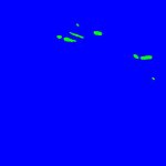
Thank you Andy, that worked! Only small problem was a few extra colors (blue-green and black) got added to the texture. Most likely its because I shared original as a jpeg. I am able to work around the few extra colors by adding a few more terrain types for now. Thank you again.
Spoke to the developer and he sent me the link, thanks!!!
You can use Microdem but if you already have a copy of Global Mapper I would probably stick with that. GM seems easier to use and more robust. Microdem seems to crash easier and can be fussy about the data it uses. My issues with Microdem may be due to my inexperience and I am certainly thankful to the developers for this program.
We also have a tutorial on using GM to create mesh which makes things easier.


