• Please see the most recent updates in the "Where did the .com name go?" thread. Posts number 16 and 17.

    Post 16 Update

    Post 17 Warning old domain name stealing credentials

  • Special Server Maintenance

    Just when you think you have everything running some what better...

    You get a message from the Hosting company. Short story they need to move us to a new server. I have been working with them to plan a good date for all concerned. Here is what we have come up with as a schedule.

    1. November 4th 17:00 -5UTC shut off the forums and start backup proceedures. During this time there will be no access to the forums or the Resource Section.
    2. November 5th Continue with Backups and download same until complete.
    3. November 6th 7:00 turn over server to hosting company to move system to new server
    4. November 7th - 8th restore backups and upgrade forum software.

    If all goes well we should be back online on November 8th.

    To keep you updated we will post updates on AVSIM forums.

    Thank you for your support.

CFS3 Terrain Creation - is anyone still around?

Well, that doesn't sound hard, if you know what you're looking for. Therein lies the rub I suppose.
 
Figuring out how to fix it. If you open the exe with a hex editor, you can find some file paths. Perhaps it's those that need some adjustments.
 
seem to be having a problem with my Mosaic editor. The Layer properties window has disappeared and I cant find a way to get it back.
 
I continue to use Global Mapper to help me create facilities files that can be moved in and out depending upon the mission.

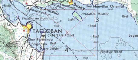
I start off with a screenshot of a square area with topos installed. In this case the area is 9k x 9k a portion of San Pedro Bay

Pedro_Bay.jpg

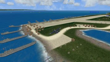
I then use G-Max to place the objects to create a facilities file. The file can be moved in and out via scendb.exe depending upon the date of the mission. In this particular case the file adds lsts, crates on runway and invasion ships in bay a few days after initial invasion .
talcoban_area.jpg
 
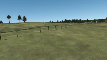
is it normal to get these telegraph/telephone lines when exporting a major_road vector with mkgnd tool? I can't say I recall seeing it happen before.


major_road.jpg
 
I remember, but can't find, a thread from long ago that discussed having these poles only along railway lines versus generating low walls along the roads. I think it may have been in 2016.
 
Last edited:
Steve
In Terrains folder /terrdata.zip or you can remove the textures for the telephone poles and for the wire.

From This
philippines_vectordatalinings.xml

<VectorDataLinings>
<VectorDataLining VectorType="MAJOR_ROAD">
<LandClass Id="6" />
<LandClass Id="24" />
<LandClass Id="25" />
<LandClass Id="26" />
<LandClass Id="27" />
<LandClass Id="51" />
<LandClass Id="69" />
<Variation>
<LinkedPattern Name="TelegraphPoles" CenterOffset="17" />
</Variation>
</VectorDataLining>
<VectorDataLining VectorType="RAILROAD">
<LandClass Id="6" />
<LandClass Id="24" />
<LandClass Id="25" />
<LandClass Id="26" />
<LandClass Id="27" />
<LandClass Id="51" />
<LandClass Id="69" />
<Variation>
<LinkedPattern Name="TelegraphPoles" CenterOffset="17" />
</Variation>
</VectorDataLining>
</VectorDataLinings>

To This
<VectorDataLinings>
<VectorDataLining VectorType="MAJOR_ROAD">
<LandClass Id="" />
<LandClass Id="" />
<LandClass Id="" />
<LandClass Id="" />
<LandClass Id="" />
<LandClass Id="" />
<LandClass Id="" />
<Variation>
<LinkedPattern Name="TelegraphPoles" CenterOffset="17" />
</Variation>
</VectorDataLining>
<VectorDataLining VectorType="RAILROAD">
<LandClass Id="" />
<LandClass Id="" />
<LandClass Id="" />
<LandClass Id="" />
<LandClass Id="" />
<LandClass Id="" />
<LandClass Id="" />
<Variation>
<LinkedPattern Name="TelegraphPoles" CenterOffset="17" />
</Variation>
</VectorDataLining>
</VectorDataLinings>
 
Last edited:
Back
Top