-
Please see the most recent updates in the "Where did the .com name go?" thread. Posts number 16 and 17.
-
IMPORTANT DOWNLOADING INFORMATION - ALL MEMBERS PLEASE READ
Please see this thread for updates. Update Thread
SOH ADMINISTRATION
You are using an out of date browser. It may not display this or other websites correctly.
You should upgrade or use an alternative browser.
You should upgrade or use an alternative browser.
City Textures rework
- Thread starter rince33
- Start date
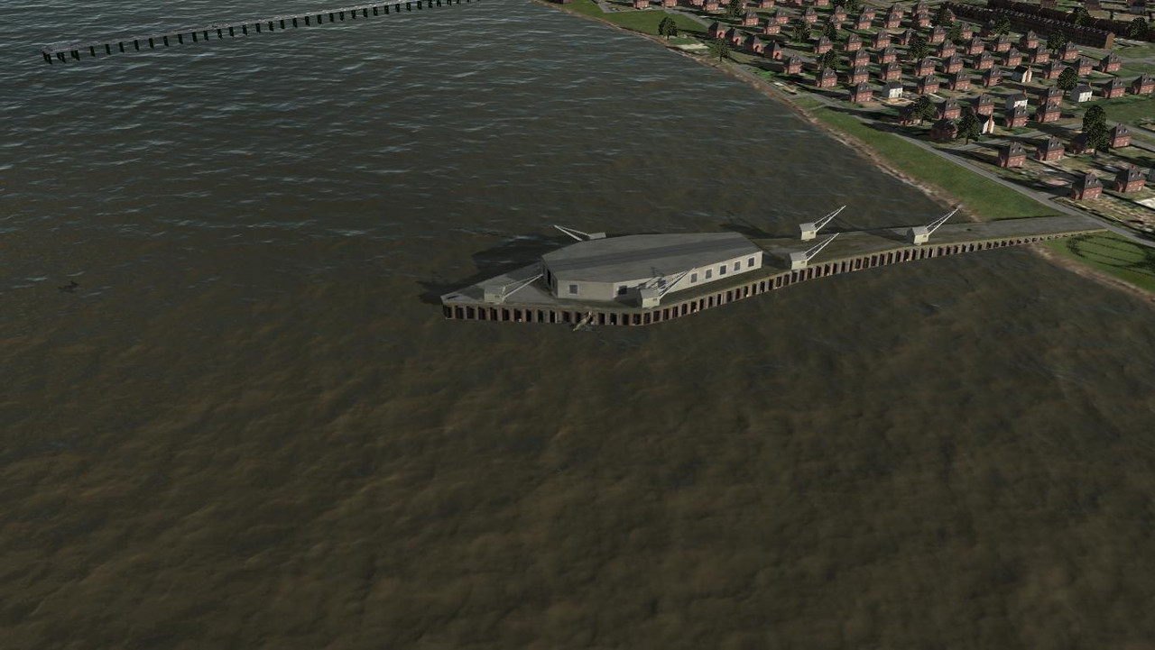
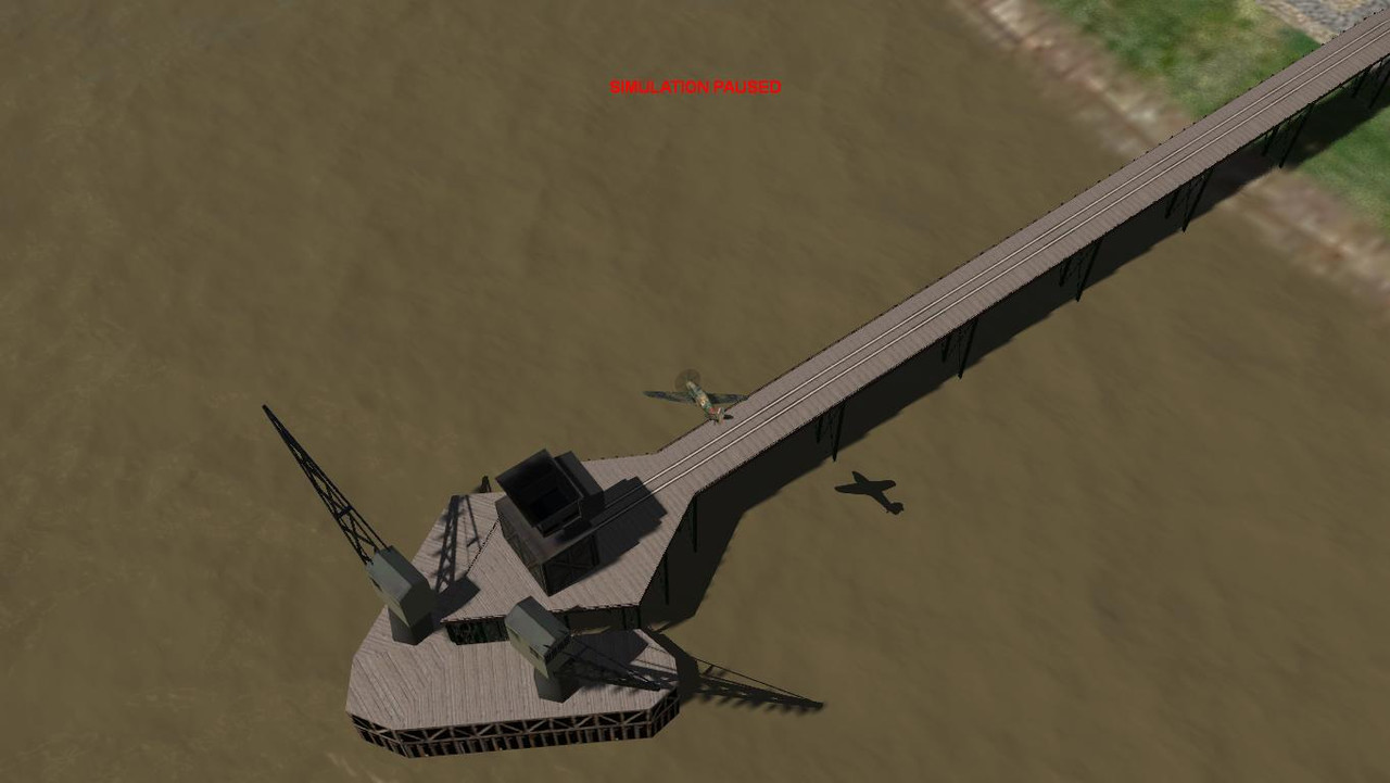
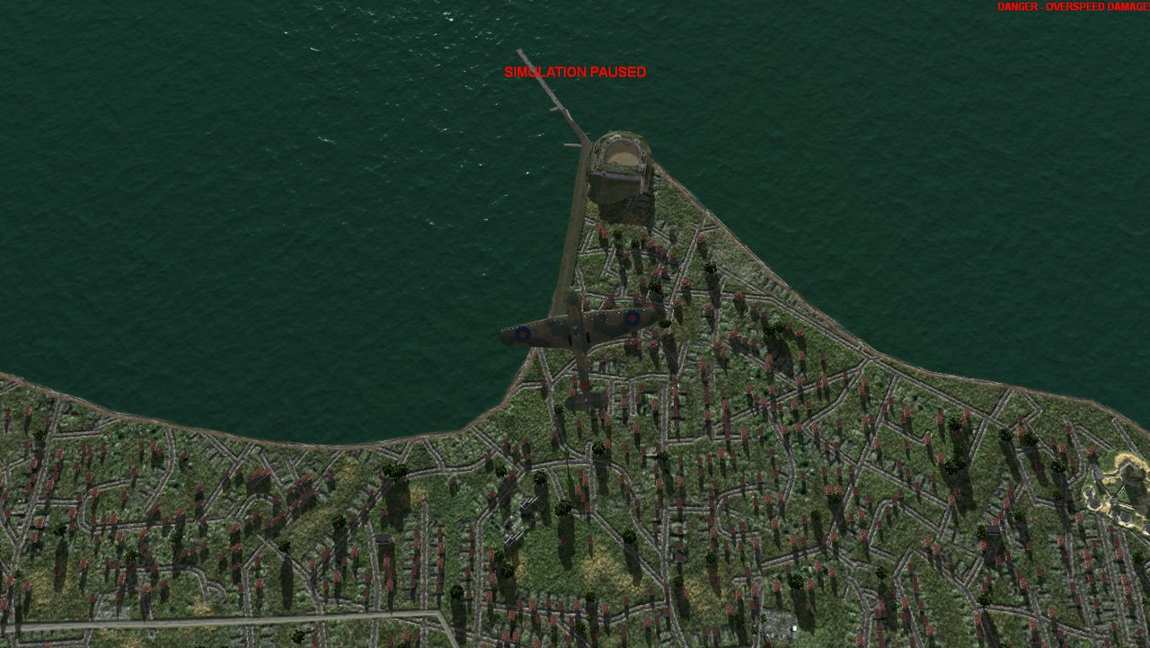
Southend loading pier.
Southend-on-Sea placements are currently 70% completed. The loading pier has a damage box but no damage modelling, basically eye candy at this stage.
The gasworks pier is still to be created and I may also create a longer main pier as the current medium pier model is a bit short.
Southend-on-Sea placements are currently 70% completed. The loading pier has a damage box but no damage modelling, basically eye candy at this stage.
The gasworks pier is still to be created and I may also create a longer main pier as the current medium pier model is a bit short.
that looks really good
Thank's mate!
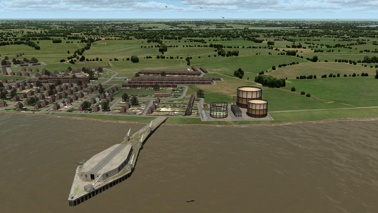
I had intended to show the gasworks on the completion of Southend but what the hell. Clive kindly provided the gmax files for his lovely gasholder model so that I could scale a large and smaller version for Southend. After I have completed the gasworks pier I will continue with building module placements above and to the east of the gas works placement.
R,
I have to tell you that the gasometers were behind the pier, well actually there were two piers. That one you've built (which is very good and exactly the shape I remember), and a second smaller one (to the right of that one) which had a black tar covered pipe that stunk of sulphur (prob because it was good ol' coal gas tar from the gas) running along it. I had most of my relatives in Southend, so spent a lot of school holidays there, on the beach, and the Pier. You could fish off that large pier, then (60's-70's) it didn't have the cranes or anything on it.
I appreciate that you've got the housing already built behind it, so I'm not being picky, just brought back a lot of old memories, amazing what you remember! ha ha.
Great stuff.
Cheers
Shessi
Hi Shessi")
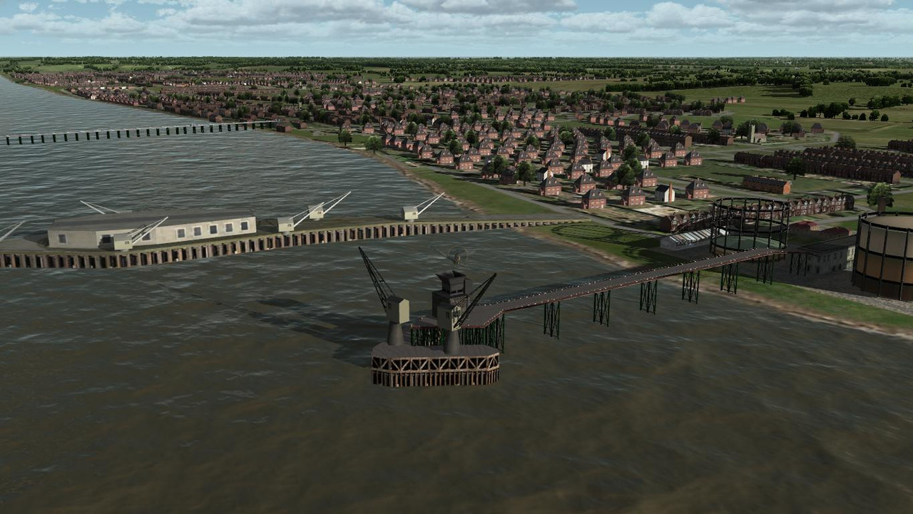
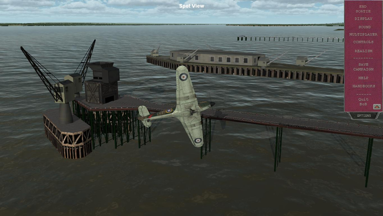
I know about that short pier to the right of the loading pier with the cranes, my next build.
I don't have any close up pics of it and its buildings, so there will be some guesswork involved. I have to be a bit selective about the detail that I add, after all this is just a representation of these landmarks which will probably never be seen in missions. I can always revisit the area at a later date and add some extra stuff.
The cranes are in 1940's pics and it was fun adding them to the pier. I had to google old small cranes to get an idea of their appearance.
I noticed a fun fair just west of the gasholders and was tempted to build it, but had to restrain myself.
Nice to read about your old memories of the area.
You all have a great week.
Yes you could go on and on...and on..have to limit it sometime!
The funfair was the Kursaal, then there was a smaller Peter Pan's Playground (funfair) next to the main public pier entrance. The Kursaal funfair went in the 80's, Peter Pan's is now called Adventure Island.
Fun fact...and you prob know, Southend Pier is the longest public access pier in the world, about 1.25 miles/2 Km long.
Aside from the memories, it really is impressive what you are doing.
Cheers
Shessi
sixstrings5859
Charter Member
Absolutely Awesome work !!!
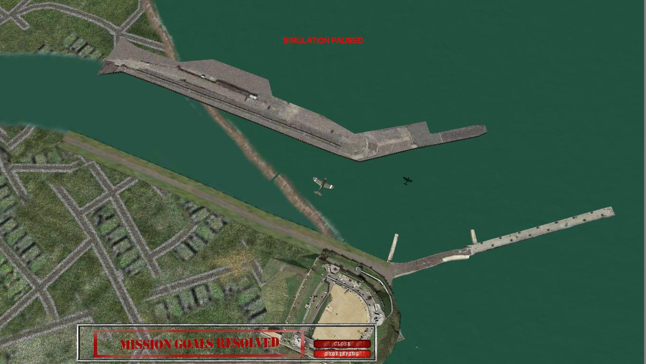
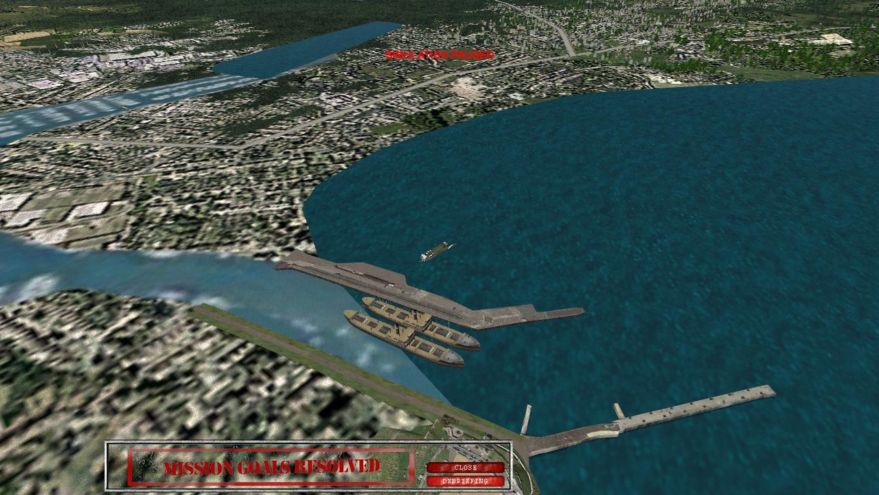
I completed the Southend gasworks pier today.
I managed to gather enough info online to create what I hope is a reasonable representation. It houses two large cranes and a coal hopper. It should have a slight Eastward kink in the middle, but I could not bring myself to ruin a perfectly good pier.
https://www.southendtimeline.co.uk/southend-timeline-gasworks-jetty-history-of-southend-on-sea.html
It includes edited bits of texture from the existing medium pier model which speed-ed things up a bit, thanks to Clive I think.
I need to push the Gasworks a bit to the north and place a few buildings on the coastline on either side of the pier as in online pics.
rbp71854
PTO Solomons ,PTO Rising Sun, ETO Expansion
I know WOW for sure and more! Amazing workWow!
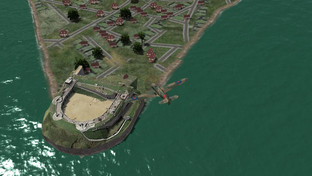
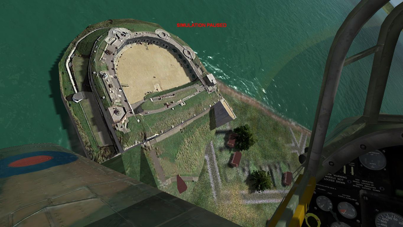
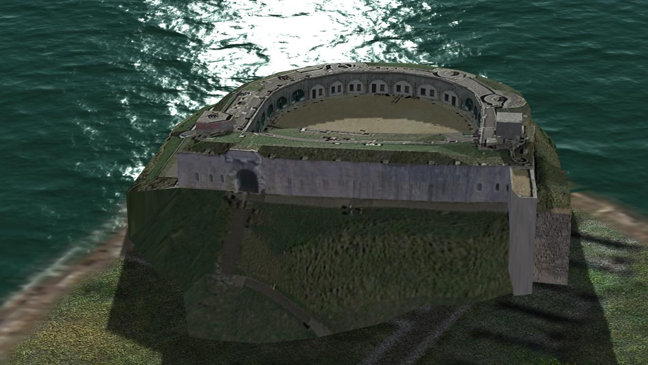
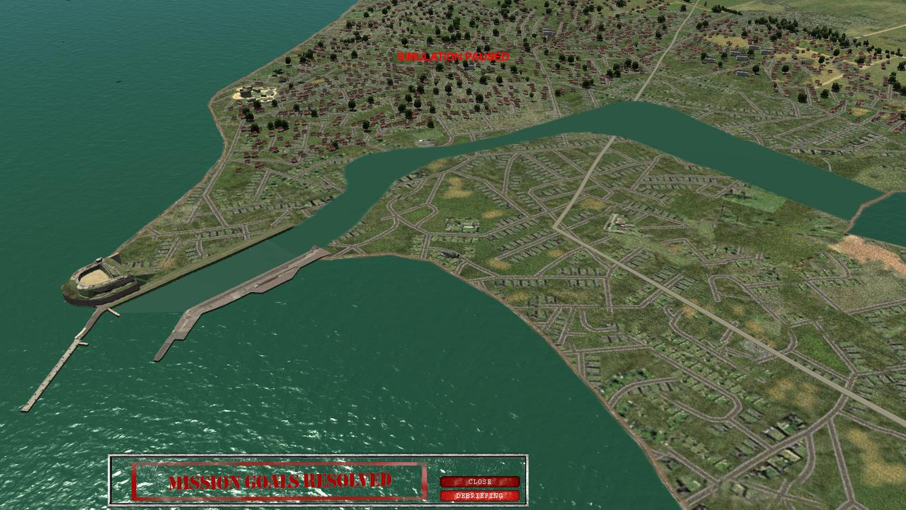
Current wip at Weymouth. I'm still not finished placements at Southhend. I got bored and reskinned my Fort Nothe model in gmax.
I added my Fort Nothe model to Weymouth.
I created a mos file to depict the harbour and river, fake water again.
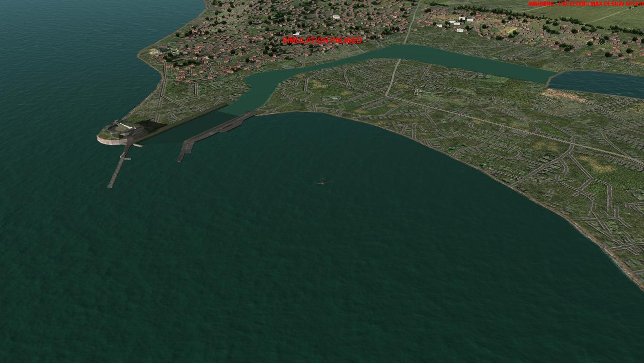
I'm having problems with the shoreline texture, and I'm almost tempted to remove it completely as per the stock install. I tried using a plane with a texture to cover the shoreline, but that introduces a third water texture colour which doesn't look bad in the afternoon but looks terrible in the morning.
My only other alternative is to clog the harbour mouth with shipping to cover the shoreline texture.
nasty shoreline texture.
Eugh! looks nasty.
My workspace in a stock install, note no pesky shoreline texture. I could darken the mos texture water so that it works better with the morning light. and place various ships in the harbour mouth to hide the shoreline texture.
I added my Fort Nothe model to Weymouth.
I created a mos file to depict the harbour and river, fake water again.
I'm having problems with the shoreline texture, and I'm almost tempted to remove it completely as per the stock install. I tried using a plane with a texture to cover the shoreline, but that introduces a third water texture colour which doesn't look bad in the afternoon but looks terrible in the morning.
My only other alternative is to clog the harbour mouth with shipping to cover the shoreline texture.
nasty shoreline texture.
Eugh! looks nasty.
My workspace in a stock install, note no pesky shoreline texture. I could darken the mos texture water so that it works better with the morning light. and place various ships in the harbour mouth to hide the shoreline texture.
Probably easier said than done, it's a large map. A more detailed map with proper coastlines would require a higher resolution image of what size I wonder, and what size system to run it?That sounds frustrating. We just need to remake the map with water in the right places!
Thank's ! Water colours change due to distance, angle of view and weather conditions, so it's impossible to get a perfect match.yeah , I find it impossible to match the dynamic water with painted on .mos file water. Your pictures look really good given CFS3's limitations.
It looks almost perfect when viewed from the opposite direction. I will make the mos water texture a bit darker because these harbour areas are usually dredged for increased depth. This will hopefully make the mos texture fit in a bit more in the morning light.third one up from the bottom looks the best.
Creating a river shaped plane with a water texture in gmax would work better than a mos texture from a lighting point of view, but when I tried this at Chatam naval shipyard, the water texture caused 'z-in fighting' over 15000 feet which resulted texture flickering. I had to use a mos file texture to render the fake water.
For this reason I had to also replace the water textured plane with a mos file texture at Sheerness shipyard.
Last edited: