-
Please see the most recent updates in the "Where did the .com name go?" thread. Posts number 16 and 17.
-
IMPORTANT DOWNLOADING INFORMATION - ALL MEMBERS PLEASE READ
Please see this thread for updates. Update Thread
SOH ADMINISTRATION
You are using an out of date browser. It may not display this or other websites correctly.
You should upgrade or use an alternative browser.
You should upgrade or use an alternative browser.
City Textures rework
- Thread starter rince33
- Start date
Pat Pattle
SOH-CM-2026
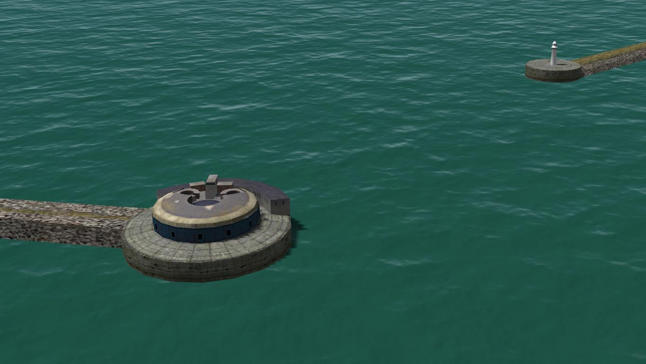
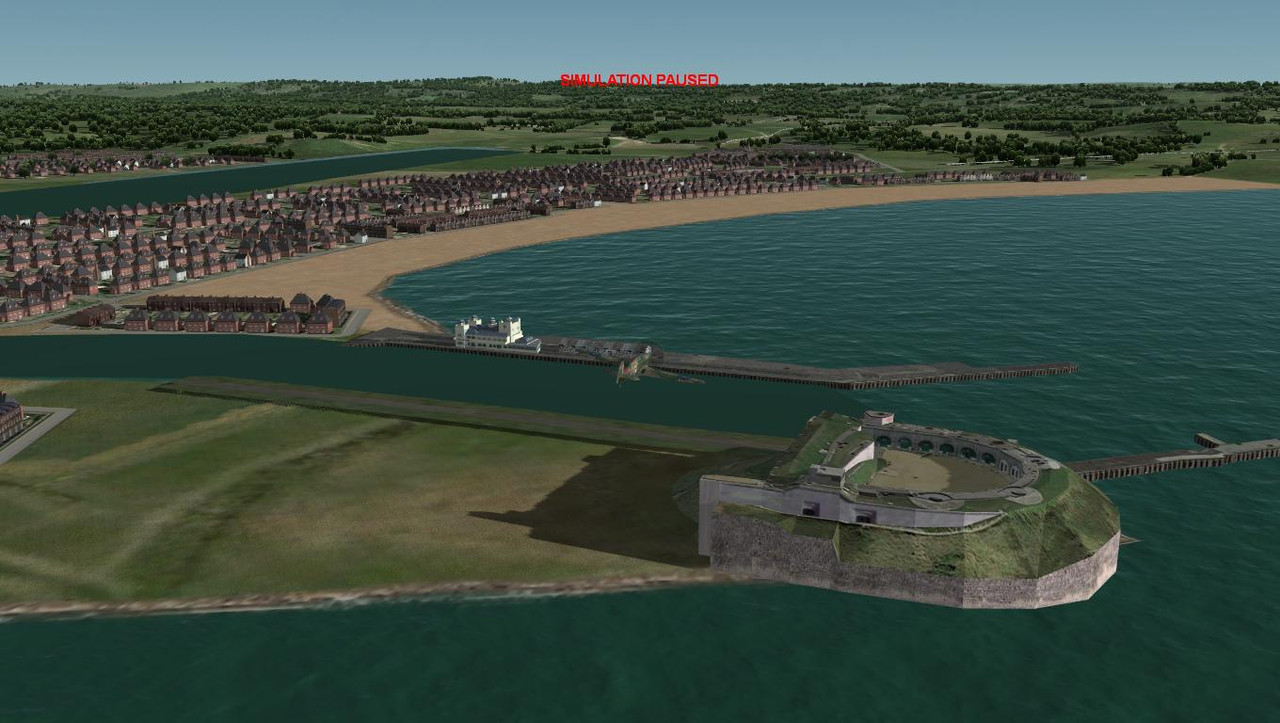
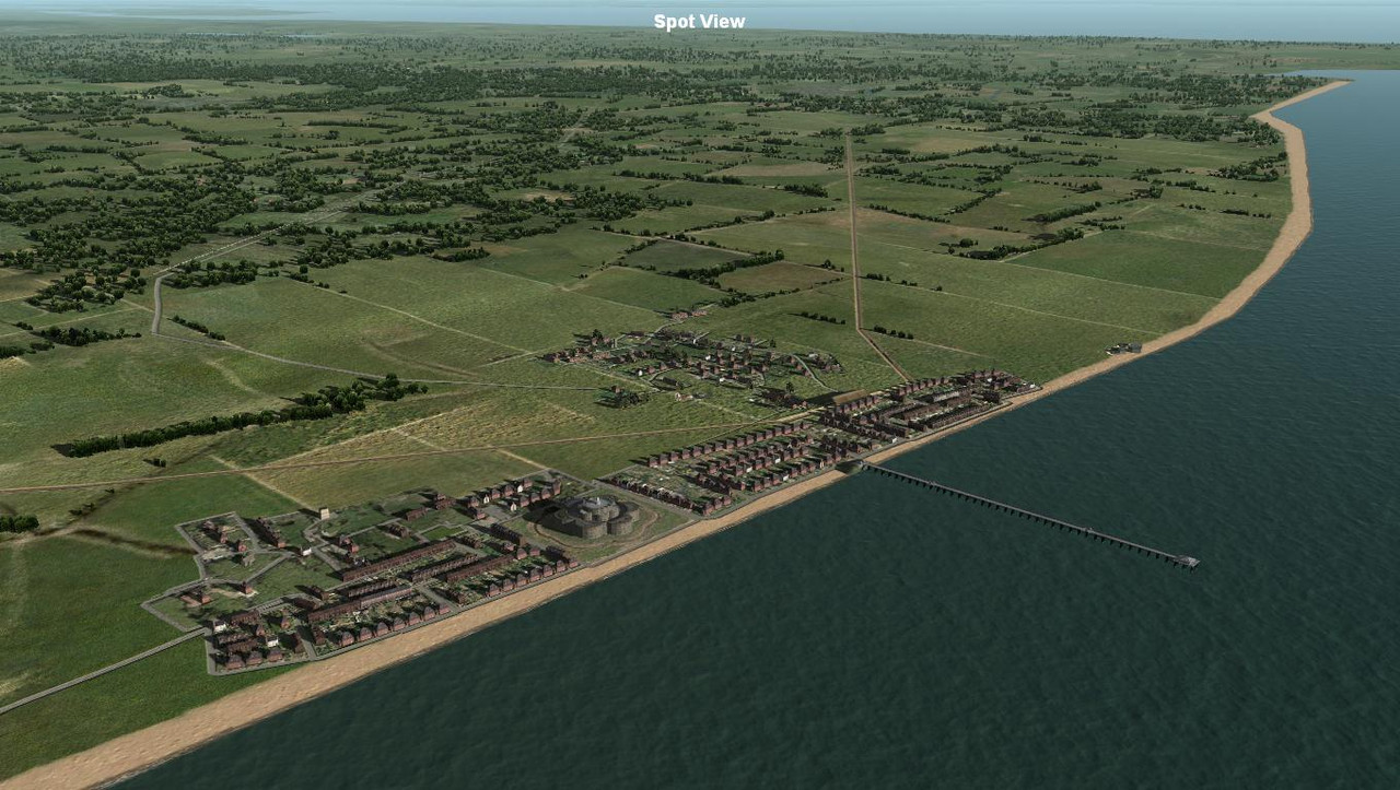
Nothe fort looks excellent! I think that the inland water is good and as you say, put plenty of shipping in there to hide the transition. It's better portrayed than not imo. 
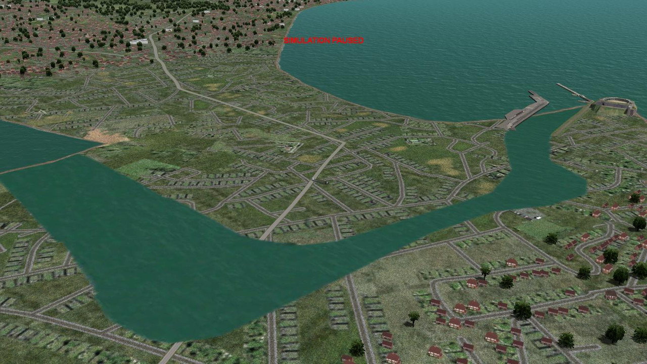
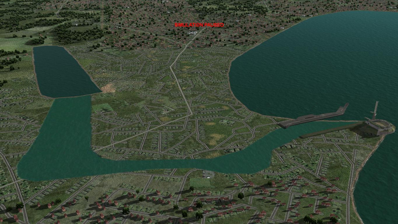
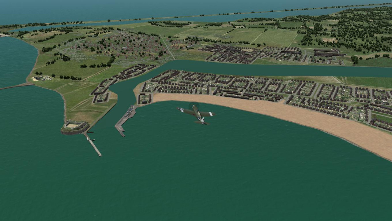
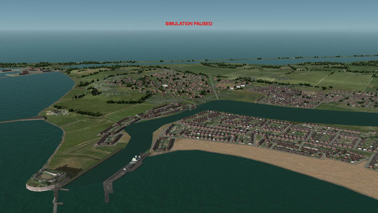
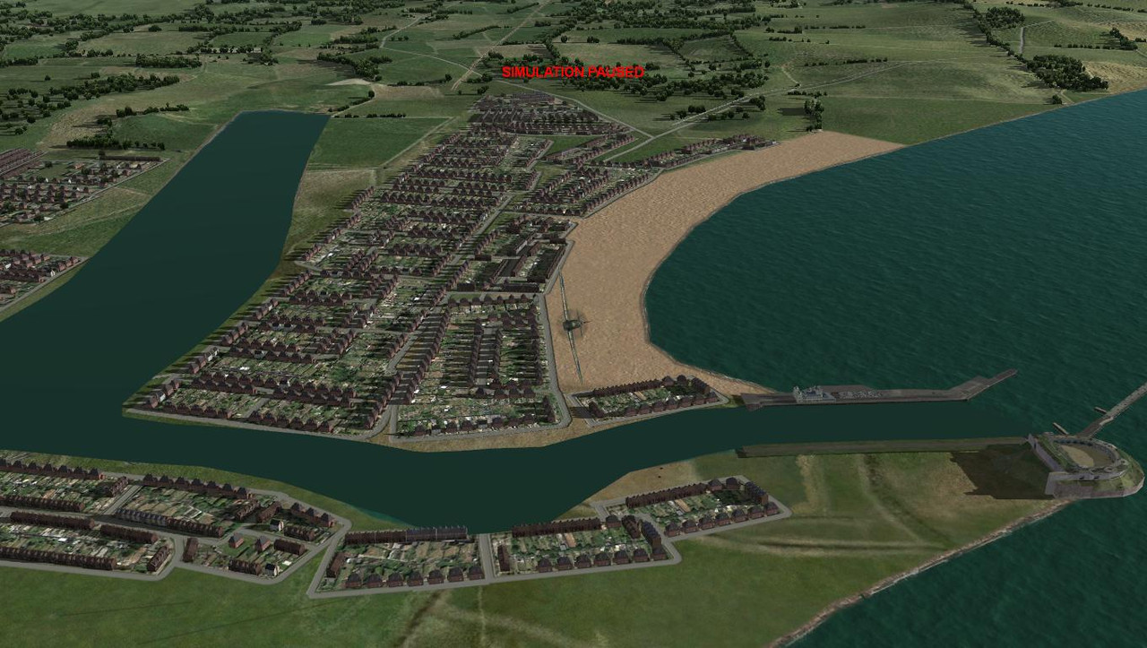
I spent a few hours working on this yesterday. I created gmax water planes to cover the entire water area and just a part, but using just the mos texture seemed to be the best option for various reasons. One was z-in fighting between the shoreline and gmax water plane texture at 11000 feet.
In the afternoon light the mos file texture match is as close as dammit, but not so much in the morning light. Unfortunately it has to be a match for one or the other. I will have to use shipping to cover the shoreline texture as best as I can.
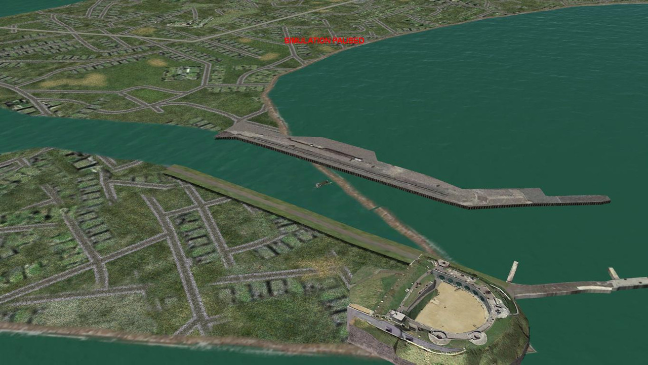
There's still some texture work to be done on the fort Nothe jetty and an old pavilion building model to be reskinned and added to the harbour. The harbour mesh must also be adjusted. A bridge will be placed between the inland dynamic water and the mos file water as per google earth images.
AFTERNOON
MORNING
In the afternoon light the mos file texture match is as close as dammit, but not so much in the morning light. Unfortunately it has to be a match for one or the other. I will have to use shipping to cover the shoreline texture as best as I can.
There's still some texture work to be done on the fort Nothe jetty and an old pavilion building model to be reskinned and added to the harbour. The harbour mesh must also be adjusted. A bridge will be placed between the inland dynamic water and the mos file water as per google earth images.
AFTERNOON
MORNING
Last edited:
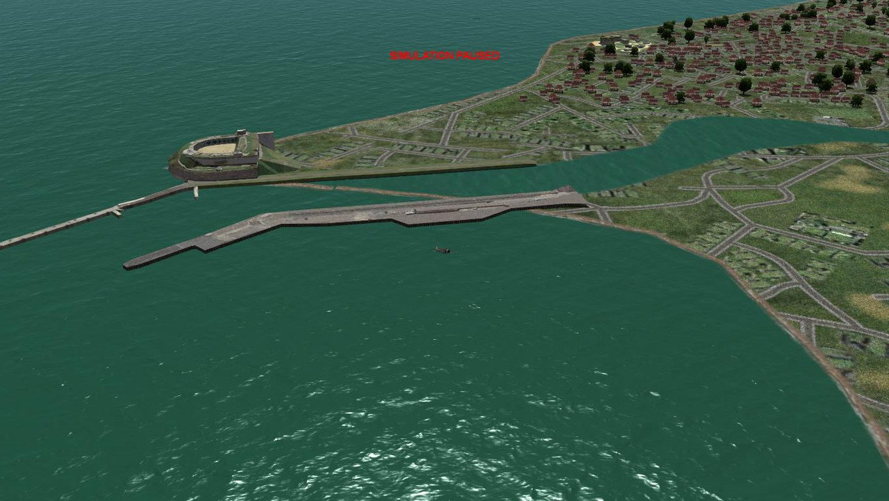
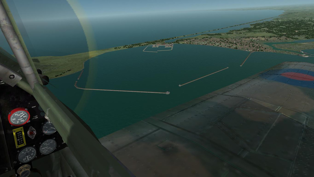
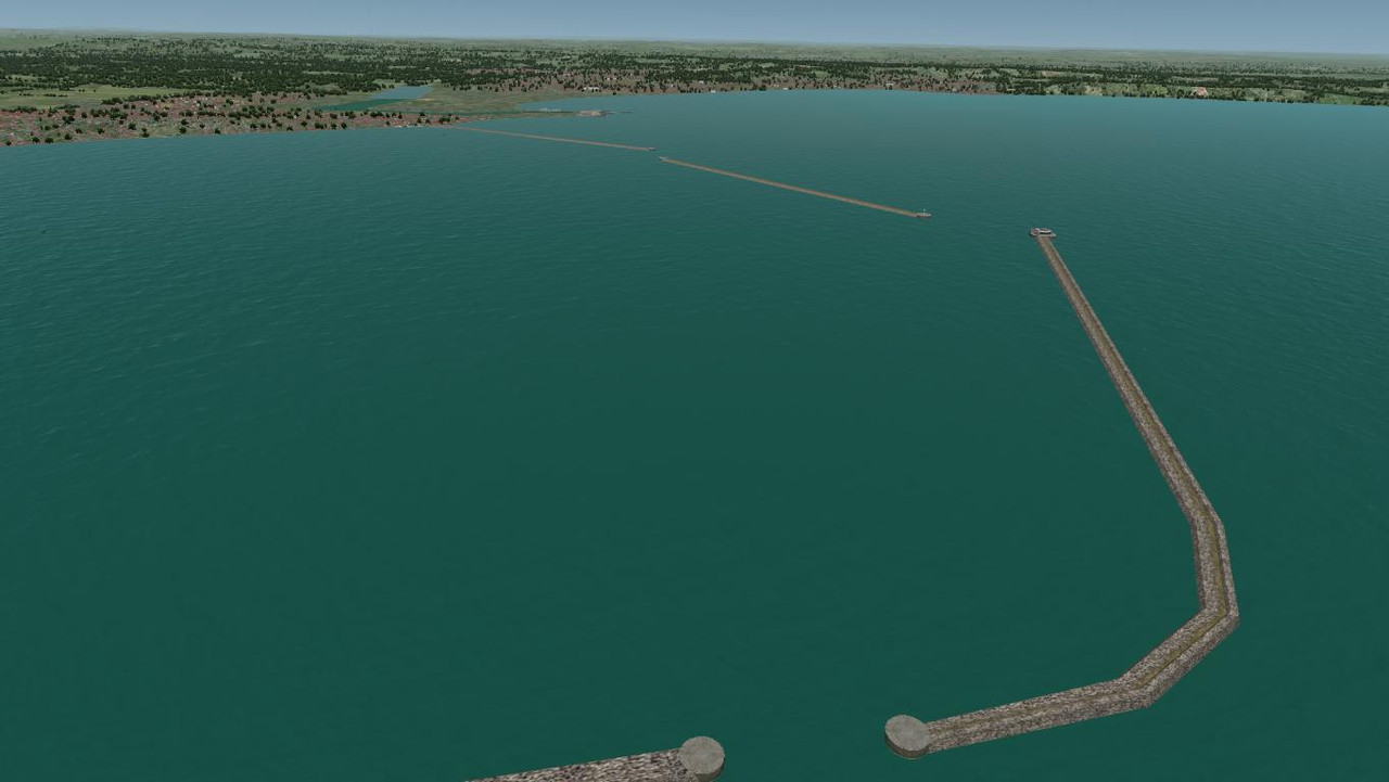
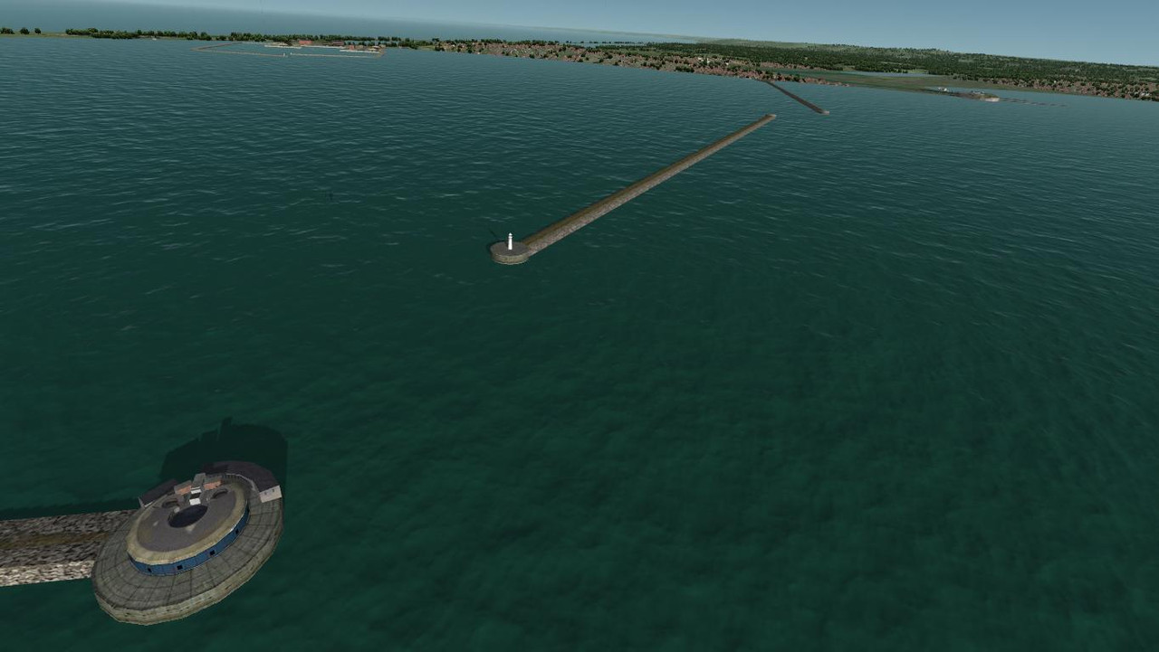
Portland breakwater and fort wip. The fort still needs a bit of work and the island harbour still needs to be built. I tend to get a bit carried away when forts are involved. Would be nice to add some working AA guns to the fort, maybe much later after I've done some research on how to achieve this.
Pat Pattle
SOH-CM-2026
Would be nice to add some working AA guns to the fort, maybe much later after I've done some research on how to achieve this.
Two methods Glen,
1. Add the guns to the Gmax model, the model then needs to be set up as a "vehicle" for the guns to work.
2. Create stand-alone gun models, again, set up as "vehicles" which are then added via the facility file. The guns have to be modelled at the height they would be mounted on the fort.
Any time-scale on releasing any of your work? I can't wait to see it.
Wow! thanks for the info Clive.
I haven't really thought about a timescale, it just adds unnecessary pressure. I just add stuff as I go until UK placements are done.
Missions also have to be amended to work with the mod, with targets updated to work with the new harbours.
I agree with Daniel that option 2 seems to be the way to go, less messy, and can be used elsewhere as well.
Pat Pattle
SOH-CM-2026
No animations required, the sim does it through the xdp file.
Just ensure to get the naming conventions and hierarchy correct.
The Gmax game-pack M16 half-track shows how it's done.
Just ensure to get the naming conventions and hierarchy correct.
The Gmax game-pack M16 half-track shows how it's done.
No animations required, the sim does it through the xdp file.
Just ensure to get the naming conventions and hierarchy correct.
The Gmax game-pack M16 half-track shows how it's done.
also the gun model parts pivot point location and orientation must follow SDK
I did browse the 88mm flak gun xdp file, and had a look at the demo models in the gmax gamepack before I started my model and was going to use the 88 flak gun xdp file as a guide to create a new xdp file.
I expected to find bones as constraints when viewing the destroyer and M16 models and was puzzled to find none, hence the query about static gun models. So it's the game engine that provides the working pivot points, I just have to name my model parts correctly, got it, thank you all for the advice.
I expected to find bones as constraints when viewing the destroyer and M16 models and was puzzled to find none, hence the query about static gun models. So it's the game engine that provides the working pivot points, I just have to name my model parts correctly, got it, thank you all for the advice.
Pat Pattle
SOH-CM-2026
Good point!also the gun model parts pivot point location and orientation must follow SDK
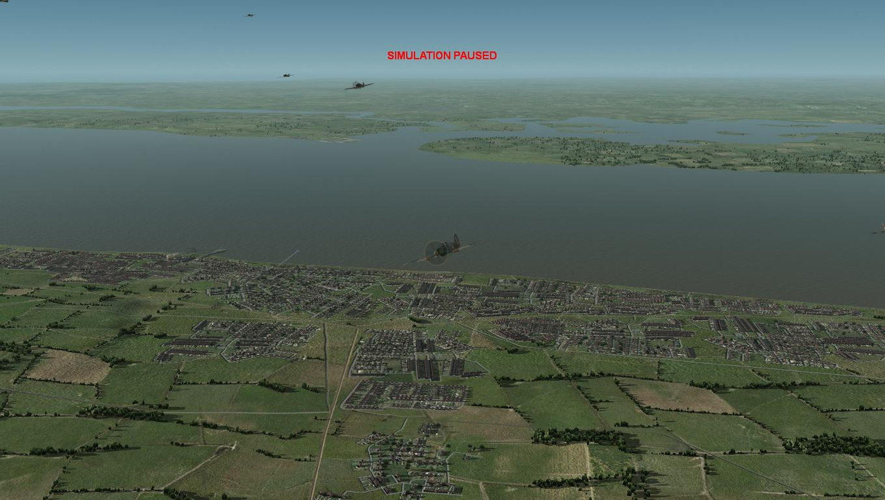
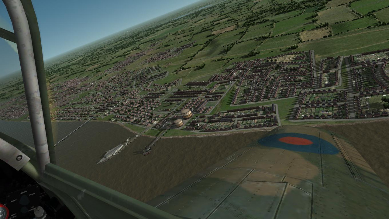
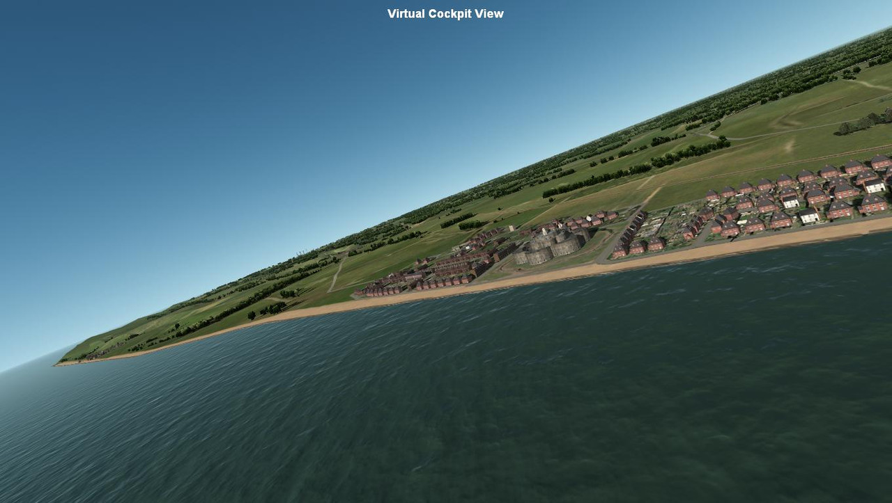
My beach experiment at Weymouth. Surprisingly the beach texture plays nicely with the shoreline texture. The beach is a bit wide so I will have to adjust placements to narrow it down a bit. A lot of placement work still to be done here.
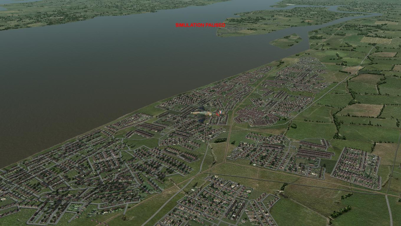
Almost done with Southend. There are some villages to be added in the Northwest, and I may have to add a beach.
Other area's coastlines will have to be reworked like the Deal objects to facilitate the beach stretch from Dover cliffs to Ramsgate.
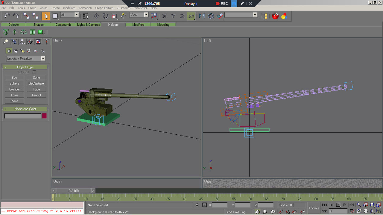
The AA gun is still a wip. I'm experimenting with the orientation of the different parts so that it trains and fires correctly. I get the vertical and horizontal training working, but it won't fire. I suspect that the barrel orientation is back to front. The orientation of the model horizontal and vertical sections is quite finicky. I had to spend more time on placements because the gun is such a small object, but I will get back to it when I'm in the mood.
Almost done with Southend. There are some villages to be added in the Northwest, and I may have to add a beach.
Other area's coastlines will have to be reworked like the Deal objects to facilitate the beach stretch from Dover cliffs to Ramsgate.
The AA gun is still a wip. I'm experimenting with the orientation of the different parts so that it trains and fires correctly. I get the vertical and horizontal training working, but it won't fire. I suspect that the barrel orientation is back to front. The orientation of the model horizontal and vertical sections is quite finicky. I had to spend more time on placements because the gun is such a small object, but I will get back to it when I'm in the mood.
Y arm (green) of the pivot points will align toward the rear of the object. The x arm (red) will align with the Y axis of the gun barrel. Gun group axis will always point forward from the barrel. Align barrel horizontal to base. This allows the full movement call-out in the xpd, I had to learn this the hard way. when in doubt check the german destroyer source file in the SDK. The AA gun is looking good
Hi Thudman
I did use the destroyer guns as an example. The m16 was just confusing with all the lod mesh.
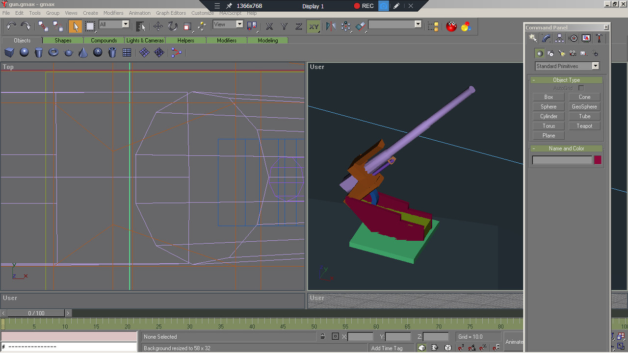
My gun barrel(gun0_fore_aft) has a pivot at the bluish/purple cylinder for vertical gun movement .The gun carriage(gun0_l_r) pivot point is centred where the grid lines meet. The cube at the tip of the barrel is the gun_grp0b0 which should indicate the direction of fire. I haven't looked at this for a while and I will hopefully get back to it shortly.
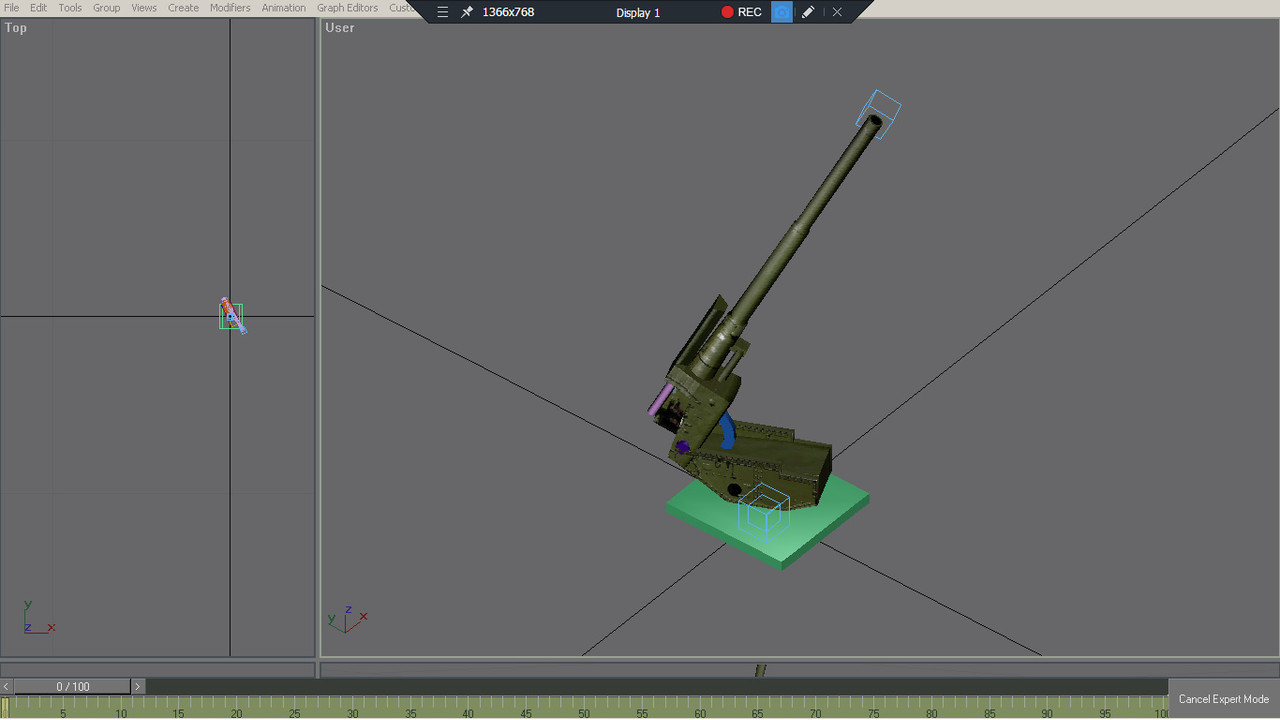
I used this simplified model in the game to test the physics.
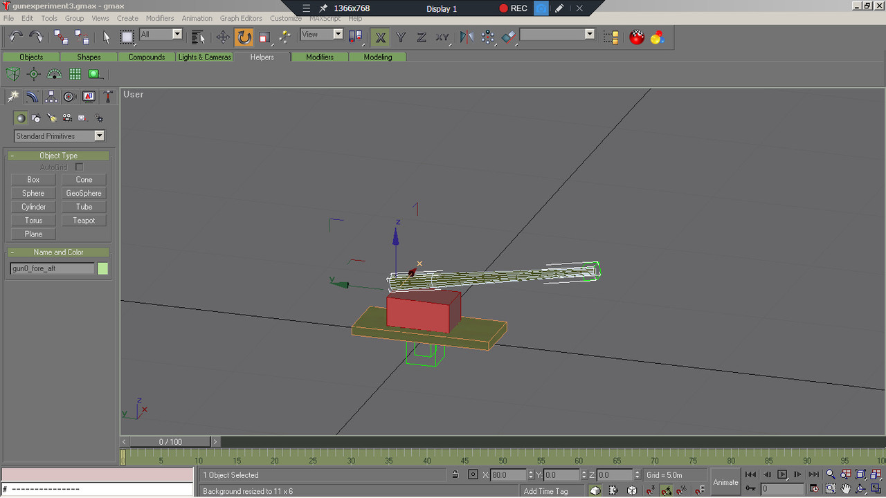
I noticed that the sdk destroyer had green dummy cubes which I could not recreate in gmax. My gmax dummies seem to be blue.
I made a copy of the destroyer gmax file and deleted the model, leaving only the green dummy cubes which I used as you can see in the image above. I dont know if the green dummy cubes are different to the blue dummies. I'm probably the only real dummy here.")
Another point of interest is that not all vehicles are listed in the cfs3 bob mission builder, notably the german 88 flak gun (g_88mm).
I did use the destroyer guns as an example. The m16 was just confusing with all the lod mesh.
My gun barrel(gun0_fore_aft) has a pivot at the bluish/purple cylinder for vertical gun movement .The gun carriage(gun0_l_r) pivot point is centred where the grid lines meet. The cube at the tip of the barrel is the gun_grp0b0 which should indicate the direction of fire. I haven't looked at this for a while and I will hopefully get back to it shortly.
I used this simplified model in the game to test the physics.
I noticed that the sdk destroyer had green dummy cubes which I could not recreate in gmax. My gmax dummies seem to be blue.
I made a copy of the destroyer gmax file and deleted the model, leaving only the green dummy cubes which I used as you can see in the image above. I dont know if the green dummy cubes are different to the blue dummies. I'm probably the only real dummy here.
Another point of interest is that not all vehicles are listed in the cfs3 bob mission builder, notably the german 88 flak gun (g_88mm).
Last edited:
Frosty
SOH-CM-2026
Dummy colour shouldn't matter, as any other object colour in gmax. It is a matter of preference or visibility etc. My dummies are magenta...
I haven't checked but you probably can set the dummy colour in the 'preferences'-menu, just as the colour of brackets, selections etc.
As said above, the orientation and naming of the object do matter - but "orientation" refers to the actual orientation of the object's pivot point, which may differ from its world/view/screen etc. orientation!! (Use the "Pivot" -buttons on hierarchy tab in the command menu, you'll see differently shaped XYZ arrows. These should point to the directions mentioned in the SDK (use the "Affect Pivot only" -button to reorient them if neccessary without rotating the object itself).
Okay! I didn't know about this. Thanks for the info Frosty.(Use the "Pivot" -buttons on hierarchy tab in the command menu, you'll see differently shaped XYZ arrows. These should point to the directions mentioned in the SDK (use the "Affect Pivot only" -button to reorient them if neccessary without rotating the object itself).
Pat Pattle
SOH-CM-2026
Fabulous!!