Sbob
SOH-CM-2025
Meanwhile, I've attached an ACS flight plan for KMHR to KMER that I cooked up using Nav30. 
I included the Top-Of-Climb and Top-Of-Descent (to prove a point). You can practice how to delete waypoints after you find out why I don't like using them.
Just dump the KMHR-KMER plan file into your ACS "Programs" folder then run the ACS data loader and select the flight plan. Hit "Load To GPS" then "OK". Start FS and load your T-43 at a KMHR parking spot. Bring up your GPS to make sure the new plan is loaded. Check the clock and note the time. Start the engines, lights On, pitot heat On, then contact Ground and request a straight-out departure. Use Progressive Taxi and get to the hammer head. Check your time again and write it down. Contact the tower and tell them you're ready for take off. You've already set up the auto pilot, right? Now would be a good time. While we're on the that subject, you wrote down all that data you'll need for Castle, right? Your pattern altitude is 1,000 feet. Make sure your altimeter is calibrated, hit the "b" key just to be safe (later on, your "b" key will be how you set a Combat Altimeter). Set your course on the HSI for 140. Make sure everyone has a barf bag. You'll be flying with ATC so remember your "O-N-E". We'll be flying almost due south so figure out an even altitude plus 500 feet. Did you remember to polish your boots? Too late.. Remember to check the clock when you start rolling and again once you take off.
Basically, take off from Mather and steer to 140. I included the LINDEN VOR (114.80) because its on our route. Set your A/P for something below 20,000 feet and keep your airspeed around 245 KTS. Set the GPS so it's talking to the auto pilot. Stay with the ATC. We're in their play ground. Dial up the LINDEN VOR and notice how well ACS compensates for the wind. From here on out, ACS IS your Navigator.
This flight should take less than half an hour. If you goofed something up, you can do it again without too much of a time hassle. Just be sure to recognize when and how you screwed up. Remember how we figured out when to descend to the pattern altitude? Castle's pattern alt is 1,000 feet, same as Mather. Try to get down to your pattern altitude just a little early. Try playing around with the auto throttles to see what works best.
Check in with Castle for a landing as soon as you can. We'll be using what is, essentially, a Combat Break (in an old 737) from here on out. Aim for the AFB at the pattern altitude, gear and flaps down, speed 150 KTS, and fly over the runway, then break to line up with the right glide slope. Remember, the folks in the tower and on the flight line will be watching so try to look classy. Once you're down, request a Gate to taxi to and shut down.
Remember to log your flight time.
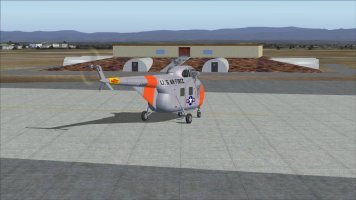
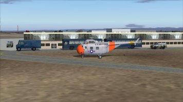
If you haven't set up Dan's Castle AFB scenery, at least consider it as a temporary install in your scenery.cfg file. There's some stuff I'd like you to check out that was common to SAC bomber and tanker bases. You'll just need your favorite chopper for the tour.

I included the Top-Of-Climb and Top-Of-Descent (to prove a point). You can practice how to delete waypoints after you find out why I don't like using them.
Just dump the KMHR-KMER plan file into your ACS "Programs" folder then run the ACS data loader and select the flight plan. Hit "Load To GPS" then "OK". Start FS and load your T-43 at a KMHR parking spot. Bring up your GPS to make sure the new plan is loaded. Check the clock and note the time. Start the engines, lights On, pitot heat On, then contact Ground and request a straight-out departure. Use Progressive Taxi and get to the hammer head. Check your time again and write it down. Contact the tower and tell them you're ready for take off. You've already set up the auto pilot, right?
Basically, take off from Mather and steer to 140. I included the LINDEN VOR (114.80) because its on our route. Set your A/P for something below 20,000 feet and keep your airspeed around 245 KTS. Set the GPS so it's talking to the auto pilot. Stay with the ATC. We're in their play ground. Dial up the LINDEN VOR and notice how well ACS compensates for the wind. From here on out, ACS IS your Navigator.

This flight should take less than half an hour. If you goofed something up, you can do it again without too much of a time hassle. Just be sure to recognize when and how you screwed up. Remember how we figured out when to descend to the pattern altitude? Castle's pattern alt is 1,000 feet, same as Mather. Try to get down to your pattern altitude just a little early. Try playing around with the auto throttles to see what works best.
Check in with Castle for a landing as soon as you can. We'll be using what is, essentially, a Combat Break (in an old 737) from here on out. Aim for the AFB at the pattern altitude, gear and flaps down, speed 150 KTS, and fly over the runway, then break to line up with the right glide slope. Remember, the folks in the tower and on the flight line will be watching so try to look classy. Once you're down, request a Gate to taxi to and shut down.
Remember to log your flight time.
If you haven't set up Dan's Castle AFB scenery, at least consider it as a temporary install in your scenery.cfg file. There's some stuff I'd like you to check out that was common to SAC bomber and tanker bases. You'll just need your favorite chopper for the tour.


 Flying this plane showed me that FS models "ground effect", big wings pushing down on the ground and the ground pushing back. If you're used to fast fighters flying at low level, the last thing you want to do is push the stick down. With the B-52, pushing the yoke down at low level is, well, normal.

