CFS3 Terrain Creation - is anyone still around?

Based on my experience with Rising Sun, Solomons and ETO. I recommend concentrating on one theater to completion before adding additional theaters to the project.

Take little bites not the whole hog. There is more work and manhours involved than meets the eye putting together one of these theaters.

Based on what I know and remember now, if I was starting out working on the Rising Sun I would take one theater of operation and completly flesh it out before moving on to the next one.

Cheers
 
Amen to that

Yes making theaters is so time consuming. First you spend quite a bit of time getting the terrain files form some provider USGS maybe. The Bay of Biscay needs 166 files, the eastern front, over 300. No little task here. Then it is making the theater files with Global Mapper, and other software. That is the easy part. Then you need to make an image file with multiple layers for each landclass type. Such as grass, marsh, crops and towns, deciduous forest and the like. If that works, roads and other parts. So, my musing about making more than one theater is my wish list. I have spent a bit of time downloading vegetation maps, topo's, city and town locations, and I am not done yet. I really enjoy this as it is new and demanding, but life is busy. Oh, did I mention that cfs3 math is well a bit different! If you have the time, are willing to learn from failure, and just like a challenge then the more the merrier.

I am going to make a complete Bay of Biscay theater and if I survive that who knows.


Slava Ukraini
 
So I think I understand that you both are saying the same thing? I was thinking that my suggestions overlapped the original CFS3 theatre and that original part could still be used with only the new parts added. Does it work like that? Is therer any chance that one of the new AI programs can help in some of the tasks?
 
AI

I would think that AI could if one knew how to use it.....The over lap is there, but you are limited to what you can use. Parts of the original global layer can be applied or even the global layer from ETO or TOW. But the altitudes are not always the same so fiddling with each entry is required. The difficult piece for me is the colorization of the image used for the landclass. You need to map a version of what you see here. This requires an image with 12-13 layers one for each color arranged so that the colors are showing the correct vegetation and land use. It is just a time-consuming effort. Once this is done than it is roads and vectors, mosaic layers etc. Look this fun but involved. It would be better, I think that folks working on terrain could get together and piece out various aspects of the work, but who knows we all want different areas. I will make what I can. may not be a functional as the original, but it will serve its purpose (I hope)
 

Attachments

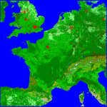
  • stuff.jpg
    stuff.jpg
    39.5 KB · Views: 69
I am sure whatever theaters the pair of you (Ted & Steve) develop will be of high quality.
 
Sorry Missed your question

Found this while i was setting up the theater generation tools.....

Ted, sorry I missed your question regarding CFS_Terrain-Scratchpad. No did not that have that xls worksheet. Thank you for sharing. I used CG Lat-Lon calculator when dong RS.

As I have finally got a replacement liquid cooler for my Gaming Tower and got it running I am finding all kinds of goodies buried in the remaining ssds.

I would be curious if you get the same results using this tool.
 

Attachments

  • CG Lat_Lon_Data.zip
    185.1 KB · Views: 7
Great

Ted, sorry I missed your question regarding CFS_Terrain-Scratchpad. No did not that have that xls worksheet. Thank you for sharing. I used CG Lat-Lon calculator when dong RS.

As I have finally got a replacement liquid cooler for my Gaming Tower and got it running I am finding all kinds of goodies buried in the remaining ssds.

I would be curious if you get the same results using this tool.

I will take a look at this. Hope you find the lost treasures.....
 
Just a thought..do the theatres have to be a certain size or can they be made smaller if need be, or how small can they be?
Just thinking of tactical maps rather than strategic. I've had in mind to have a go at this myself but to concentrate on a small area like Singapore or the Falkland Islands even.

Yes, they can be of smaller size. HOWEVER, they must be a power of 2, up to but no larger than 1835008 meters.

Tactical operations would be a great concept.
 
So WRT multiple theatres; tactical or otherwise, what folders would have to be swapped in and out? Batch exe file possible? I have yet to mater JSGME but I assume that would be better?
 
Like Steve still messing around

Finally learned how to have the different scenery display and such. Will move to shorelines and cities.
 
Great Looking Theater Ted

Ted you have made quick work putting together your theater.

Got my tower finished up with the addition of some hardware and updating my drivers. Not much luck in finding any development work other than what I have already shared.

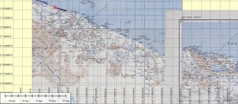
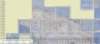
I have started on recreating PNG, have the bil completed, and have manually entered the coordinates for the topos and generated an overlay. Also made a start on manually creating the shorelines of the 1945 army topos. I will take that slow, don't want to mess up my wrist again.
 

Attachments

  • Global Mapper_showeline_start.jpg
    Global Mapper_showeline_start.jpg
    233.5 KB · Views: 55
I have started on recreating PNG, have the bil completed, and have manually entered the coordinates for the topos and generated an overlay. Also made a start on manually creating the shorelines of the 1945 army topos. I will take that slow, don't want to mess up my wrist again.

you're a pro :encouragement:
 
you're a pro :encouragement:

Not by a stretch of the imagination.:biggrin-new:

Wasn't looking forward to creating one vertex at a time of the shorelines, remembered the ability to convert areas to lines. So will use the world shape files and then move and add vertexes to match the topos.
 

Attachments

  • PNG-Shorelines-AreaTo Line-Topo.jpg
    PNG-Shorelines-AreaTo Line-Topo.jpg
    314.3 KB · Views: 6
  • PNG-Shorelines-AreaTo Line.jpg
    PNG-Shorelines-AreaTo Line.jpg
    289.3 KB · Views: 6
Question on Globalmapper

Help Please.

My winxp where my globalmapper 13. is installed does not have internet.

Line work.
There is a beginning vertice (green) and at the other end an end vertice (red). Is there a command to join those two vertice so that you have a combined line?

I can't remember how its done and can't find the command.

Thank you.
 
GM

I know that there is a way to combine the vertices, will need to see what I can find. Why are you making the shorelines manually when GM will create the shp file that you then can edit? I know that some editing is required to get rivers and lakes to display properly, but GM will make the shorelines for you and then you just check for errors. Still a lot of clicking with the mouse. Found this

Reshaping Area and Line Features (bluemarblegeo.com)

Found that the vertices will snap together. To confirm you can convert the line to an area. If successful converting to an area, then the line is connected. Then you just convert back to a line.

I am doing a combination to create the shorelines. (manually and using Global shp files.) I am trying to match the shorelines of the 1945 US Army Topo maps.

I agree it makes life easier downloading the shp files and editing them.

Thank you for the link. I will try that, don't know if that is possible in GM13.*
 
Ran into a bit of roadblock adding the terrain mos files . Easy enough to follow Bob's example and generate the mos tiles but I can't get them to show up in game.
 
Back
Top